The Cotswold Way July 26th-31st 2009
 Mike Riley, Sean Bond, Nick Barber, Ken Hodgkinson,
Dave Swarbrook, Ann Baxter, Alison Bond, Gordon Darlington, Dave McNeaney,
Jane Salt
DAY 1 - Chipping Campden to Winchcombe
Here we go again! Another year and another long distance walk.
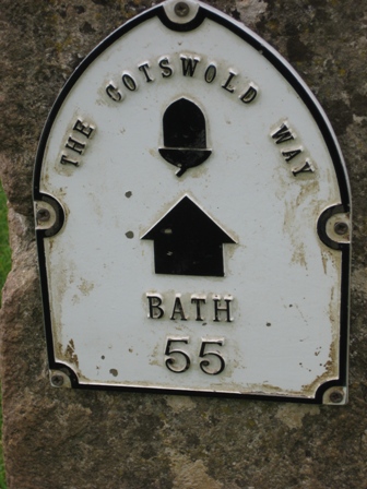
It was finally time to take on the challenge of the Cotswold Way, a 102 mile
walk which runs from Chipping Campden to Bath. This was the biggest walk to
date and had resulted in possibly the busiest training regime since the West
Highland Way in 2004.
Dave and Macca had already alluded to missing certain days, especially
Monday's 22 miler, and Ann hadn't walked as much as she'd liked due to an
ongoing foot injury. Gordon has also missed quite a few weekends due to a
combination of an aching groin and allotment raves. Apart from that it
looked like the usual 'reliablish' crew would add the prize of the Cotswold
Way to their growing list of long distance successes.
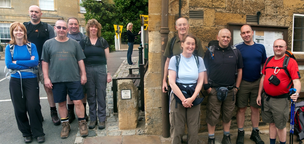
Ten hopeful walkers reached Chipping Campden on the Saturday in readiness
for Sunday's 18 miler to Winchcombe. The weather forecast wasn't looking too
good which would appear to be following the pattern from the previous four
weeks where torrential rain and storms had been the norm.
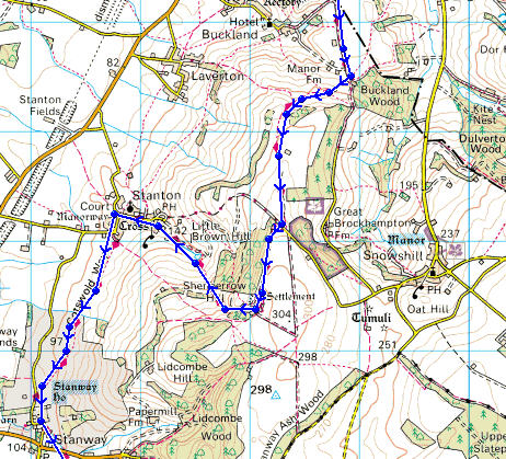
 Day 1: Chipping Campden - Winchcombe (18 miles\2296ft ascent)
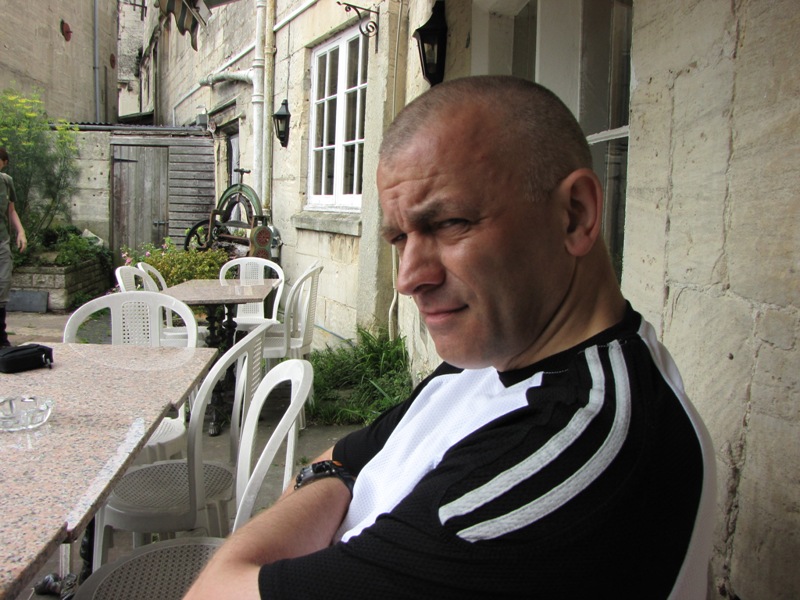
The weekend didn't start too well for me. An innocuous Saturday afternoon
stretch on the hotel bed appeared to have 'disturbed' my back but it didn't
feel too problematic so we started with a full 10 on the Sunday morning. The
morning's weather wasn't too bad but the forecast was for rain later in the
day so we set off in a weak attempt to reach Winchcombe before the weather
turned for the worst.
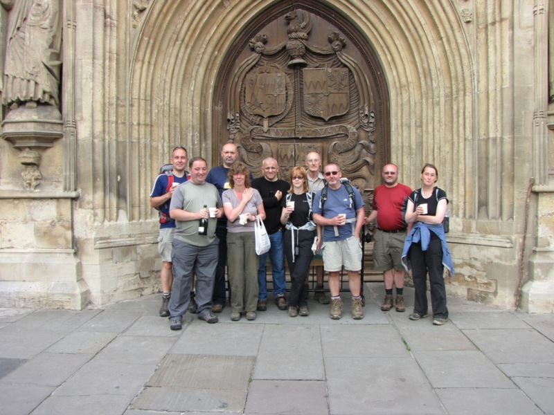
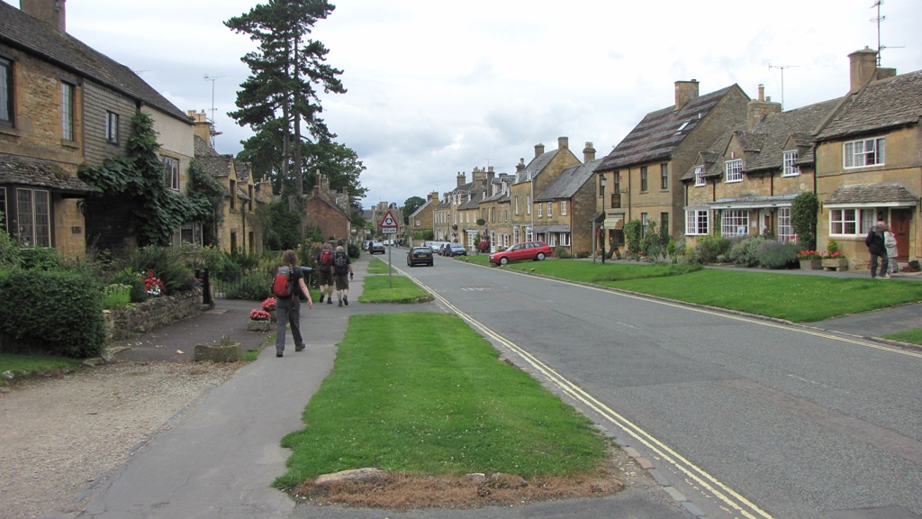
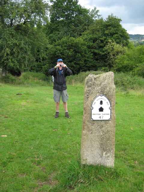
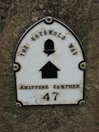
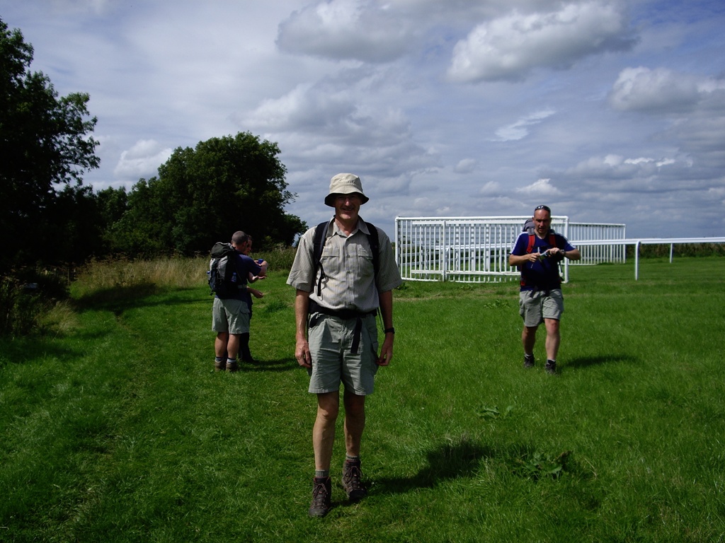
 The official start, or end, of the Cotswold Way in Chipping Campden. My
back problem had caused my head to change shape. Note a smiling Alison.
The official start, or end, of the Cotswold Way in Chipping Campden. My
back problem had caused my head to change shape. Note a smiling Alison.
As the official start wasn't the easiest place to get a group photo Nick
arranged for two separate shots to be taken. He would then use the magic of
photo trickery to join the two images together - magic!
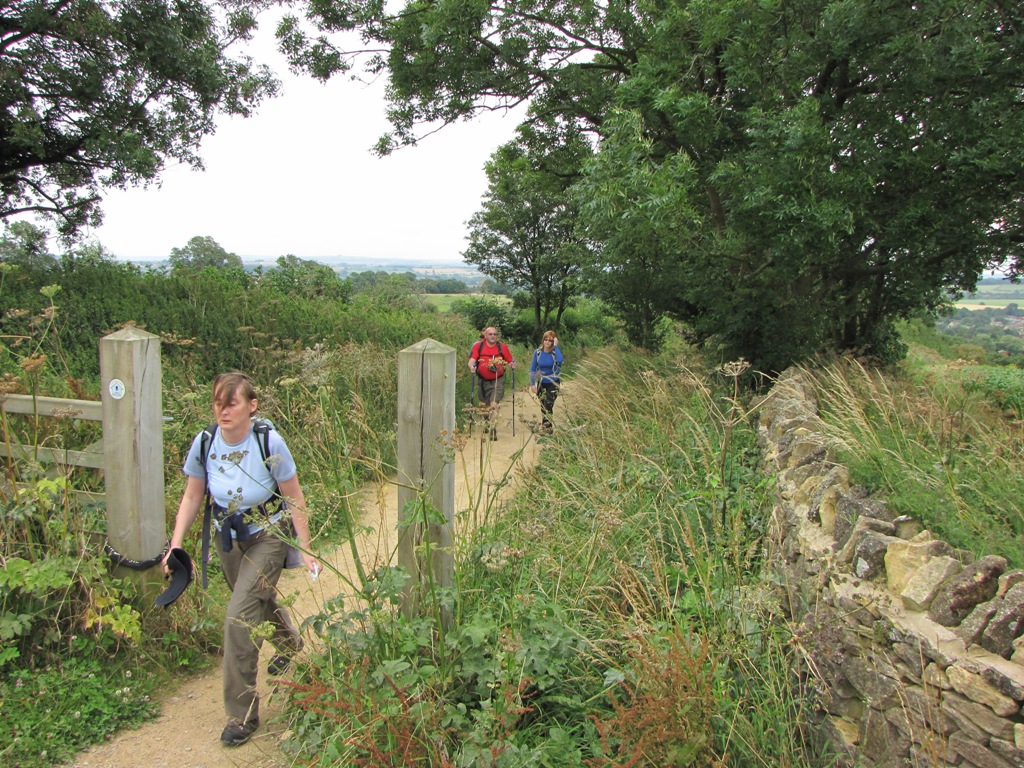
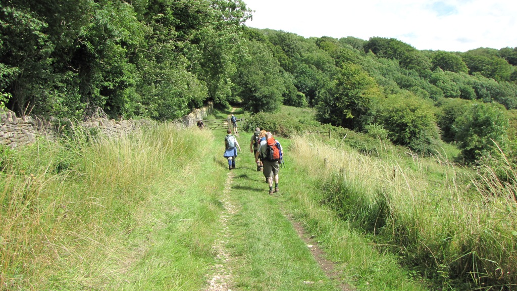
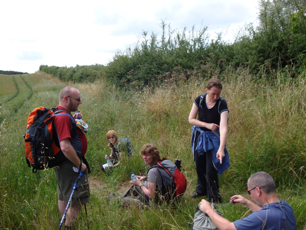
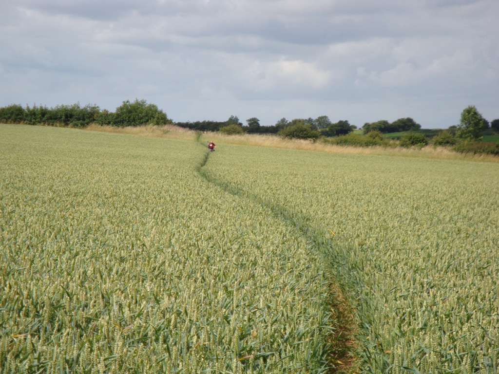
We climbed steadily out of Chipping Campden through what Sting would
describe as fields of gold. The going was easy with the gentle tickling of
wheat on bare legs adding to the morning's pleasures. The route was almost
impossible to miss due to the abundance of official waymarkers so we settled
into our stride and marched merrily on.
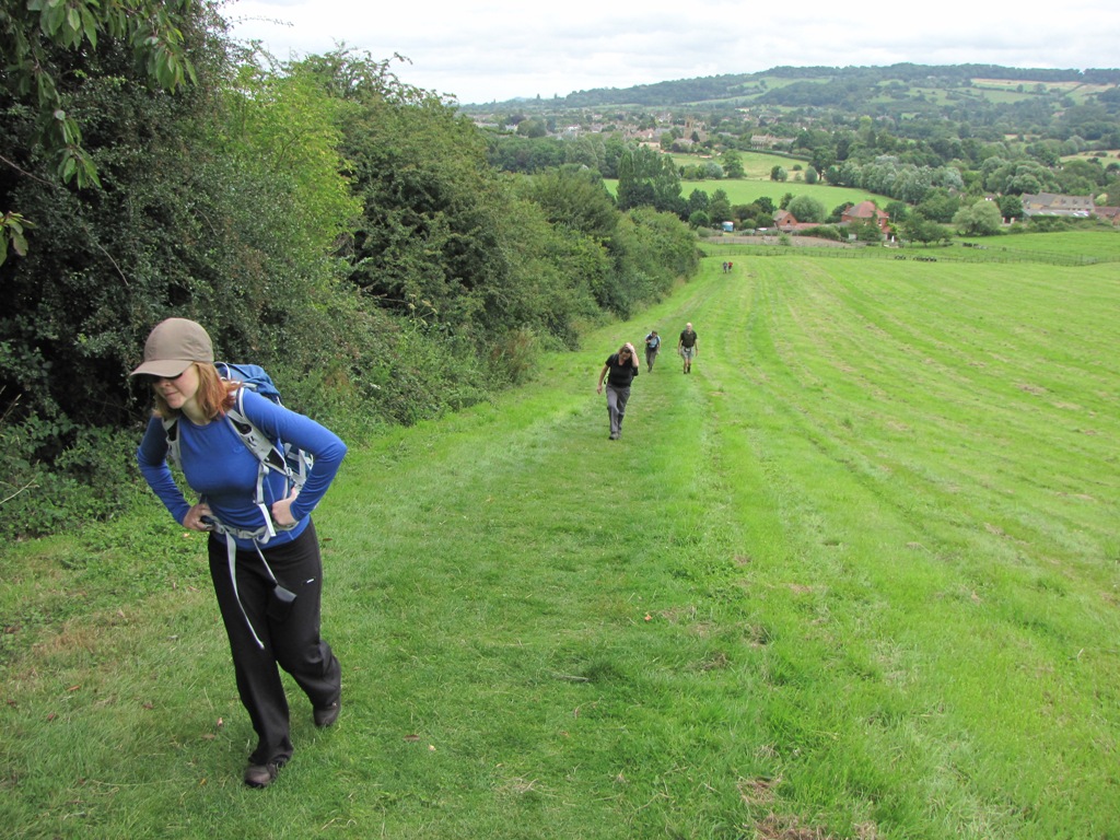
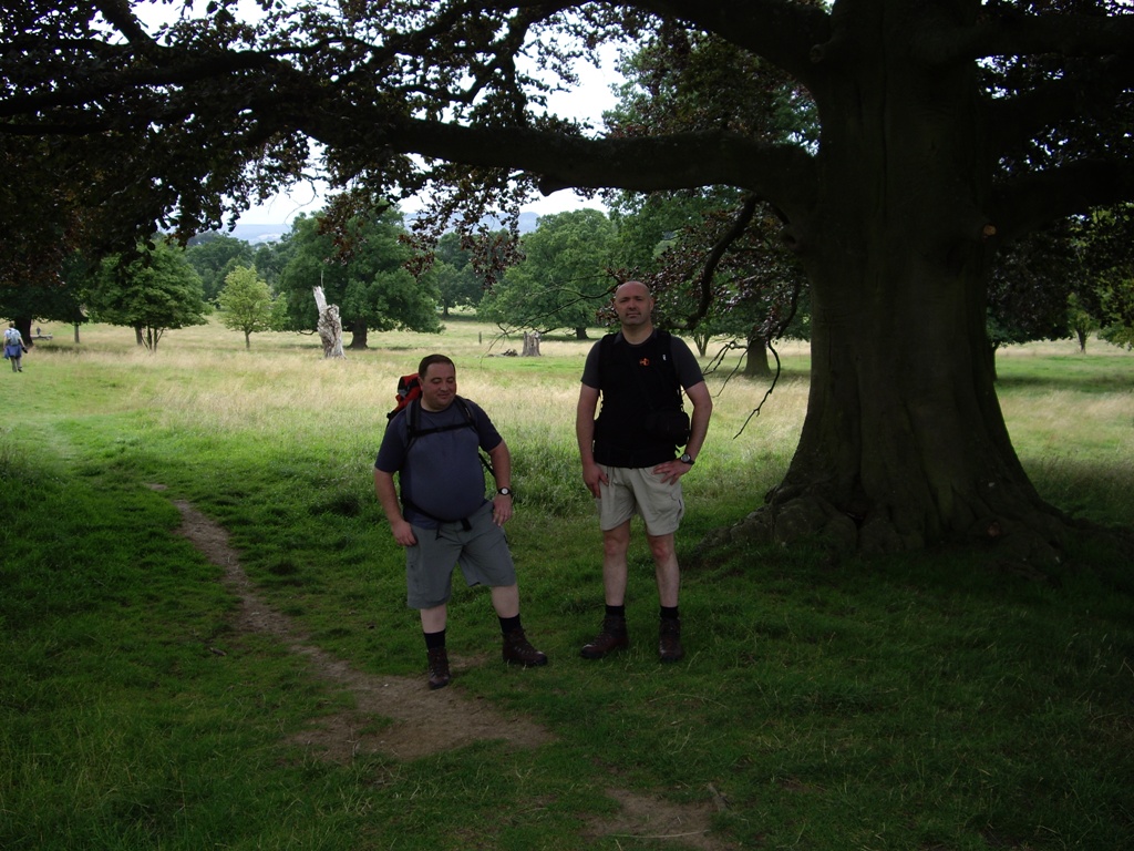
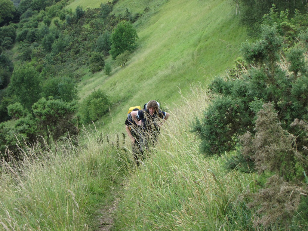
 Jane, Macca and Alison on the ascent from Chipping Campden. Alison is
still smiling cos it's early days - I can't see that being the case all
week.
Jane, Macca and Alison on the ascent from Chipping Campden. Alison is
still smiling cos it's early days - I can't see that being the case all
week.
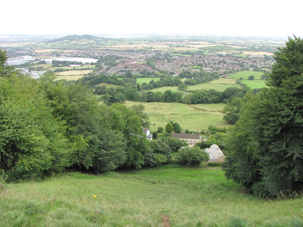
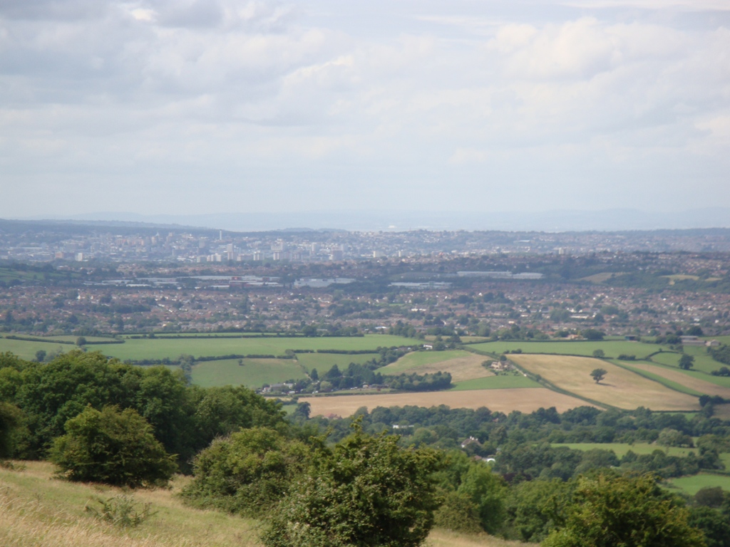
After negotiating the flatness of the the Mile Drive we eventually reached
Broadway Tower where we enjoyed the first of many expansive views from the
Cotswold escarpment. This was to be a feature of the walk - gentle rolling
countryside to the east with big views over the flat landscape of the Severn
floodplain and the Vale of Gloucester.
The threat of rain was evident on Broadway Hill so a few of us donned our
waterproofs - just in case! 650ft below us was the chocolate box village of
Broadway which meant that we were about to experience the first of many of
the week's descents\ascents.
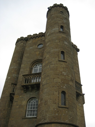 Broadway Tower - where they imprison naughty children.
Down we went, down, down and down until we finally reached the Morgan-filled
tourist trap that is Broadway. As we'd only walked 5 miles there didn't
appear to be much of an urge to spend too much time in Broadway - mainly
because we'd dropped the average age down from 80 to 50! (it would have been
45 if Ken hadn't have been with us).
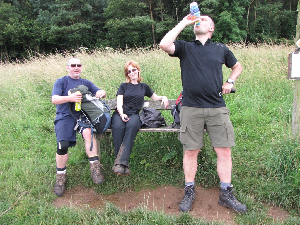
 Ann, Mike and Nick hit the streets of Broadway and the smell of stale
piss.
Ann, Mike and Nick hit the streets of Broadway and the smell of stale
piss.
We'd covered the first 5 miles in pretty good time but with 13 more miles
awaiting we powered on out of Broadway with the pretty village of Stanton,
nearly 5 miles further, next on our list. My back was beginning to ache
along with a numb left calf and foot but all was OK as long as we were
moving. Everyone else, apart from the Daves on the grassy climb out of
Broadway, was in fine fettle.
 Although not evident in this shot the climb out of Broadway was a sweaty
little affair and no place for anyone with a fear of heights. Alison is
still smiling even though she's going up hill.
Although not evident in this shot the climb out of Broadway was a sweaty
little affair and no place for anyone with a fear of heights. Alison is
still smiling even though she's going up hill.
After a short stint of woodland walking it became clear that Macca's pace
had slowed considerably. Was he injured or just suffering from a lack of
training?
The lunch stop, after approx 8 miles, gave us time to wait for Macca and
query his sudden drop in pace. Macca was, and I quote, 'suffering from
numerous bodily failures' which looked like forcing him to abort the first
day. Nobody, in the history of Bond Tours Walking holidays had ever quit on
the first day so whatever Macca was suffering from must have been pretty
serious.
 The team wait for Macca. Nick's extra sensitive nose appears to have
detected something in the air. Alison's still smiling - what's going on
here?
The team wait for Macca. Nick's extra sensitive nose appears to have
detected something in the air. Alison's still smiling - what's going on
here?
Macca took an alternative route into Stanton whilst the remaining 9 followed
the way faithfully and descended yet again (500ft). We bumped into a more
chirpy Macca who appeared slightly slimmer that the one we'd left a few
miles earlier.
 The Stanton Stinky.
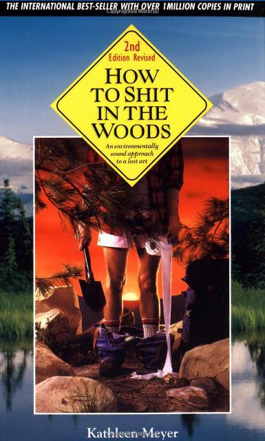
The terrifying truth of what happened to Macca during that fateful first few
miles is too grisly to document but I suggest that he purchase the following
book, available from Amazon, to assist in future walks....
 The Ordnance Survey have since added the name of 'Little Brown Hill' to
commemorate the shocking events of July 26th, 2009. It's rumoured that
Laverton will be shortly renamed to Lavatory and Papermill Farm renamed to
Toiletpapermill Farm.
The Ordnance Survey have since added the name of 'Little Brown Hill' to
commemorate the shocking events of July 26th, 2009. It's rumoured that
Laverton will be shortly renamed to Lavatory and Papermill Farm renamed to
Toiletpapermill Farm.
Macca found the local pub and ordered a taxi for Winchcombe. Was this to be
the first of many taxi bookings for the week - Who knows?
Winchcombe didn't look too far away on the map but the devious route meant
that we still had 8 miles to negotiate along with a 500ft climb from Wood
Stanway up to Stumps Cross.
We rested for a minute or two in the grounds of Stanway House which gave me
ample time to perform the 'downward dog' in order to maintain anything like
my normal walking pace. The rest of the team looked on with a puzzled look
apart from Ken who passed on a few additional stretching tips for my
enjoyment.
 Oooh that's better - upright after a bit of 'downward dog'.
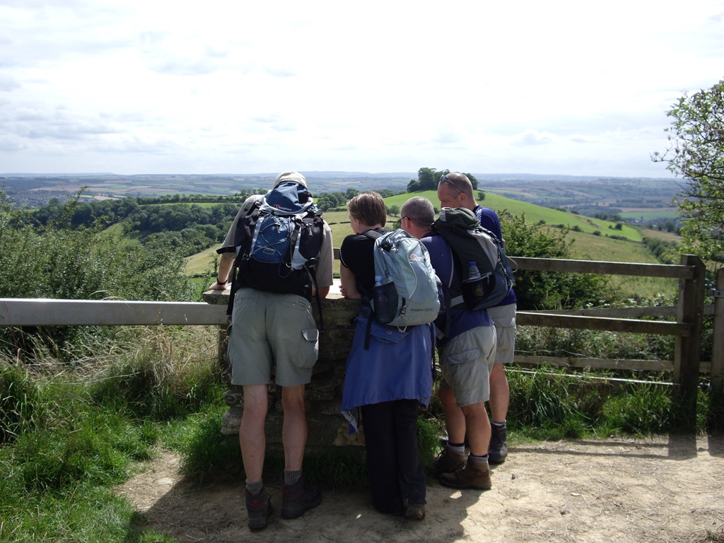
The climb to Stumps Cross wasn't enjoyed by all but the resulting view,
and the perfectly positioned bench, made the climb worthwhile.
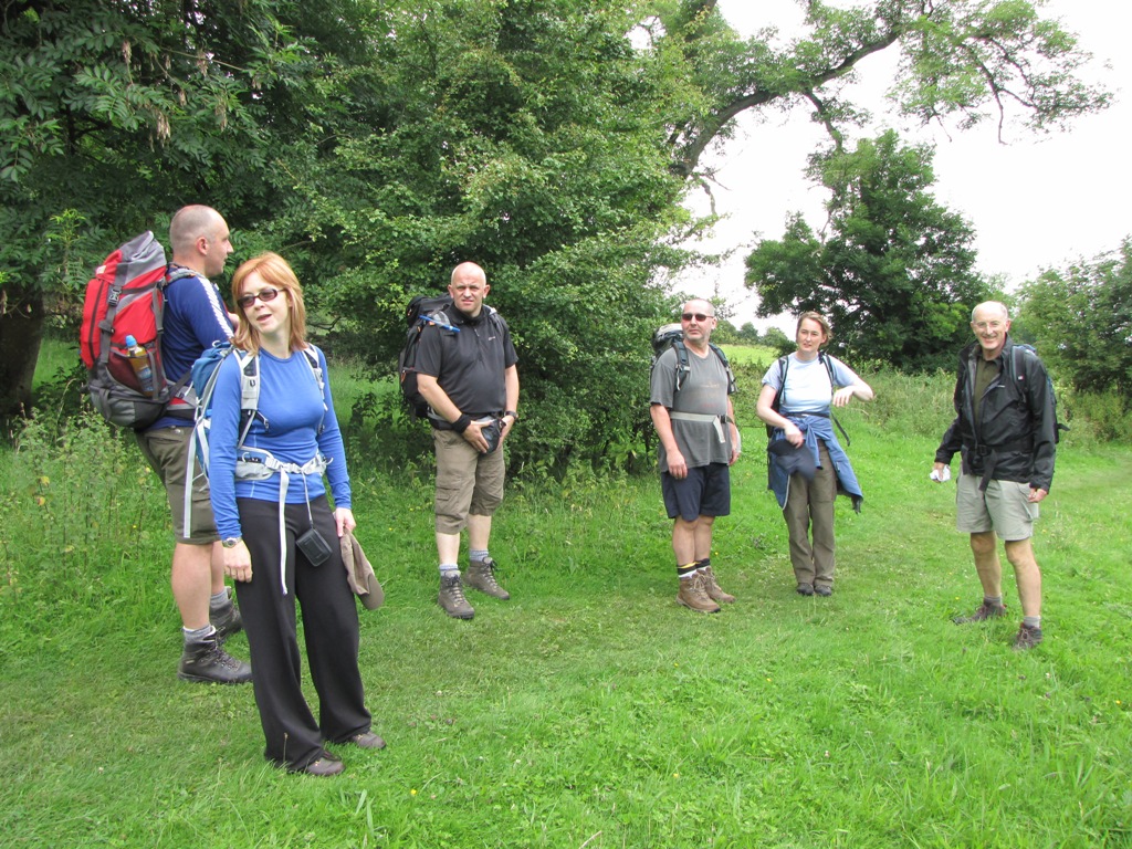
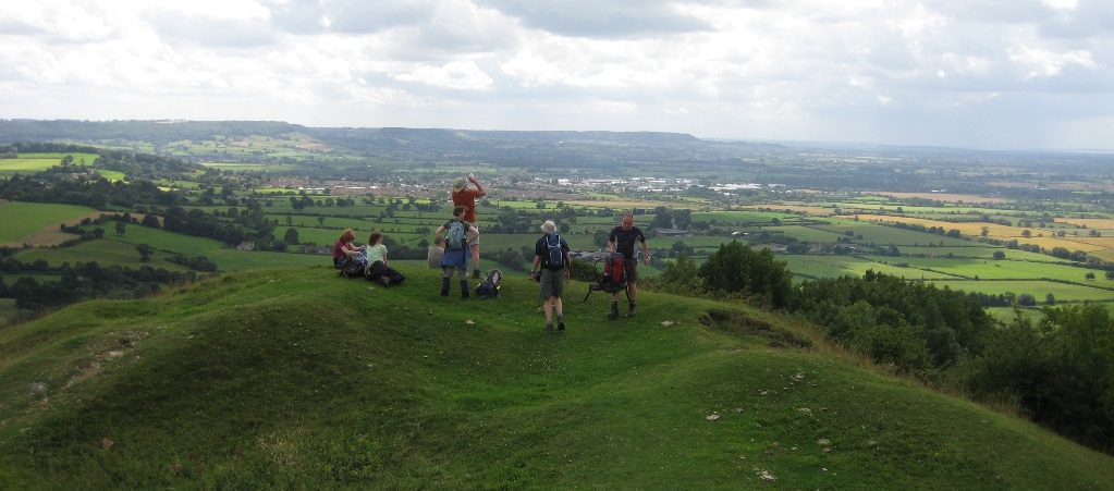
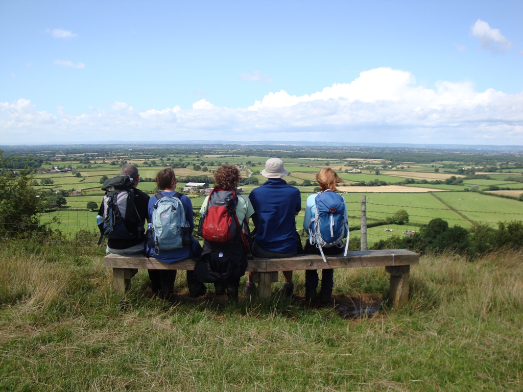
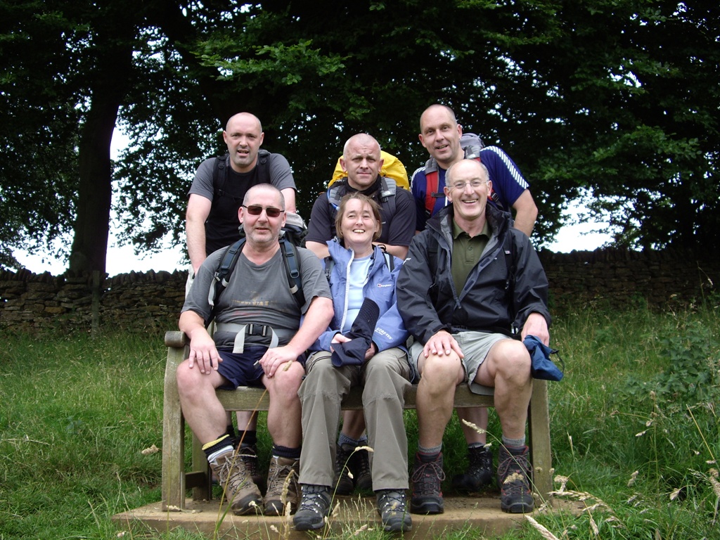 One of Jane's fantasies comes true on a bench near Stumps Cross. Nick
can still smell something. Weeks before the walk, Alison had forecast that
the 6 in the picture would be the only people to complete the walk. Would
she be right? Place your bets now.
One of Jane's fantasies comes true on a bench near Stumps Cross. Nick
can still smell something. Weeks before the walk, Alison had forecast that
the 6 in the picture would be the only people to complete the walk. Would
she be right? Place your bets now.
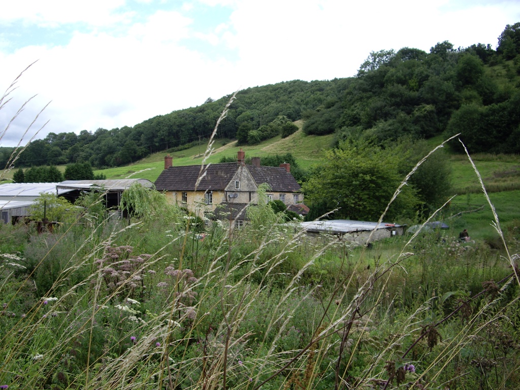
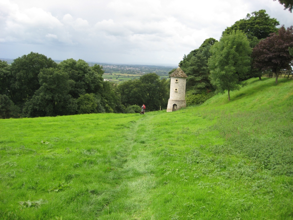
We passed an Iron Age hill fort and walked around some extremely interesting
'Strip Lynchets' before descending to Hailes and the remains of Hailes
Abbey. A long couple of miles was all that was left but the skies were
darkening and the fields were coming thick and fast. As we approached
Winchcombe the rain started which meant that our triumphant march into town
was a slightly subdued affair.
A couple of pints of 'Bob' were enjoyed in the White Hart before we
retreated to our rooms in readiness for sausage and wine. The skies remained
dark and the weather wasn't looking too clever for the following day's 22
mile epic.
My back wasn't feeling too good but a good night's sleep would hopefully
sort that out - along with a few more 'Bobs' of course!
So, 22 miles was the order for Monday. We hadn't walked this sort of
distance since the very first day of the West Highland Way. Who would turn
up ready for the big day? Was Macca still feeling a bit 'shitty'? Was Dave,
who'd made mincemeat of the first 18 miles, up for the challenge? Would my
back hold up? Was Ann's foot ready for the 'big one'?
Read on and find out!
DAY 2 - Winchcombe to Birdlip
Day two was upon us and 22 miles separated us from Birdlip - the destination
for the day.
 Day 2: Winchcombe - Birdlip (22 miles\3987ft ascent)
Macca and Dave decided to opt out and head for Cheltenham and even though
I'd suffered from a crappy night's sleep it was decided that all was OK for
the walk so I donned my shorts and joined the others.
The weather was cloudy and slightly threatening as we left Winchcombe and
the odd shower meant that waterproofs were the choice for many. A gradual
650ft climb to Belas Knap meant that before too long we were all back down
to shorts (apart from Ann and Alison who like to maintain their Victorian
dignity).
After a mile I was walking with a strange gait thanks to my back and Alison
wondered if I'd be OK to carry on. She suggested that compensating for my
back would result in foot problems and that 22 miles could be too much. I
felt all was OK, if slightly uncomfortable, so carried on.
After investigating Belas Knap, which simply meant walking around it, we
headed northwards and downwards through a forest and then suddenly, after 4
miles of up and down, we were treated to a magnificent view
of......Winchcombe! I waited for members of the team to ask about the town
in the distance as I knew the truth would come as something of a shock. It
did.
 Finally, after 4 miles of ascent and descent we can see where we've come
from!
Finally, after 4 miles of ascent and descent we can see where we've come
from!
After losing a few hundred feet it was time to ascend to the highest point
of the entire Cotswold Way, Cleeve Hill. A simple traverse over Cleeve
Common would have saved us from walking a couple of extra miles and
prevented the need to climb another 500ft but the rerouted Cotswold Way
decided otherwise so on we marched.
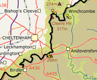
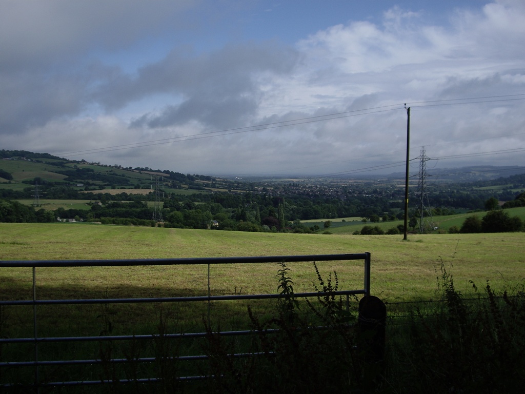
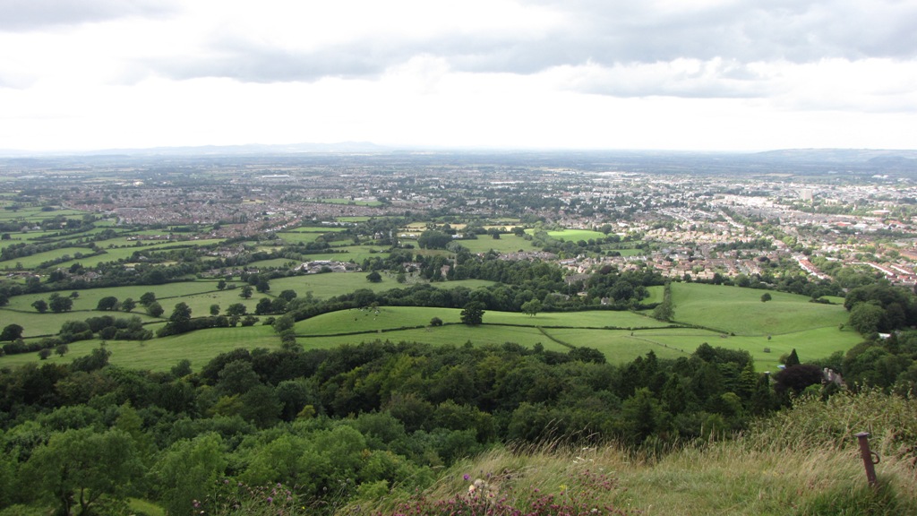
On reaching the summit of Cleeve Hill the views over to the west were
superb. The weather was fine by now and a panoramic view of Cheltenham,
Gloucester, Bishop's Cleeve and Tewkesbury was enjoyed by all.
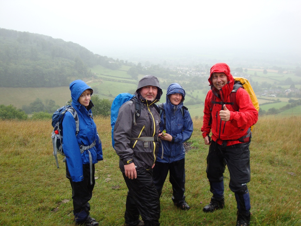
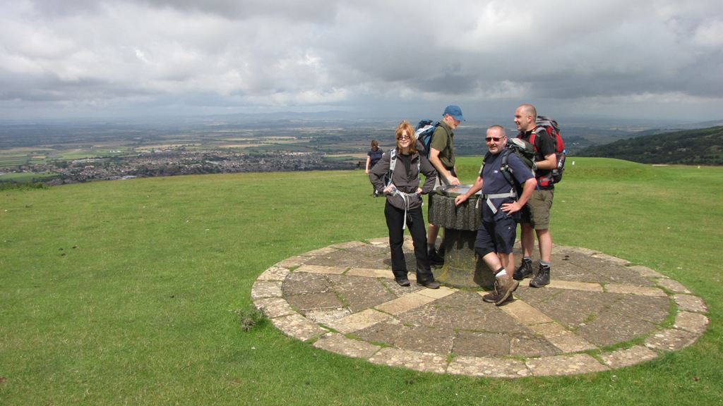 The summit of Cleeve Hill with Bishop's Cleeve in the background. Day
two and Alison's still smiling. Hhhmm - it's looking a bit black over
yonder.
The summit of Cleeve Hill with Bishop's Cleeve in the background. Day
two and Alison's still smiling. Hhhmm - it's looking a bit black over
yonder.
Dark clouds were visible in the far west but for the time being all was OK.
The occasional shower appeared to float past and for a few miles all was
fine but we all kept our beady eyes on a rather ominous looking belt of piss
poor weather that was looking dangerously close for comfort.
 Another view to the west - the Malvern hills were now covered in cloud.
We took bets with each other as to whether the clouds of death would shed
their devilish tears on us poor walkers. I opted for the positive 'it'll
just miss us' option whereas a few of the team went for the 'we're going to
get wet' option. I turned out to be wrong.
Just as we were descending from Cleeve Hill and had come across an unsightly
area of motorbike race tracks the heavens opened. We all donned our
waterproof tops and leggings apart from Alison who had completely separated
her leggings and couldn't work out how to get them back on. It rained hard
and after a few minutes the deep tyre worn tracks had turned into small
streams. This wasn't good and was probably the hardest rain we'd endured on
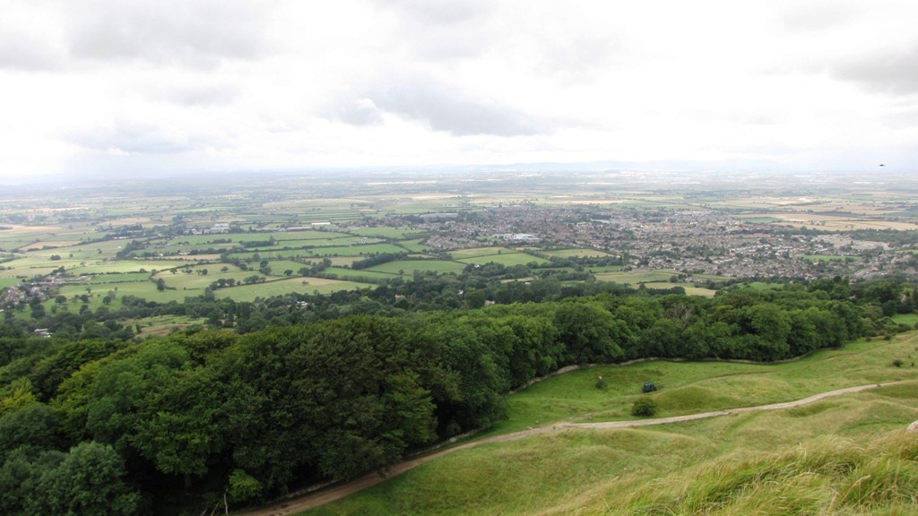
any of our walks - up to now. No one could be arsed with the views of
Cheltenham racecourse, GCHQ or Gloucester Cathedral so we ploughed on in an
attempt to eat up the miles as there were still plenty of them left to eat!
Nick enjoyed the rain so much that he decided that the previous 30 minutes
had been the worst he'd ever experienced.
After what seemed like an age the rain stopped and the sun returned but
rather than fill our rucsacs with wet waterproofs many of us left them on in
a vain attempt to dry them out. Lunch was taken using the classic 'Cumbria
Way' upright technique as the ground was too wet for sitting.
The walking improved as we descended to Dowdeswell reservoir, lost another
550ft, and reached the day's halfway point. This gave me a chance to call
the baggage carriers and ensure that our luggage would be delivered to
Wotton-under-Edge and not Bradford-on-Avon for the following evening. Nick
was beginning to suffer from a problem with his achilles and wasn't overly
happy but in true Bond Tours style he resisted the opportunity to pack in at
the reservoir and looked forward to the remaining 11 miles!
Remember I mentioned losing 550ft of height? Well another 600ft climb was
coming up next and it just happened to coincide with an increase in
temperature. Ann had decided to continue to walk with her waterproof
leggings on which made other team members feel warmer than they should have.
After suffering from a few cruel jibes she let common sense win the day and
eventually gave in to freshness and good personal hygiene. We eventually
reached Lineover Wood where the climbing appeared to end - but it hadn't.
A final steep 300ft climb was next which wasn't enjoyed by anyone. Luckily
another strategically placed bench, similar to the one near Stumps Cross on
the previous day, provided us with an opportunity to take a well earned
breather. This was Wistley Hill.
 Dirty stinky sweaty Ann and Nick, who was now suffering, nearing the
summit of Wistley Hill.....
Dirty stinky sweaty Ann and Nick, who was now suffering, nearing the
summit of Wistley Hill.....
....whilst the others have a breather. 'You know who' is smiling again -
this is weird.
The route descended gently to Seven Springs and the junction of the A435 and
A436 roads. Nick was suffering to the point where he decided that another 8
miles was too much so, as a road sign indicated that Birdlip was only 3.5
miles away by road, decided to take a short cut. Ann decided to join Nick so
we were down to 6.
It turned out that the A436 wasn't the greatest of routes for the walker so
after a few near misses Nick and Ann dropped into a local pub where a lift
to Birdlip was arranged. How convenient.
Hartley Hill and Leckhampton Hill were next on the list. The weather was now
glorious and the views over Cheltenham improved with every step.
 Cheltenham from Hartley Hill.
My right foot was feeling rather sore in places which Alison had
correctly forecast earlier in the day. The area above my right ankle was
very sore and meant that I had to amend my gait yet again in order to walk
comfortably. This didn't prevent me from walking off route for a few yards
to get a glimpse of the Devil's Chimney - one of the highlights of the walk.
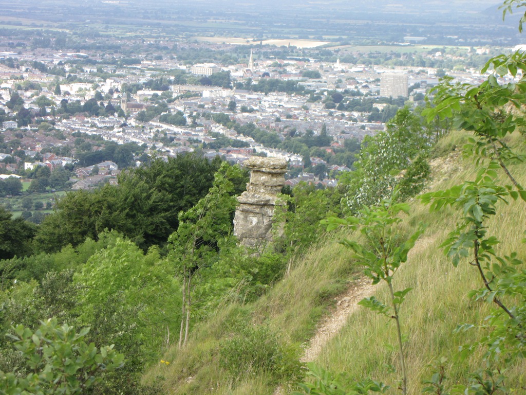 The Devil's Chimney with Cheltenham in the background. Apparently 12
people have stood together on the top!
The Devil's Chimney with Cheltenham in the background. Apparently 12
people have stood together on the top!
As I was attempting to catch up with the main group a commotion involving a
couple of small dogs, a large dog and a couple of women could be heard.
Apparently 'Razor', a nasty looking bull terrier type thingy was running
amok and having a go at a smaller dog. The owner of the smaller dog wasn't
too happy about this and let Razor's owner know. All good fun!
We descended gently to a B road where I tried to refit my sock in an attempt
to ease the aching in my right foot. My back was now quite painful which
meant that Alison had to assist in removing my socks. Jane looked on with an
envious look as my sock steam entered Alison's nostrils - Yeeahhh Baby!
We walked past the National Star College, a college for people with physical
and learning disabilities. If I'd have known this at the time I would have
enrolled there and then. We then passed a rather fancy looking firefighter
training facility before leaving the road and transferring onto a path that
was only 4 inches wide.
Unbeknown to us, this was close to where Dave and Macca had decided to join
the route after their Cheltenham jolly and earlier in the day, and shortly
after Crickley Hill Country Park, they decided to leave us a secret message
in the woods. Readers who have endured the horrors of the description of day
one will be wondering what type of secret message Macca could have left in
the wood but luckily all was OK down below so you can read on and eat your
tea at the same time....
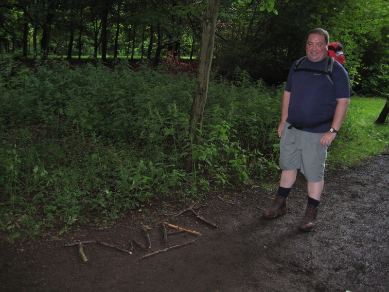
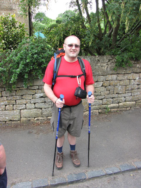
Dave poses proudly next to his and Macca's masterpiece. A bit of a wasted
effort as Ann had packed in a few miles back.
After walking through 'Macca's Wood' we finally reached the Air Balloon
roundabout which signalled the fact that there was only a couple of miles to
go. There was only one problem - we couldn't cross the A417 as it was now
rush hour and fast moving traffic was coming at us from every direction.
After a few failed attempts we finally crossed safely thanks to a couple of
drivers who slowed down for us hardy Cotswold Way walkers.
The last couple of miles was an annoying undulating affair which was saved
by the excellent views over to Gloucester and the M5. We reached a B road
after leaving a small wooded area and walked up the road into Birdlip. At
last we had finished the 22 miles and along with day one had now completed
the two longest days. My back wasn't feeling great but with 40 miles under
my belt maybe it could hold out until the end?
We checked into the Royal George where Macca and Dave divulged their amazing
woodland message, beer was drank, food was enjoyed (apart from Alison's dry
tuna) and wine was quaffed!
Alison, Mike, Ken, Gordon and Jane were walking well and were showing no
signs of fatigue or injury so all was looking good for the next day's piss
easy 15 miler to King's Stanley. What could possibly go wrong?
DAY 3 - Birdlip to King's Stanley
Most of the team were looking forward to the easy 15 miler to King's
Stanley. A quick look at the map showed that the route would see us spending
most of the time in woods and forests so there'd be some protection from any
rain.
 Day 3: Birdlip - King's Stanley (15 miles\2772ft ascent)
All 10 starters were in position. Nick felt that his achilles was OK to go
whereas I'd had a slightly improved night with my back. Macca had checked
the route and decided to take a shortcut out of Birdlip which would enable
him to meet up with us after a couple of miles.
We marched down the road and entered Witcombe Wood where we soon spotted the
rare Great Gutted Woodshitter in the distance. The going was easy and quite
pleasant but my back and right foot didn't appear to be improving so a quick
stop was required in order to see if a Compeed patch would ease the bruising
above my ankle.
 Taking in the pleasures of Witcombe Wood. I'm not smiling.
We eventually left the confines of the wood and enjoyed the view northwards
over Witcombe reservoir and Gloucester. All eyes were now on the lookout for
Cooper's Hill which is the location for the annual cheese rolling event. We
walked beneath what we believed may be Cooper's Hill but decided that it
couldn't be due to the excessive steepness and morass of nettles near the
bottom. A short sharp climb to the top of the hill and a quick check on the
old GPS confirmed our worst fears - this was Cooper's Hill!
 Mike confirms that we're on top of Cooper's Hill whilst Nick appears to
be transferring energy from the magic 'wood' to his crotch.
Mike confirms that we're on top of Cooper's Hill whilst Nick appears to
be transferring energy from the magic 'wood' to his crotch.
Cooper's Hill is steep. The cheese rolling event looks a pretty mad affair
when seen on TV but when you're actually looking down the slope it all
appears a bit bloody stupid to be honest. Apart from the steepness there's
nettles, uneven ground and a house and trees located at the bottom of the
hill which I assume are meant to assist in stopping the runners from
demolishing Gloucester?
 Looking down Coopers Hill with the outskirts of Gloucester in the
background.
Looking down Coopers Hill with the outskirts of Gloucester in the
background.
The route returned to the woods and after a couple of sharpish ascents
crossed the A46 to enter a rather large golf course located on Painswick
Hill. After watching a couple of forest-bound tee shots we continued over
the hill and enjoyed an easy descent into the pleasant town of Painswick
where it was decided that lunch was in order. The weather had been excellent
but a few dark clouds were beginning to gather as we searched for the best
place to enjoy lunch.
We eventually decided that a pub lunch was the order of the day so found a
suitable pub and ordered soft drinks and sarnies. Nick wasn't looking to
happy thanks to his ongoing achilles problems and decided that Painswick was
to be his finishing point for the day so he booked a taxi and headed off to
Stroud and the hotel.
 Nick looking rather unhappy in Painswick. The magic of the 'wood' hadn't
worked.
Nick looking rather unhappy in Painswick. The magic of the 'wood' hadn't
worked.
An hour had passed by the time we'd all eaten our sarnies and the lack of
movement hadn't done my back any good at all. As we left Painswick the rain
came in and waterproofs were required for the first 20 minutes. A gradual
descent out of Painswick meant that a 500ft ascent was required to gain the
summit of Scottsquar Hill. A short photo stop was held at a signpost
indicating how far we'd walked and how far was left to go. The post was
positioned just before the main ascent which I assume was done on purpose.
 Ken uses the best camera he's ever had to get a good shot of the
signpost.
Ken uses the best camera he's ever had to get a good shot of the
signpost.
 Hooray - 47 miles walked and we're only halfway through day 3!
 Bollocks - another 55 to go!
 Alison and Dave reach the top of Scottsquar Hill. One looking slightly
happier than the other. Something is very wrong - day three and she's still
happy.
Alison and Dave reach the top of Scottsquar Hill. One looking slightly
happier than the other. Something is very wrong - day three and she's still
happy.
We headed back into the woods. The weather was glorious and the next
section was enjoyed by all. We passed a memorial to 'something' that had
happened during the civil war and suddenly came across a rather spooky
figure positioned in a barn window....
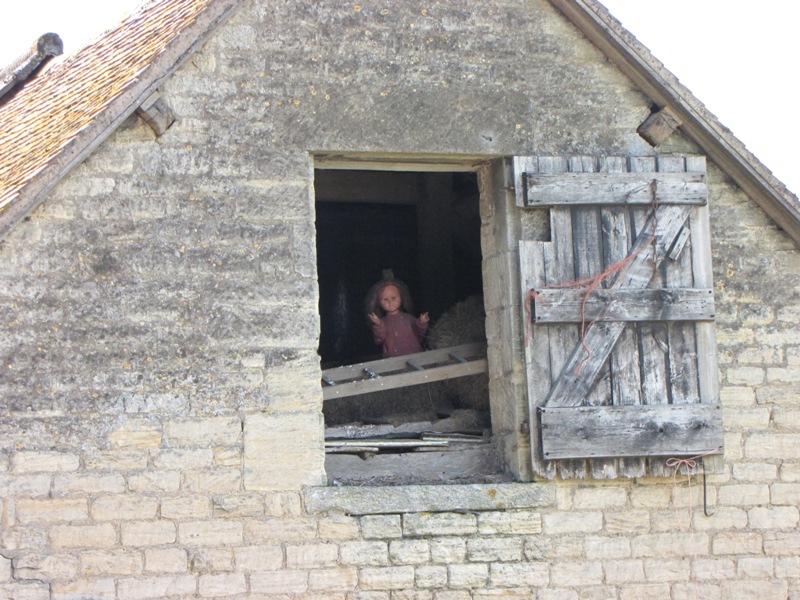 What the f**k! This little girl can cause balance havoc for men named
Ken.
What the f**k! This little girl can cause balance havoc for men named
Ken.
Ken decided that this was another great opportunity to use the best camera
he'd ever had and got into position to grab a shot. Unfortunately Ken's
inability to master his camera's zoom function meant that he had to walk
backwards to frame the ghostly apparition. This resulted in Ken going down
like he'd been shot but in an attempt to break the fall decided that a spot
of mid-air break dancing was required. Ken dropped the best camera he'd ever
had and broke it. Silly Ken!
We returned to the walk once the laughing had finished and headed towards
the day's big viewpoint - Haresfield Beacon. This was another enjoyable part
of the walk as the views to the west and north were exceptional.
A few minutes were enjoyed on the top of Haresfield Beacon thanks to the
excellent turf and magnificent views. Ken missed out on the scenery whilst
he attempted to fix his broken camera (the best he'd ever had) but I managed
to free the stuck lens and returned the camera to Ken in fully working
order. Lucky Ken!
 Gordon enjoys the views over to the River Severn.
 Time for drinks on the breezy summit of Haresfield Beacon.
We took in another viewpoint to the west and then set off towards the last
wood of the day - Standish Wood. Only 4 more miles to go and most of it
involved either flat or downhill walking.
 Heading towards Standish Wood.
Shortly after entering the wood we came across the Standish Wood equivalent
of the spaghetti junction. Paths veered off in every direction with the
Cotswold Way sign appearing to beckon us straight ahead. Mike checked his
GPS and cast doubt on the direction we were heading and after a couple of
hundred yards I too believed that we'd taken the wrong path. Our mistake was
confirmed as we reached a small country road but rather than retrace our
steps we planned a devious return to the route further ahead.
We rejoined the Cotswold Way and after a brief return to Standish Wood we
finally reached Maiden Hill where the descent to King's Stanley was finally
upon us.
 A final rest before leaving the wood and descending to King's Stanley.
Mike so wanted to sit on a big stone but Ann, Alison and Jane had already
taken the best seats which made Mike all glum. What's up with Jane?
A final rest before leaving the wood and descending to King's Stanley.
Mike so wanted to sit on a big stone but Ann, Alison and Jane had already
taken the best seats which made Mike all glum. What's up with Jane?
The final march into King's Stanley seemed to go on forever. The scenery
deteriorated with each step as the beauty of the Cotswolds gave way to the
crapness of Stroud and its surrounding environs. At one point Jane decided
to run, yes - run, downhill in order to ease her aching feet. The run
appeared to do the trick so I decided to try walking quickly downhill to see
if it would ease my back - it didn't.
 Jane takes the piss and decides to run downhill whereas Ken looks nice
and happy cos his camera's fixed.
Jane takes the piss and decides to run downhill whereas Ken looks nice
and happy cos his camera's fixed.
We crossed the disused Stroudwater canal. We knew it was disused because it
was a foul bright green colour and did nothing to remind us of the lost
glories of the Cotswolds. The skies darkened as we approached the King's
Head pub where we were to call the taxis that would take us to the Bear of
Rodborough hotel. The hotel was a few miles off-route and at one point when
organising the walk I considered walking to the hotel and turning the 15
miles into 18. The taxi journey confirmed that the additional 3 miles would
have been a bad idea and that the rest of the team wouldn't have been too
happy.
The rain was coming down pretty steadily by the time we had reached the
hotel. The forecast for the following day was for prolonged heavy rain and
it looked like it had come early. The Bear of Rodborough was a pleasant
place with a bear, a bar, beer and a bath.
 Nick, still looking rather fed up, greets us at the Bear of Rodborough.
Dave, Macca, Ann and Nick decided that they would miss out on tomorrow's
walk due to varying combinations of fatigue, injury and the threat of a day
of heavy rain. My back wasn't feeling great and as the night progressed the
pain increased despite regular applications of ale and Ibuprofen. Little
insignificant factors such as the height of toilets and the lengths of baths
and beds were now critical to my wellbeing so I knew I was close to the
point of packing it in. I would see how the night went and make a decision
in the morning. I was slowly turning into the real 'bear' of Rodborough.
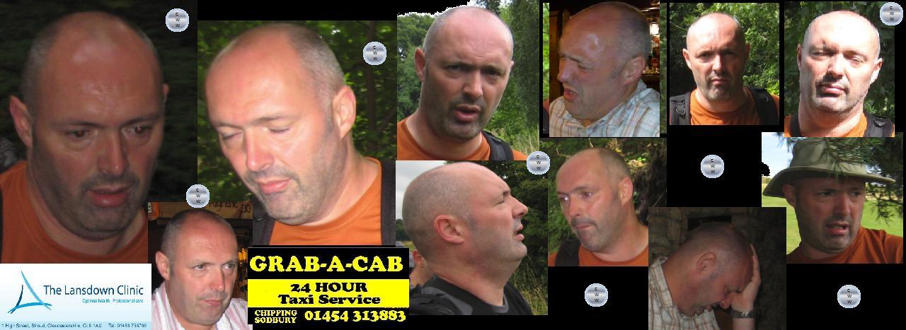 The montage of agony. Did Macca's camera have had a pain sensor?
DAY 4 - King's Stanley to Wooton-under-Edge
The smallish bed, toilet and bath in my room resulted in me being unable to
move in a manner that would allow me to walk. My back and leg was suffering
from shooting pains whenever I moved so I made the decision to abandon the
walk. Bollocks!
My plan was to head into Stroud and find a physio ASAP. The taxis arrived
and we returned to King's Stanley to drop off the 5 walkers - Alison, Mike,
Ken, Gordon and Jane. The rest were off to Stroud. We watched as the walkers
marched off into the rain. The forecast was correct - it was pissing down
and didn't look like clearing. I gave Alison my Cotswold Way guide so she
could navigate alongside Mike. It was my favourite book so I prayed that
she'd look after it.
The taxi journey proved that I'd made the right decision as every turn and
bump spiked into my back. There was no way I'd have walked this off. I found
a chiropractor in Stroud who confirmed that I'd got a prolapsed (slipped)
disc and that I'd been a very silly boy. That was it, no more walking for me
- it was over, finished!
It is now time to hand over to my new co-author, Alison, who will hopefully
describe the rest of the walk in the same droll manner.....
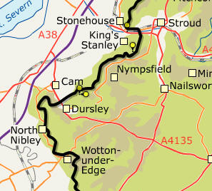 Day 4: King's Stanley - Wotton-under-Edge (15.4 miles\3181ft ascent)
Sean told me at midnight that ‘there’s no way I can ******’
walk tomorrow’ amongst
ooohs
and aaahs and oh my god will you shut the **** up (the latter was me).
He also told me exactly the same at 00:25, 01:15, 01:55, 02:12, 03:47
(that was a good hours sleep I got in there),
04:27, 04:59, 05:18, 06:23. I got up at 07:30 feeling fully refreshed
and ready for a 13-15 mile walk (depending on who you asked) in piss poor
weather.
There were some slightly surprised faces at breakfast when Sean pitched up
in his ‘civvies’ but most of them had that ‘why didn’t you listen to Al 2
days ago’ kind of face.
The Daves
had already decided they weren’t walking, Nick was a no-no too and Ann had
decided she couldn’t be arsed to walk in the rain.
Me, Gordon, Jane and Ken awaited Mike’s arrival at breakfast with baited
breath – if he wasn’t walking how were we going to cope without his ‘thing’?
No one else had the ability to communicate with satellites the way he
does.
Would we have to resort to
reading a book and ....a map? Mike arrived and we all breathed a sigh of
relief when he said of course he was walking. We all felt instantly
reassured in a cosy, glowing kind of way until somebody pointed to what was
going on outside with the weather and we were immediately stripped of our
Readybrek aura (Sean – I thought you said this writing lark was difficult).
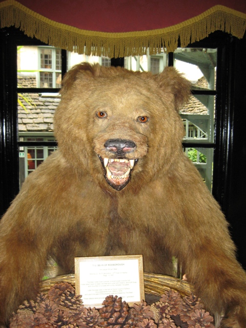
It's that bear again! - Touch my pinecones and I’ll rip yer ‘ed off.
We met in the foyer of the hotel by a big nasty bear carrying a tray of
pinecones (scary) and had a 15 minute debate as to who should go in which
taxi.
Once that had been settled we
alighted our various cabs and set off for Kings Stanley.
Team Spat (a conjugation of Spaz and Fat – good eh?)
set off for Stroud but not before Macca had trapped Ann’s foot in the
seat of the taxi.
Macca said it was
an accident but I think he’s a big (fat) liar.
The rest of us headed for King Stanley Co-op to raid their fridges of
fabulous bounty.
Unfortunately there
were only 2 packs of out of date sandwiches so we ended up with the
nutritional wonderfulness that is McCoys crisps and Galaxy chocolate.
We set off – waterproofed to the hilt. Sean had entrusted me with his
Cicerone Guide to the Cotswolds Way which was safely tucked up in my
rucksack and believe me I had no intention of disturbing it.
Under Mike’s leadership we walked up some path or other for a while,
heads down against the bloody awful weather.
After a short while Mike stopped us and pointed out that we were on
the wrong path, we should have turned off right someway back.
Ken was adamant (determined – not the guy who sang Prince Charming)
that it didn’t matter and we ought to carry on as it was bound to work out
the same but a bit further up.
We
didn’t have any objections so carried on despite the fact that Ken has
probably never read a map in his life and at 82 is probably slightly senile
as well (too much attention to consuming his five a day and not enough
coffee).
But we shouldn’t have
doubted him – for there at the top of the hill was a way marker saying
Cotswolds Way.
The rain was really
driving hard at this point and we trudged up a hill which I think turned out
to be Selsey Common.
We stopped for
a photo to prove to the others what fun we were having.
 Mike pretends to be enjoying it whereas Al’s expression reveals the true
feelings of the group.
Mike pretends to be enjoying it whereas Al’s expression reveals the true
feelings of the group.
We walked a little further before Mike consulted his thingamajiggle and said
it looked like we needed to be lower down and further back i.e. in a
different place altogether. Not to worry, we plodded on down to the road and
decided we were quite lost so there was only one thing for it – reach for
the guidebook. I hadn’t got a clue where we were, where we were supposed to
be, or indeed where we’d even come from that morning (Mars , I think). I
tried to pretend I knew about maps and stuff so read a few random sentences
from the book. I don’t think it helped really. Mike asked me to look for
Redhill Farm on the map and to my utter amazement I only went and bloody
found it! But that was all I could do so Mike had a look at the map, told us
we’d almost gone full circle and were nearly back in Kings Stanley i.e. we’d
been following the signs for Cotswolds Way north. How we laughed, after all
we’d only been walking for about an hour and a half. To be fair we did
actually find it quite amusing . We soon got on the right track and turned
right where we should have done earlier that morning . I have replayed the
morning’s events in my mind and on reflection have concluded that it was ALL
KEN’S FAULT.
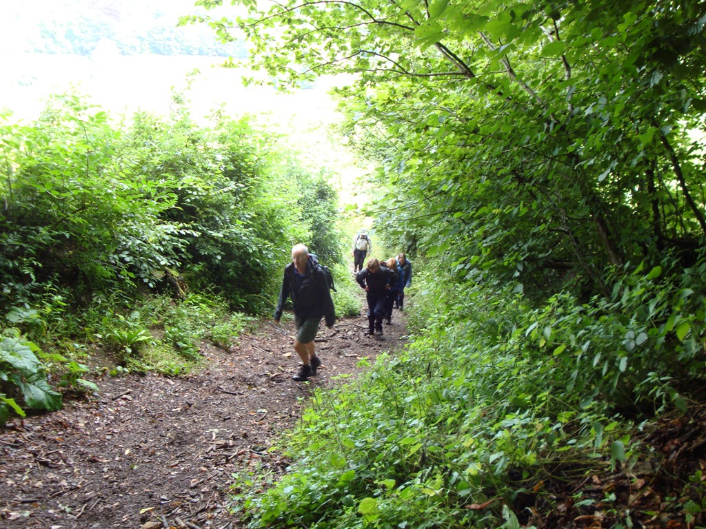
The rain was relentless but we plodded on through Stanley Wood and onto
Coaley Peak Picnic Site where we stopped so Gordon could empty his bladder
and also the pockets of his very expensive waterproof which had turned into
little pools (just right for carrying tadpoles and maybe a newt or two). We
carried on through Coaley Wood which was damp and dark and the mist created
an eerie spectacle which you, lovely reader, would have found enchanting had
any of us been arsed to take a photo.
Ahead of us through the rain we could see Cam Long Down (which for some
reason I thought I’d eaten in a Chinese restaurant the week before). Jane
and I were pretty fed up when we realised we’d got to climb the bloody thing
instead of skirting round it - after all, it wasn’t like we were going to be
able to take advantage of the ‘wonderful panorama’ as promised in the
guidebook. When we reached the top (is summit too grand a word?) we were met
with the worst weather of the day – driving rain and gale force winds (at
least 7 on the Richter scale). We quickly crossed the ridge to its western
end, skirted Cam Peak and crossed a rather slippery meadow before arriving
in the ‘wool and cloth’ town of Dursley. Me, Jane and Ken did another half
mile to find a loo whilst Mike and Gordon stripped off and eat their lovely
lunch under the arches of the Old Market House. My lunch of McCoys flame
grilled steak crisps was nicely rounded off with a mint courtesy of Jane.
After a good 5 minutes break we headed off again into the rain and through
Dursley’s main shopping street to Hill Road. Hmmmmm, Hill – did this mean
what I thought it meant. Yes – it was another bloody hill, leading onto
another bloody hill called Stinchcombe Hill. The day was getting better and
better. At the top of Stinchcombe Hill we had a very difficult decision to
make – but I’m not going to tell you what that was – read the guidebook and
see if you can guess.....
Despite being the longer part of the day’s walk, the afternoon passed
quickly and without incident. Between Mike’s gadget, my exemplary reading
skills and a plethora of Cotswolds Way markers we soon found ourselves on
The Street in North Nibley. We headed up the B4060 for a few metres before
turning off onto a classic sunken track before being faced with the
steepest, wettest, longest set of steps we’d seen that day. We hauled
ourselves up the steps which took us up to Nibley Knoll and the Tyndale
monument.
We followed the scarp edge to Westridge Wood and apparently passed the site
of the Brackenbury Ditches (another iron age hill fort). We then dropped
down into Wotton-Under-Edge and after a slight detour to take in the sites
of the town, arrived at our destination, physically soaked but spirit only,
well, slightly damp.
(By the way, the walk turned out to be 15.4 miles, including our unscheduled
detour)
DAY 5 - Wooton-under-Edge to Tormarton
Ann had decided to join us again today because the weather was almost
pleasant.
The Daves were going to do
approx 8 miles, picking up the walk at Hawkesbury Upton.
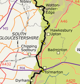
Day 5: Wotton-under-Edge - Tormarton (15.1 miles\2122ft ascent)
We had lost quite a bit of height dropping down to Wotton under Edge
the previous afternoon and thought that the morning would begin with a
trudge back up the hill. However, my newly found skill of reading (the
guidebook) meant that we didn’t have to and were in fact almost right on
track outside the door.
All we had
to do was find St Mary the Virgin (presumably a church) and follow a
millstream before a steep climb up Blackquarries Hill. To be sure we were on
the right track, Ken asked a little local chap who looked and sounded like
the lead singer from the Wurzels.
No
one had a clue what he said but somehow we found ourselves on the right
track.
Whilst climbing Blackquarries
Hill we bumped into the man who had been listening to our ‘banter’ in the
restaurant the night before.
He was
pleasant enough but his BO was a little too much to allow him to walk with
us for long (well that was the opinion of the rest of the group anyway).
The group climb Backquarries Hill - Mr Stinky can be seen at the rear –
how appropriate.
We had to walk along the road for about half a mile and then turn off
sharply back to the right – that’s what Mike’s machine said and that’s what
the guidebook confirmed.
Ken saw a
way marker which had been knocked down and promptly told us it was pointing
left.
Oh ok – Mike says right, the
book says right, but a knocked over way marker says left - that’ll be right
then, Ken. Duh.
We set off along the track heading for Tor Hill and Alderley,
catching sight of the Tyndale monument we’d visited the previous afternoon –
it looked quite splendid glinting in the sunlight, a bit different from the
day before.
We carried on through a
field where we had to turn left somewhere across a sloping terrace of
pasture.
There had been some farming
tomfoolery so we had a brief debate as to where we needed to be before
opting for the correct route as signified by a waymarker further down the
path (phew).
Meanwhile, in Chipping Sodbury, Nick and I were enjoying comedy moments like
this....
We walked for 7 miles up that road before realising it was a joke.
We carried on through a wood before having one of those ‘waterproofs
on, waterproofs off’ moments.
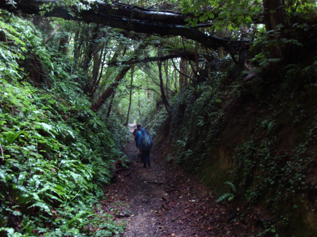
We
lost height through a dark, deeply sunken track with trees high overhead
completing a tunnel-effect.....
We passed the outskirts of Wortley, headed through Alderley
and through meadows into the Kilcott Valley.
We followed Kilcott Brook and admired the extremely large testes of a
Highland Bull before passing Kilcott Mill.
Kilcott Mill, not the bull’s bollocks.
This particular part of the Cotswolds Way is also shared with the Monarch’s
Way.
At 609 miles, I don’t think
we’ll be doing that anytime soon.
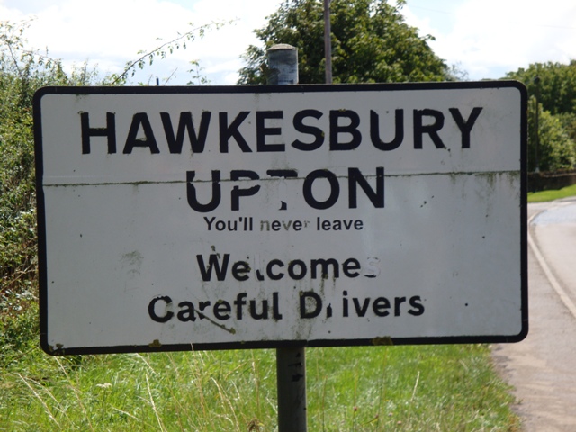
We passed through Claypit Wood and over a large field and soon found
ourselves heading towards the Somerset Monument and just beyond that
Hawkesbury Upton whose sign had the disturbing caption ‘You’ll never
leave’...and Jane nearly didn’t, deciding to take a dive into the village
pond (without getting wet) .
Jane
was in shock but the rest of us were left reeling by Jane’s language – Ken
said he heard ‘Bloody Hell’ but I’m convinced I heard ‘Fuck and Bugger it’.
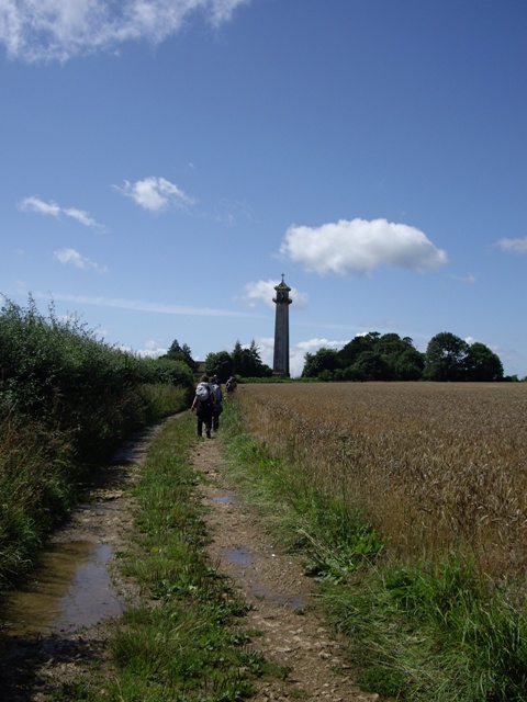
Approaching Somerset Monument
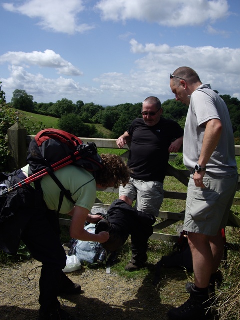
We stopped for some lunch shortly after Jane’s pond dipping incident so we
could all recover (and they call me Princess Potty Mouth).
Gord had a comedy moment trying to remove his waterproof bottoms,
admitting that his legs were too short to enable him to climb on a fence to
facilitate the manoeuvre.
In the end
Ann had to give him a hand....
Lunch over, we carried on over a field where we bumped into Barry who’d lost
his yellow cap.
Barry had attempted
to do the Cotswolds Way in one go but had only managed 63 miles.
The loss of his yellow cap had left him somewhat traumatised and we
were given instructions that should we find it we had to give it to two
ladies, Ann and Beryl (or something like that).
Sadly for Barry we never saw it, although the Daves believe they had
spotted it.
That Monty Pythonesque
episode over, we crossed yet more fields before a brief walk through a wood
before traversing a meadow which enabled an episode from another BBC classic
– we had a Last of the Summer Wine type moment where we all stopped on a
well positioned bench to admire the view.
l-r Compo, Marina, Nora, Foggy and Clegg.
We then dropped down to the village of Horton, crossed the village and
headed for Little Sodbury, crossing a number of fields before arriving at
Little Sodbury Church.
We then
headed for Old Sodbury (not to be mistaken for Miserable Old Sodbury who was
by now in Tormarton anaesthetising his bad back) via another steep hill, at
the top of which was Sodbury Hill Fort.
Having navigated our way through the fort and more woodland, we
dropped down onto an enclosed path which brought us out at Old Sodbury
village school.
This part of our
walk went without incident but on their walk, Dave and Macca had an
interesting time with some dangerous dogs (well strictly speaking Dave did,
Macca was some distance away taking photos and trying to recollect what he’d
learned from all those years of watching
Dog Whisperer).
Just relax Dave, he’ll pick up on your fear.
We then had to walk through the lovely churchyard of Saint John the
Baptist and out onto another meadow where we paused briefly for photos at a
topograph erected by the villagers to commemorate the start of the 3
rd
Millenium....
At this point, my phone was ringing persistently.
It was Sean supposedly giving me directions to the hotel once we
arrived in Tormarton, however he appeared to be talking gibberish.
I asked him to repeat but he’d lost patience by this time – “put Mike
on” he said, to which I didn’t respond. “PUT MIKE ON” - so I did.
Mike also confirmed he was talking shite.
The guidebook instructed us to ‘Go down the slope to the bottom left hand
corner’ which we did and promptly lost all Costwold Way-markers. We wandered
through a couple of fields looking for a way out onto the A432 opposite The
Dog Inn.
I was having another
episode like yesterday morning – when will I learn that reading random
sentences isn’t really a proper solution.
Anyway, Mike soon got us on the right road after consulting the stars
and we found ourselves having another of those pointless Costwold Way
detours (of which there have been several). We must have walked about a mile
and a half up hill and down dale to reach a point about 200 yards from where
we started.
Yet more uphill was to
come, passing Dodington Park before dropping down to the A46 for a quick
game of chicken.
We then walked over
too many fields and over too many stiles and ended up in the village of
Tormarton.
We could spot a little
oasis in the distance but unfortunately on arriving there we found there was
no one at the Inn....
So we trudged half a mile back up the road to the Compass Hotel where Sean
was instructed to get the beers in whilst we peeled off our boots after
another eventful day.
DAY 6 - Tormarton to Bath
Some of us were surprisingly fresh after the evening’s gin fest. Some of us
were not, having listened to bedfellows snoring all night due to the gin
fest.
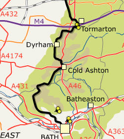 Day 6: Tormarton - Bath (16.8 miles\1844ft ascent)
Walkers today were me, Mike, Gord, Jane, Ken, Ann and Macca.
However, for reasons known only to himself, Macca decided to set off
on his own a good 20 minutes/half an hour before the rest of us (miserable
tart). Having read the guidebook and consulted local knowledge behind the
bar on the previous evening it was deemed unlikely that we’d find anywhere
to buy lunch during today’s 17 miler so we all decided to plunder the
breakfast offerings for later – sausage sandwich for me, jam on toast for
Gord and Jane, croissants and pastries for Mike, fruit for Ken (it won’t
keep you alive any longer, Ken).
We set off across the fields and stiles that we’d overdone yesterday out of
Tormarton heading south to cross over the M4 (luckily there was a bridge).
 Bath, here we come – downhill all the way, apparently.
We made really good progress over successive, flat fields and before we knew
it we’d done nearly 4 miles. We had another game of chicken over the A46 and
into some woodlands and out again to follow the boundary of a field, heading
for Dyrham Park.
According to the
guidebook we carried on along a bridleway beside a sturdy grey wall that
contains the unseen deer park.
Except one of the deer wasn’t unseen, cos we seen it.
We sashayed down the strip lynchets and bounded over the mounds of
Hinton Hil Fort.
We then followed a
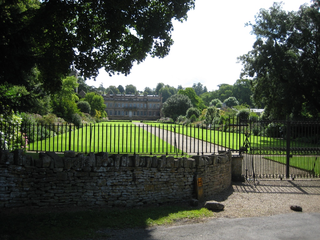
sunken track into the little village of Dyrham itself where we stopped to
admire Dyrham House....
Ann’s foot was beginning to give her some grief so we consulted the
guidebook for a likely get out point over the next couple of miles and
phoned Team Spaz for some taxi numbers....
We headed out of Dyrham, following the boundary of a field, through a small
wooded area and across a meadow.
We
crossed a field, up and over the brow of a hill and then down again,
crossing a footbridge by a stream.
We then climbed up to and through Dyrham Wood, checking the little message
book left in a sandwich box to see if Macca had left us any handy
hints/abuse, but he hadn’t. We crossed over more fields heading for
Pennsylvania (grid reference 65000).
As we approached the A46 we spotted a little round oasis (drinking Oasis) in
the field over the road – yay it was Macca!
 So much for the head start Macca!
We had a brief break then carried on over the fields, thinking that Macca
was now in our fold.
But lo, where’d
he go?
 There he is!.
We waited for him outside the White Hart in Cold Ashton where Ann decided to
call it a day.
It was 11:50, only 10
minutes till opening time.
She’d got
the taxi numbers, but in the end didn’t need them as she was inundated with
offers of lifts from local gents and after a blind date type elimination
test, picked number 3 and rode off into the sunset with him (well, to Bath
at least).
Macca followed us for a bit but in the end went off and did his own thing,
opting for the dangerous ‘A’ road walk which is apparently littered with
killer road signs.
Final section – Cold Ashton to Bath – 10 miles to go.
We crossed the A46 for the final time (on foot) and ultimately onto a
lane which was very steep but in a downward direction (hooray).
We met a couple who were also completing the walk (8 days for them –
lightweights) whilst we stopped to enjoy more of our breakfasts for lunch.
It wasn’t to be the last time we saw them (the people not the
breakfast/lunch).
Having dropped so steeply I knew we would end up paying for it and sure
enough we did.
We ascended a
hillside and up two steeply sloping fields (they’re all bloody hills in my
book) before crossing the hilltop to the commemorative paraphernalia
celebrating the Battle of Lansdown.
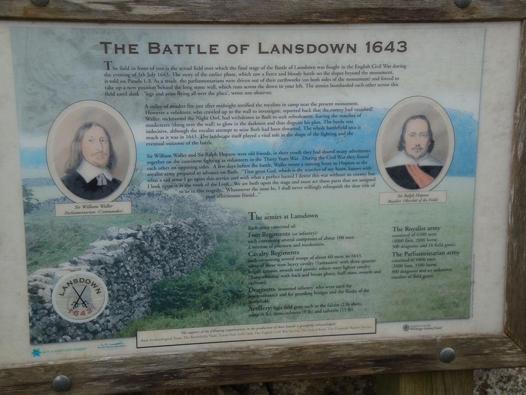 This one’s for you Neil.
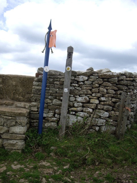 The leaning flag of Lansdown.
Like true soldiers we crossed the battlefield and through a small wood which
led us to yet more flags and the Granville Monument.
We crossed a meadow to yet more Battle of Lansdown flags and
information panels. We crossed over a road and headed for the Avon Fire
Brigade complex.
Jane and I were
hoping to get into a difficult situation from which we needed rescuing but
alas no slips, trips or falls were forthcoming.
[Note to self – be careful what you wish you for....].
We walked down a path, through a small wood and out onto a meadow
with views over the city of .....Bristol.
Calm down dear, it’s only Bristol.
Having crossed Hanging Hill we came across – guess what – yes, more
Battle of Lansdown information panels.
Despite the plethora of these panels, I haven’t got a bloody clue
what the Battle of Lansdown is about [note to Avon people – less is more].
We passed a trig point and walked along a scarp edge heading south east for
a very large, very deserted golf course.
We walked round the golf course and Jane stopped us, complaining of
déjà vu.
How did that happen,
haven’t we been here before?
Yes we
have.
So we found the right
direction and headed east to the ramparts of Little Down Hill Fort.
We crossed the grassy rampart which brought us out onto Bath
Racecourse.
And they’re off....
We continued along the scarp to a vantage point known as Prospect Stile. OMG
our target was in sight!....
At this point we met the couple we’d met at lunchtime. Despite our best
efforts they stayed with us for the rest of the walk.
Now we’d all been under the impression it was all downhill to Bath.
That is until we got to Bath and did some of the steepest bloody ups
and downs of the day.
True to
Cotswold Way form, we did some strange, convoluted route around Bath before
we found our way to our destination – Bath Abbey - and a champagne welcome
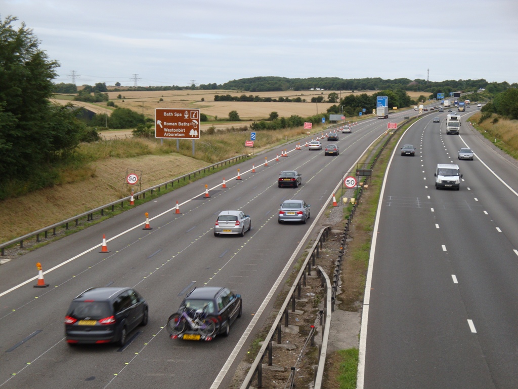
from, well, those who failed. End of the Cotswold Way.
102 miles.
Done!
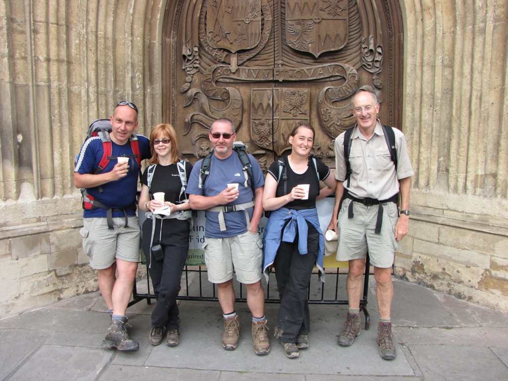 The famous five at the official end of the Cotswold Way - the doors of
Bath Abbey. Magic Mike, Amazing Alison, Great Gordon, Fulgent Jane* and King
Ken.
The famous five at the official end of the Cotswold Way - the doors of
Bath Abbey. Magic Mike, Amazing Alison, Great Gordon, Fulgent Jane* and King
Ken.
(* - can't think of anything that starts with 'J')
And so ends Alison's description of the final 3 days.
In typical Bond Tours style we celebrated with a Friday night curry in the
famous Eastern Eye restaurant. This was followed by a free day in Bath where
we all managed to find something interesting to do. Alison, Jane, Mike and I
enjoyed the spa immensely (Mike and me probably more than Alison and Jane)
whilst Nick and Ann went on a tour of Jane Austen's Bath. Macca and Dave
enjoyed the bus tour whilst Gordon went on shopping expedition. Ken met up
with an old 'friend' for a cheeky lunch. Sneaky Ken!
We all had Saturday night's Italian restaurant to look forward to along with
more Bath beers. What could possibly go wrong? Alison decided to slip in the
hotel shower cubicle and knock her head and back. She was in quite a bit of
pain but managed to take in the Italian before deciding that the pain
warranted a visit to Bath A&E. Great! Two hours later we returned to the
hotel and enjoyed a couple of night caps in readiness for the following
day's journey home.
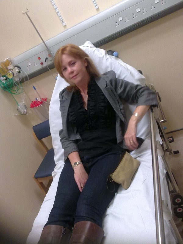 Alison, jealous of my back injury, decides to join in on the fun.
Before the walk had begun I believed that the weather would have been the
deciding factor in how many people would complete the walk and whether it
would be deemed a success. The rain had been constant and heavy during the
previous few weeks so coupled with the occasional thunder storm it wasn't
looking too good.
As it turns out the weather wasn't too bad at all. The 30 minute downpour on
the Tuesday wasn't great and the 5 that completed day 4 won't have many fond
memories but apart from that we appeared to have missed the worst of the
week's weather. Dave and Macca were probably happy with their week's effort
and Ann was unsure about how her foot would hold up. She'd managed to walk a
good 50+ miles so things could have been a lot worse. After his success on
last year's Lakeland Valleys walk Nick was expected to nail the Cotswold Way
but it seems that distance and not ascent\descent is the killer for Nick?
As for me, I hadn't even contemplated not finishing the walk and even after
the 'twinge' in Chipping Campden didn't expect to finish after only 3 days.
I'll never know what may have happened if I'd have continued on day 4 but my
gut feeling is that I would have packed in after a couple of miles and had
to have called a taxi to pick me up from the middle of nowhere.
Gordon was a bit of an unknown quantity before the walk due to an ongoing
groin problem but he managed the 102 miles with ease. Mike's training regime
had certainly paid off, the same regime had also worked for Alison and Jane,
and as for Ken, what can you say? He's now got more golds than Steve
Redgrave and is proof that a good diet, moderate drinking and regular sex
with multiple partners is the way to live.
Is this the last we've seen of Dave and Macca? Will my back ever mend? Will
Alison's back ever mend? Will Ann manage a year without a long term injury?
Will Nick sort out his achilles heel? How much longer can Ken's body last? -
we'll find out next year!
Now it's time for the ever popular injury table....
| Walker |
Blisters |
Prolapsed Disc |
Bruised Leg |
Woodland Splatter |
Achilles Pain |
Spa Stonker |
Foot Injury |
| Sean |
X |
X |
X |
|
|
X |
|
| Alison |
|
|
|
|
|
|
|
| Ken |
|
|
|
|
|
|
|
| Mike |
|
|
|
|
|
X |
|
| Nick |
X |
|
|
|
X |
|
|
| Ann |
|
|
|
|
|
|
X |
| Gordon |
|
|
|
|
|
|
|
| Dave |
X |
|
|
|
|
|
|
| Jane |
|
|
|
|
|
|
|
| Macca |
|
|
|
X |
|
|
|
