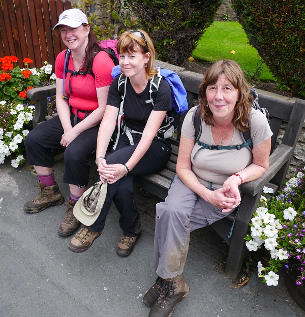
The Inn Way to Northumberland - August 16th-21st 2015
Sean Bond
Terry Jones, Mark Jones, Jim Eason, Sandra Brooks, Susan Lewis, Ken
Hodgkinson, Sarah Austin, Gordon Darlington, Jon Gilson, Mike Riley,
Karen Riley, Alison Bond
Ann Baxter, Jane Salt
DAY 1 -
Warkworth to Embleton (15 miles)
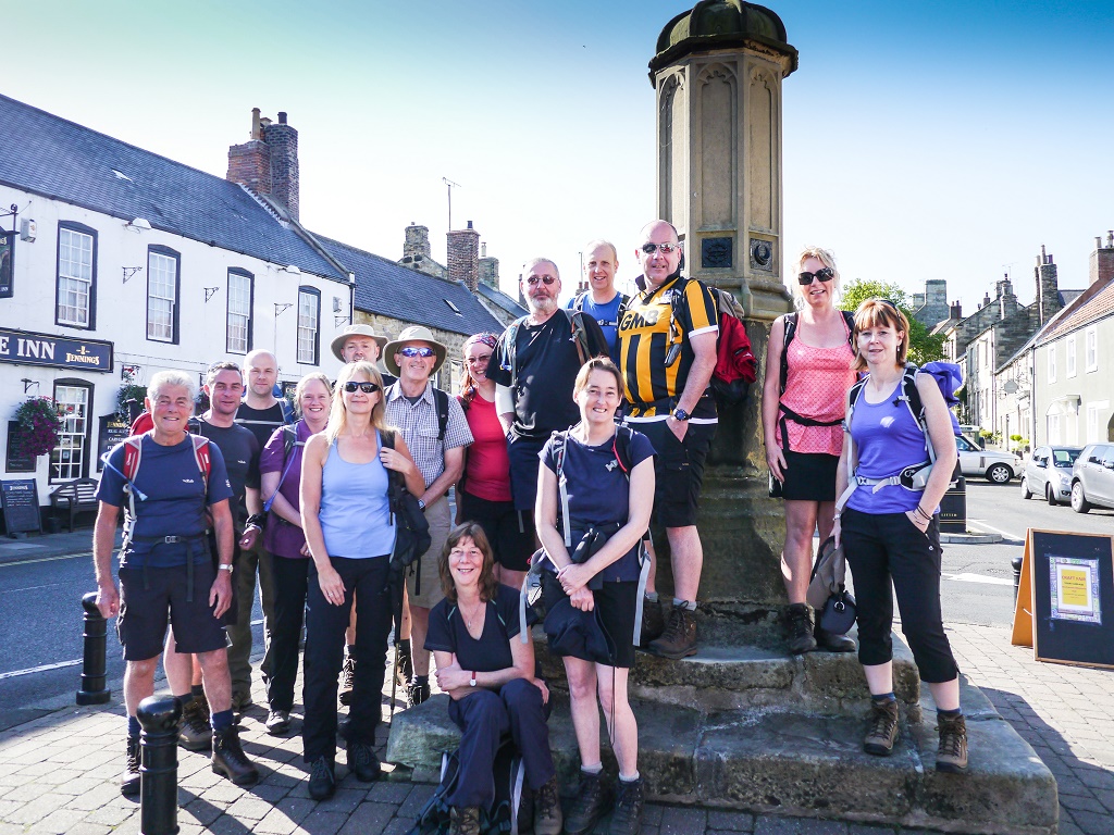
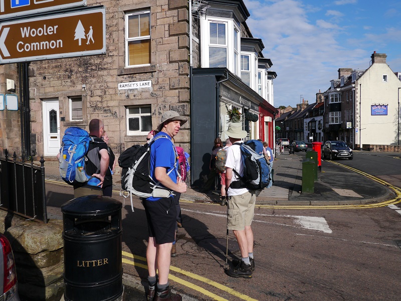
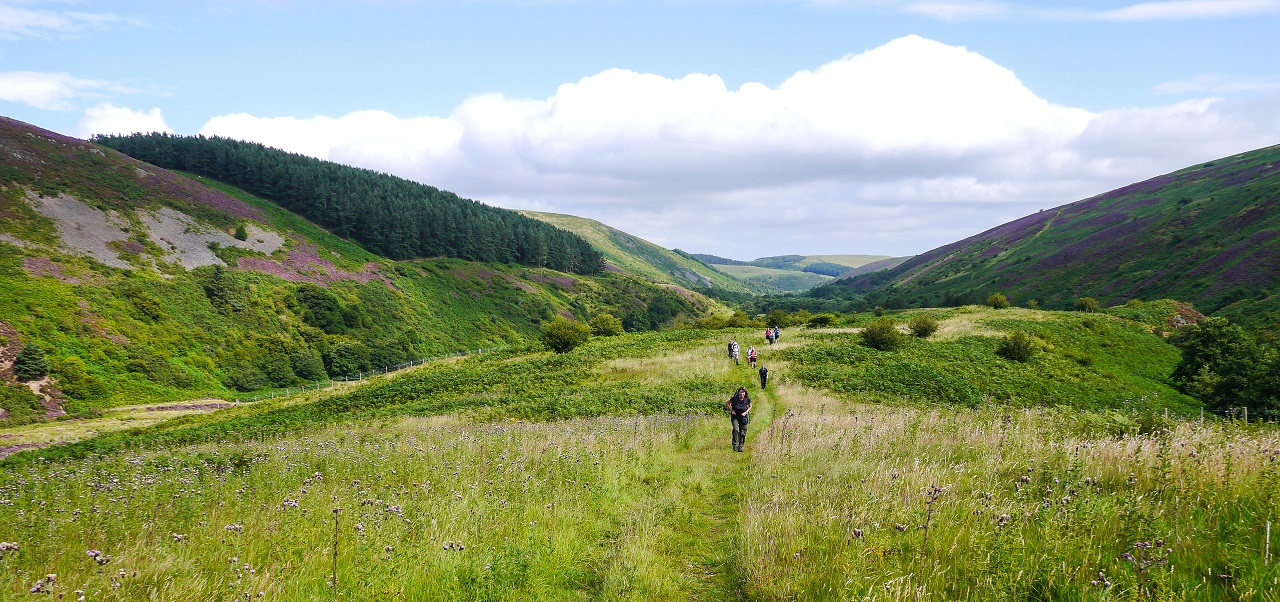
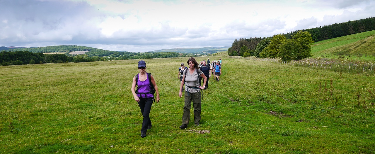
Fiftteen walkers had decided to take on this year's challenge of the Inn
Way to Northumberland. This neck of the woods had popped up as a
possible destination on a number of occasions but accommodation issues
had forced us to look elsewhere. However, the recent addition of
Clennell Hall to the accommodation list meant that the Wooler to
Alwinton section of the walk could now be completed with ample beds now
being available in the Alwinton area.
As always seems to be the case, the weather leading up to the walk
hadn't been good so we were expecting a patchy week from a weather
viewpoint. An enjoyable afternoon and evening had been spent in
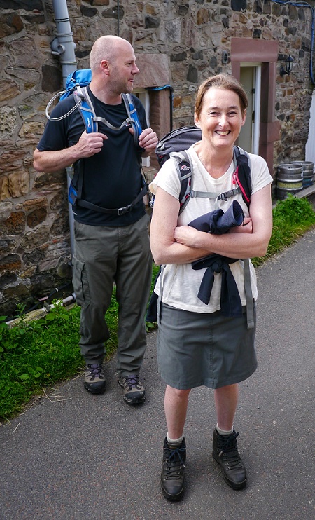
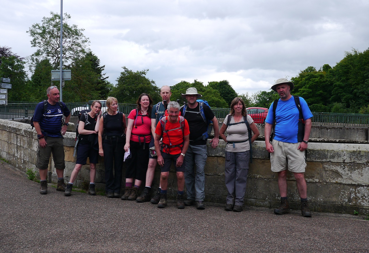
Warkworth on the Saturday so we gathered at the market place cross on
the Sunday morning for our now legendary starting photo with the sea,
sun and sand as our companions for an easy fifteen miler to Embleton.
Terry Jones and his old bones had decided to rejoin the group but after
suffering with foot problems for many months had planned to take a few
rest days and to 'see how it goes'. Terry had tested over twenty four
different sets of sole product before the walk (and cut thirteen of them up) but had
decided that Superfeet Green were the soles of choice. What could
possibly go wrong?
Rich and Netty had to opt out of this year's walk due to a shortage of
leave and a wedding but they, along with Dave Swarbrook, would join
us for a few nights at the end of the week.
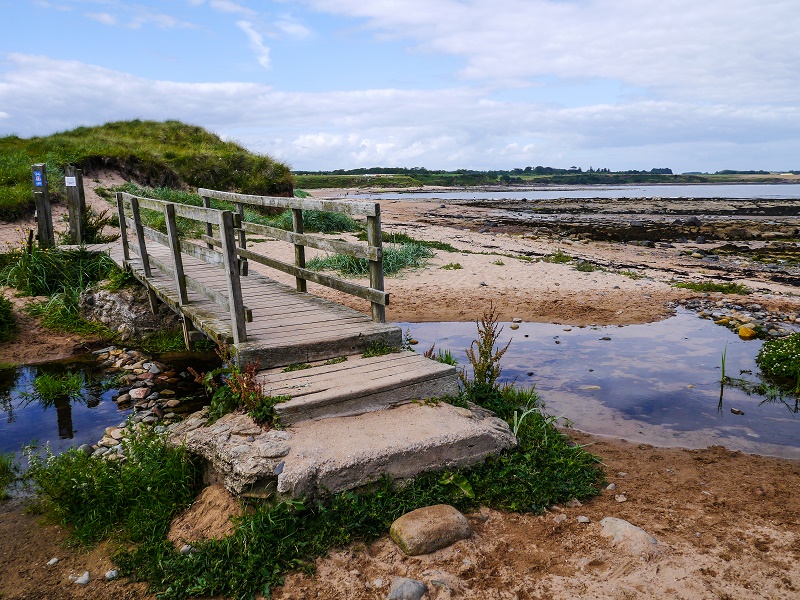
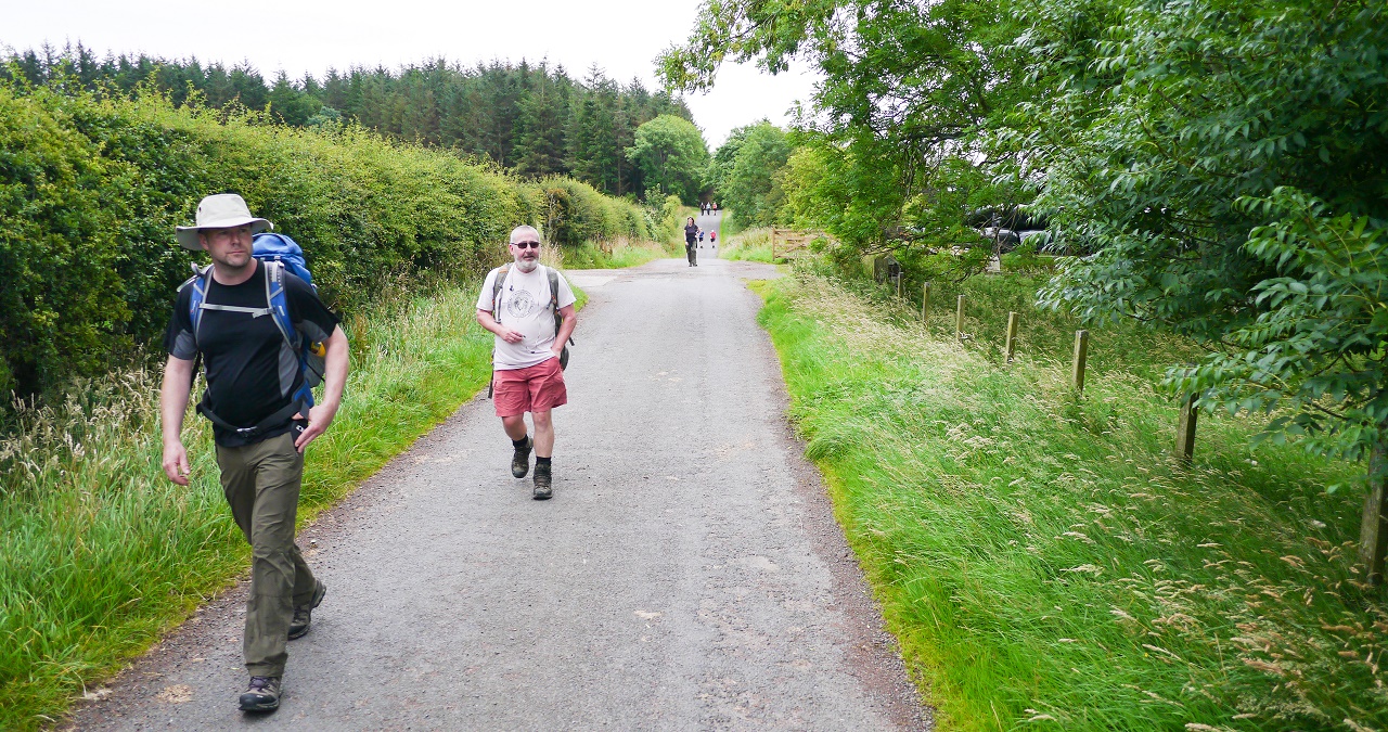
We marched out of Warkworth over the bridge over the Coquet and headed
off for the beach in quick time - just in case anyone spotted Mike's
Vale shirt.
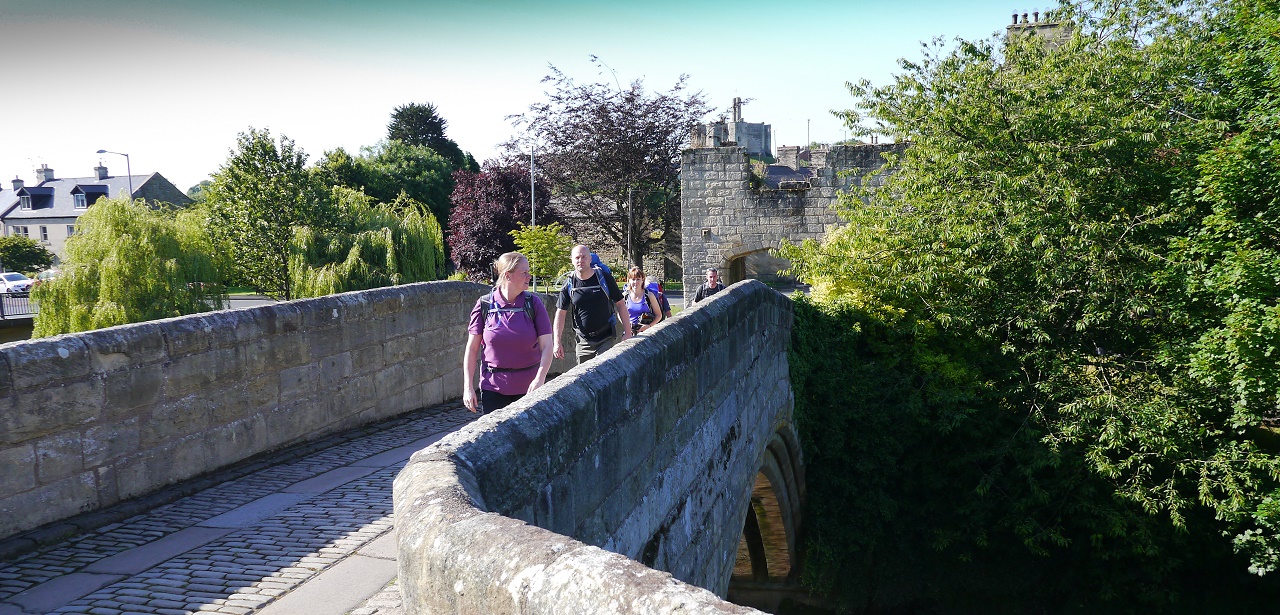
The bridge over the Coquet. Seaward bound.
After a short spot of road walking we hit the dunes and the path through the
bracken. The weather was excellent and the forecast was for it to remain
good for at least a couple of days. The route kept just off the beach but
this didn't stop Alison and Karen from disappearing for a while for an
impromptu beach excursion but they soon rejoined the group after realising
they were holding everyone up.....
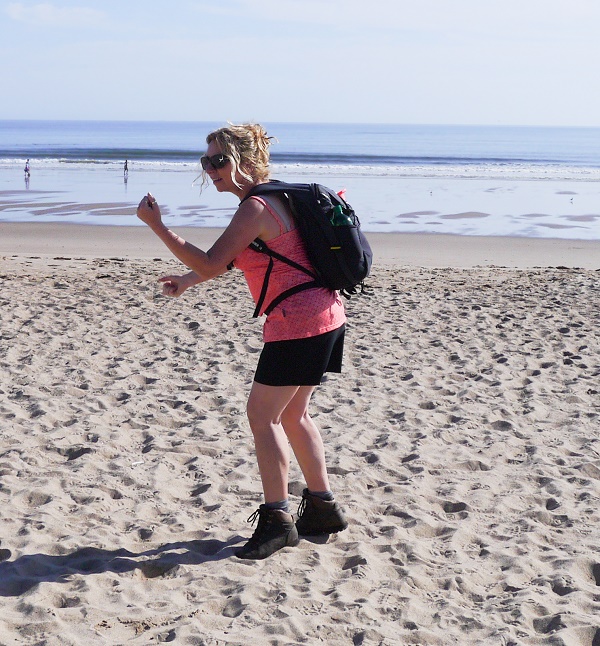
Beach stupidity.
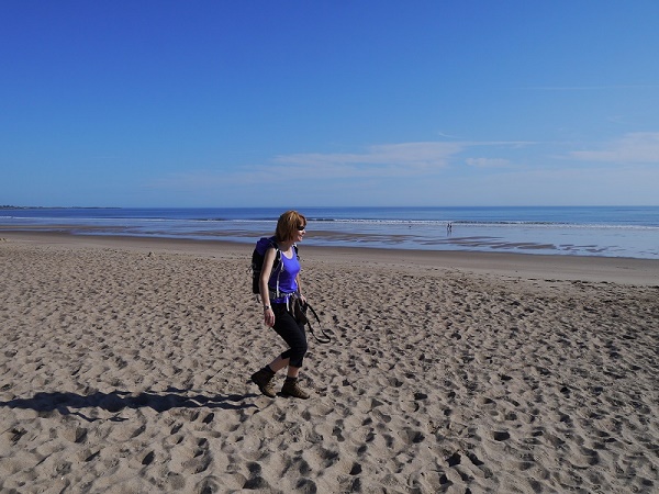
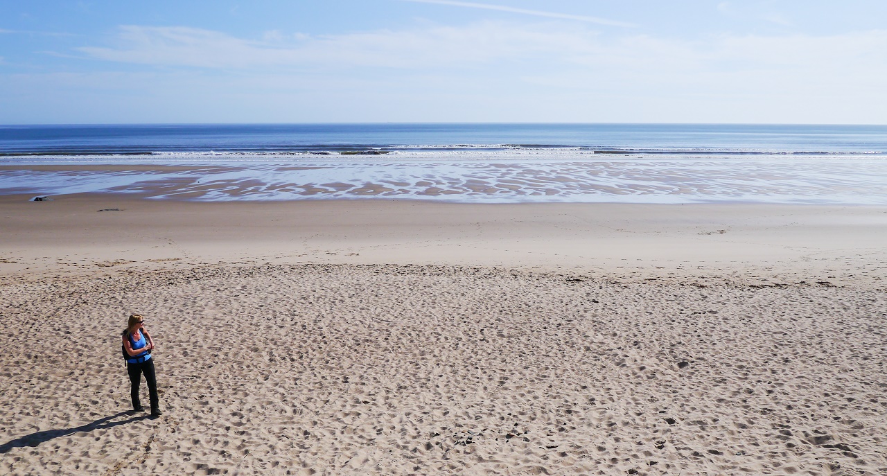 Whereas Sue wanders alone on the beach dreaming about the man she met in
Tunstall's Pound Shop.
Whereas Sue wanders alone on the beach dreaming about the man she met in
Tunstall's Pound Shop.
 The beach near to Warkworth with Coquet Island and Amble in the
distance.
The beach near to Warkworth with Coquet Island and Amble in the
distance.
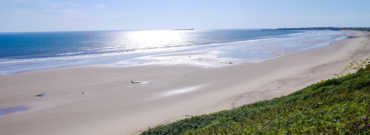
After a couple of miles of pleasant coastal walking the route turned inland
to avoid a potentially tricky crossing of Alnmouth Bay. This is marked as a
path but we couldn't take the risk of coming across impassable water or mud
so took the safe option of going inland.
 How appropriate.
 On the path to Alnmouth. Easy going with views to the sea.
Alnmouth was soon reached and we enjoyed the walk through what turned out to
be one of the prettiest villages of the week. We all picked our favourite
properties whilst others stopped for drinks and ice creams. We were soon
back on the route where our next target would be Boulmer.
 A group of old people at Alnmouth. There are some on the right of the
photo too.
A group of old people at Alnmouth. There are some on the right of the
photo too.
Jon had his eyes on the numerous golf courses along the coast but Alnmouth
Golf Club, at Foxton Hall, looked particularly pleasant. Shortly after
Foxton Hall we came across the first opportunity to walk along the beach
which happened to be excellent underfoot.
 The sand plus the availability of a stick allowed Alison the chance to
show off her artistic side.
The sand plus the availability of a stick allowed Alison the chance to
show off her artistic side.
 On the beach - heading towards Boulmer. Sarah, Jon, Sandra, Mark and
Jim.
On the beach - heading towards Boulmer. Sarah, Jon, Sandra, Mark and
Jim.
Lunch was taken at Boulmer which turned out to be a scruffy little place
with not a great deal to do or see.
 Aahhhh - Some old dears enjoying a seaside lunch.
The next stretch of the coast, up to Craster, turned out to be one of the
best parts of the entire walk. Numerous delightful bays, beaches and rocky
sections kept us all entertained with plenty to enjoy.
 Heading towards Howdiemont Sands.
 The sea air was making Jon feel horny.
The cliffs at Cullernose Point provided a chance to spy on the local sea
birds and their plentiful shittery from a safe vantage point. Still,
it made for a decent photo opportunity.
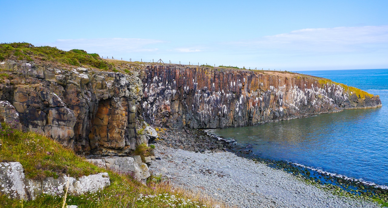 The colourful cliffs of Cullernose Point - The scene of the annual
Craster Masturbating Championship. Geoff Frampton from Blyth won this year's
event with a pretty impressive 23cc. His fantastic effort can be seen
centre left on the dark coloured rock. His mum always said he'd come good
one day.
The colourful cliffs of Cullernose Point - The scene of the annual
Craster Masturbating Championship. Geoff Frampton from Blyth won this year's
event with a pretty impressive 23cc. His fantastic effort can be seen
centre left on the dark coloured rock. His mum always said he'd come good
one day.
The next stop on the route would be Craster where Mark had mentioned that
the Jolly Fisherman was reknowned for its crab sarnies. We didn't bother
with a sarnie but did try a beer which is a very rare occurence on any of
our walks. In fact, I'm struggling to remember any occasion where we had a
pint during the day on any of our long distance walks.
 What the hell's going on here? Beer, during a walk? Disgraceful.
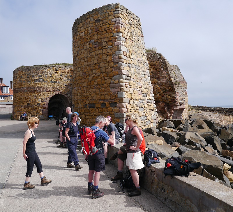
We finished our naughty beers with the next place of note being the gaunt
skeletal ruins of Dunstanburgh Castle. Its silhouette had been visible for
some miles but we were getting a better idea of its size and make up as we
approached from the south.
 Heading towards Dunstanburgh Castle along with numerous other folk.
Dunstanburgh Castle is one of those strange places that look more impressive
from a distance as, close up, it looked like any other knackered old castle.
A few of the men remarked that they'd experienced the same effect in women -
especially at Queens at Basford.
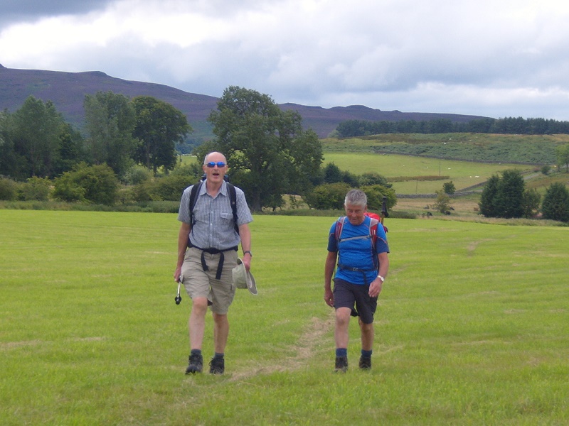
 Mark and Terry on the route to Embleton.
After another pleasant stretch close to the beach we turned inland to reach
Embleton, our destination for the day, and our hotel.
 The view south to Dunstanburgh Castle shortly before turning inland for
Embleton. All very scenic.
The view south to Dunstanburgh Castle shortly before turning inland for
Embleton. All very scenic.
As usual the bar was the first port of call in the Dunstanburgh Castle Hotel
and, once the sparkler had been fitted, the ale was rather nice. It'd been
an excellent first day with everyone looking forward to an easy eleven miler to
Bamburgh.
DAY 2 -
Embleton to Bamburgh (11 miles)
A flat 11 miler. Surely the easiest of any of the days on our long
distance walks?
We formed a group on the village green of Embleton in lovely sunny weather
with one photo opportunity proving too good to resist....
 How unfortunate.
We followed the track down to the beach where the route headed north past
numerous wooden holiday huts. Some quite nice, some a bit shitty.
The walking alongside the beach was easy and enjoyable and we soon reached
the small village of Low Newton-by-the Sea and its small brewery. Sadly, there was
no time to sample its wares so on we marched.
 Jim licks his lips at the thought of a brewery whilst Jane's just happy.
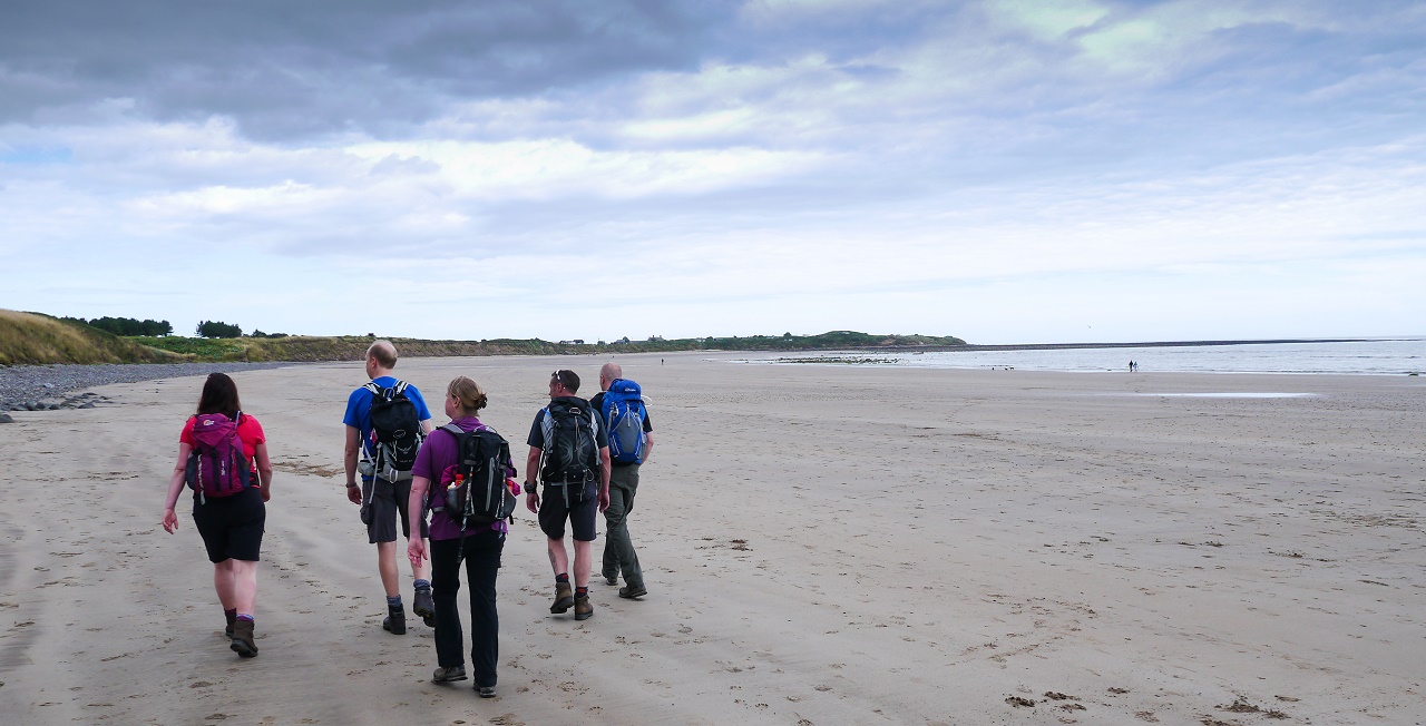
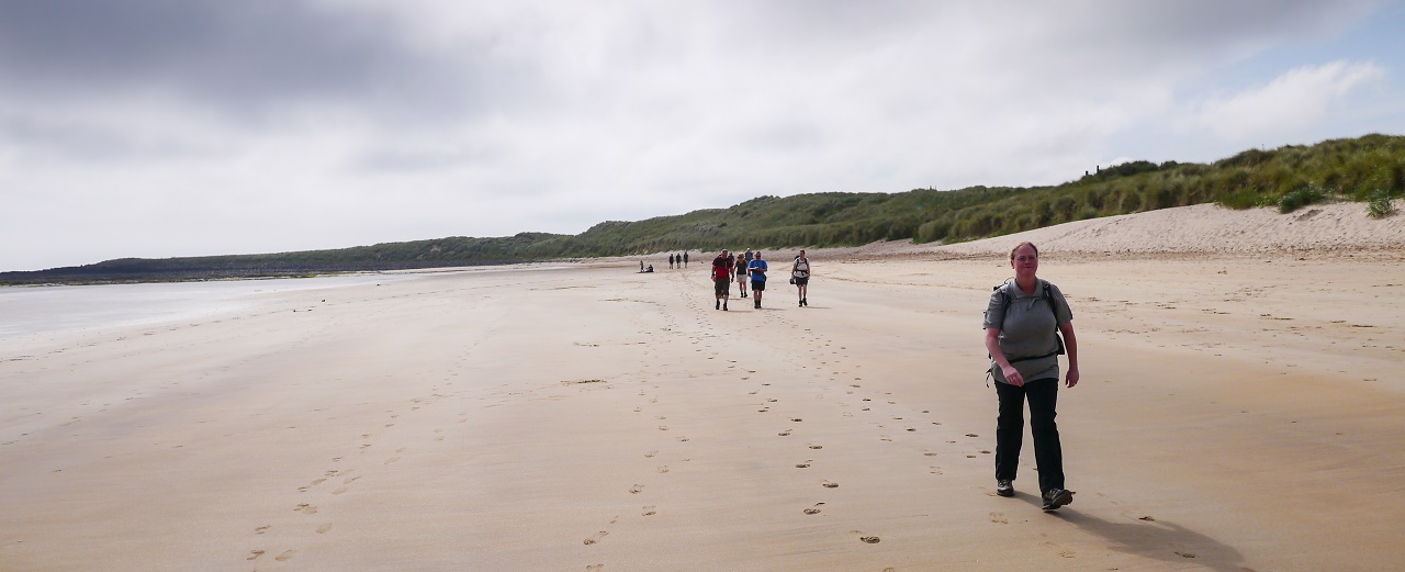
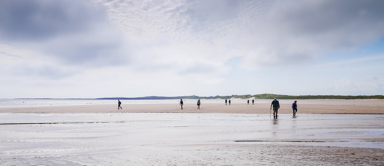
As we approached Newton Links we dropped onto the beach itself where nearly
two miles of excellent beach walking saw us all the way to Beadnell. For a
while it seemed that we'd never reach Beadnell as the beach and shoreline
seemed to go on forever but no one was complaining.
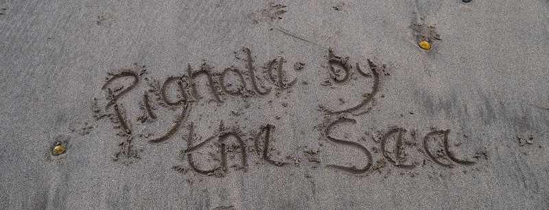
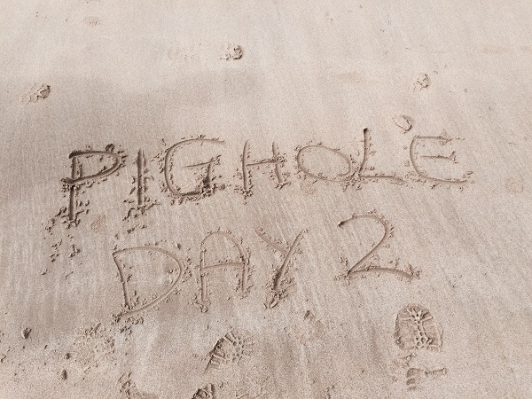 More Pighole beach art. Sarah managed to do this with her tongue.
 Sandra and co march along the beach towards Beadnell.
The OS map showed a stream entering the sea at one point which could have
proved rather tricky to cross but a few hops soon saw us over this little
obstacle.
 Will team Pighole disappear into quicksand?
We eventually reached Beadnell and discovered that a strange looking
building that we'd spotted from a distance was in fact a lime kiln. This was
the only interesting thing about Beadnell which turned out to be a strange
collection of properties (one named Shaven Haven) with a single shop and no pub which makes Beadnell
completely inhabitable as far as we're concerned.
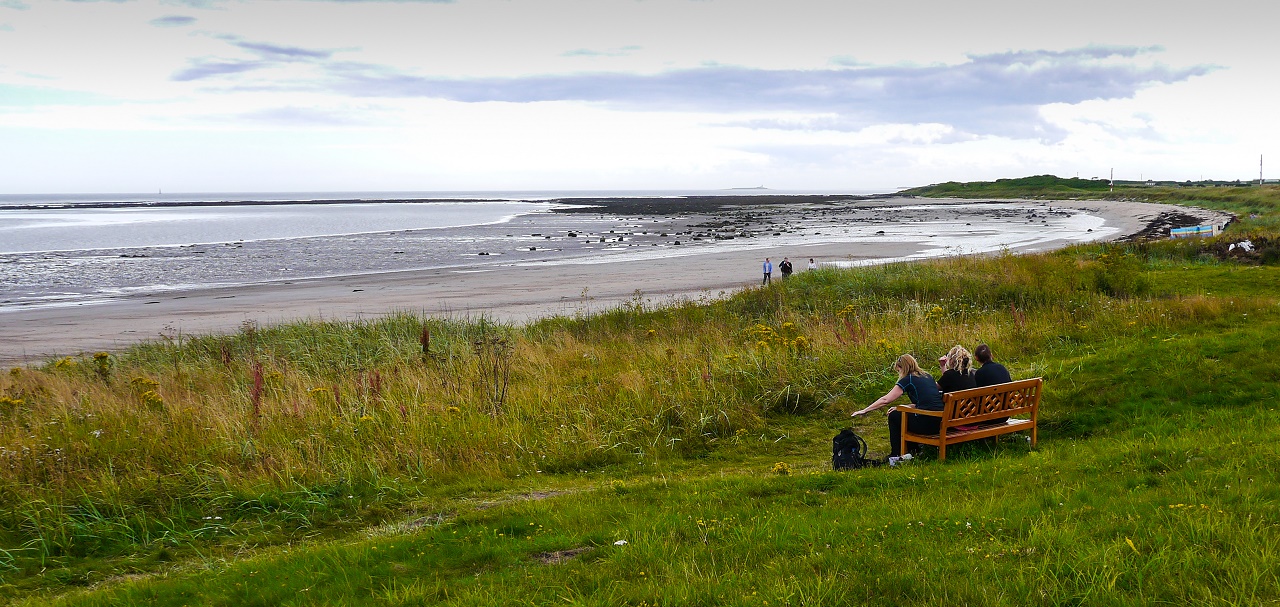
We sat by the small harbour at Beadnell and enjoyed a drink and a few
sweets. The beach had turned to dangerous rock so there was no chance of us
taking that on.
 Team stop alongside Beadnell's lime kilns.
The next mile and a half was a complete contrast to the previous mile and a
half by following the side of the road and it became
clear that either Mark or Terry were slowing down - considerably.
 Terry and Mark fall behind after leaving Beadnell. What's going on?
It turned out that Mark was struggling and not, as everyone expected, Terry.
Mark was experiencing a pain at the joint on the top of his foot and was
really struggling but he managed to make it to Seahouses where fish and
chips and a pint (yes, another one) were enjoyed.
 You can take the man out of Oldham....
A pint of lager failed to rescue Mark's foot. A few 'Ohs' from Terry
confirmed that Mark was in real trouble and the heart wrenching decision to
ring for a taxi was made.
All that was left was a long three and a half miles along the beach to Bamburgh. Without
Mark.
 Terry, visibly distraught by Mark's injury, plods along the beach to
Bamburgh.
Terry, visibly distraught by Mark's injury, plods along the beach to
Bamburgh.
We were soon approaching the majestic Bamburgh Castle and the day's end. The
skies were darkening but it was still a sight to behold.
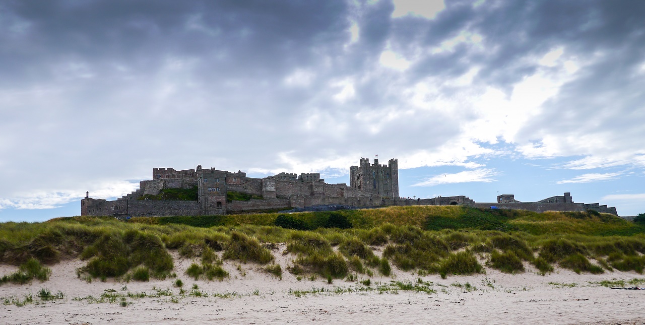 Bamburgh Castle. Ken was interested but wanted something bigger. Hhhmmm
- Looks like dark clouds are gathering.
Bamburgh Castle. Ken was interested but wanted something bigger. Hhhmmm
- Looks like dark clouds are gathering.
After a rather weary march in deep sand we reached the village of Bamburgh
and headed towards the Victoria Hotel where an alfresco drink was taken.
Mark had already arrived and wasn't feeling any fitter so he wondered if
he'd be able to walk again. We'd find out in the morning.
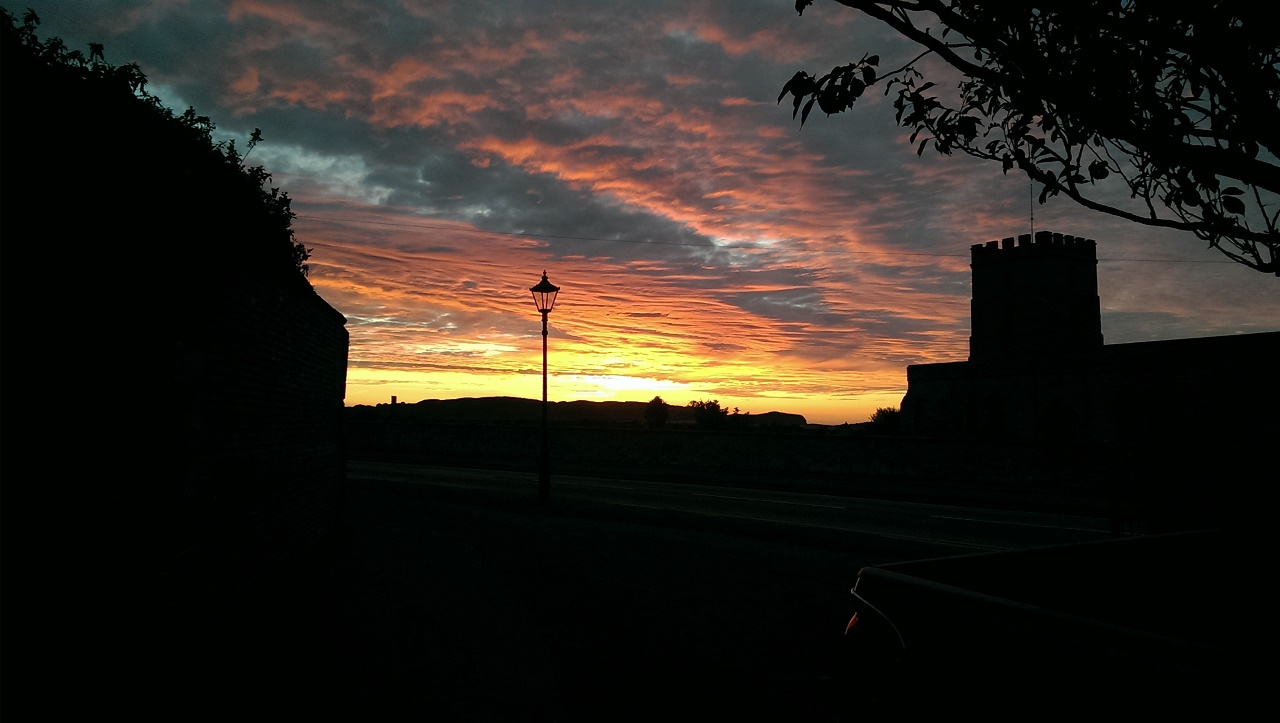 'Bamburgh sunset' by James Eason.
This signalled the end of the coastal walking which was a real shame as it'd
been thoroughly enjoyable but the next day would see us heading westward to
Wooler. The forecast was for rain. Bollocks!
DAY 3 -
Bamburgh to Wooler (16 miles)
No one really knew what to expect from this day but we knew one
thing - it was pissing it down and rather cold for August. The fact that it
was raining was drilled into us during breakfast which was enjoyed under a
glass roof. This was remarkably similar to that fateful day on the Cumbria
Way where the entire walk between Keswick and Caldbeck was a rainfest.
Mark was unable to walk as his foot was still in a bad way. His plan was to
get the car from Alnmouth Station and join us in Wooler.
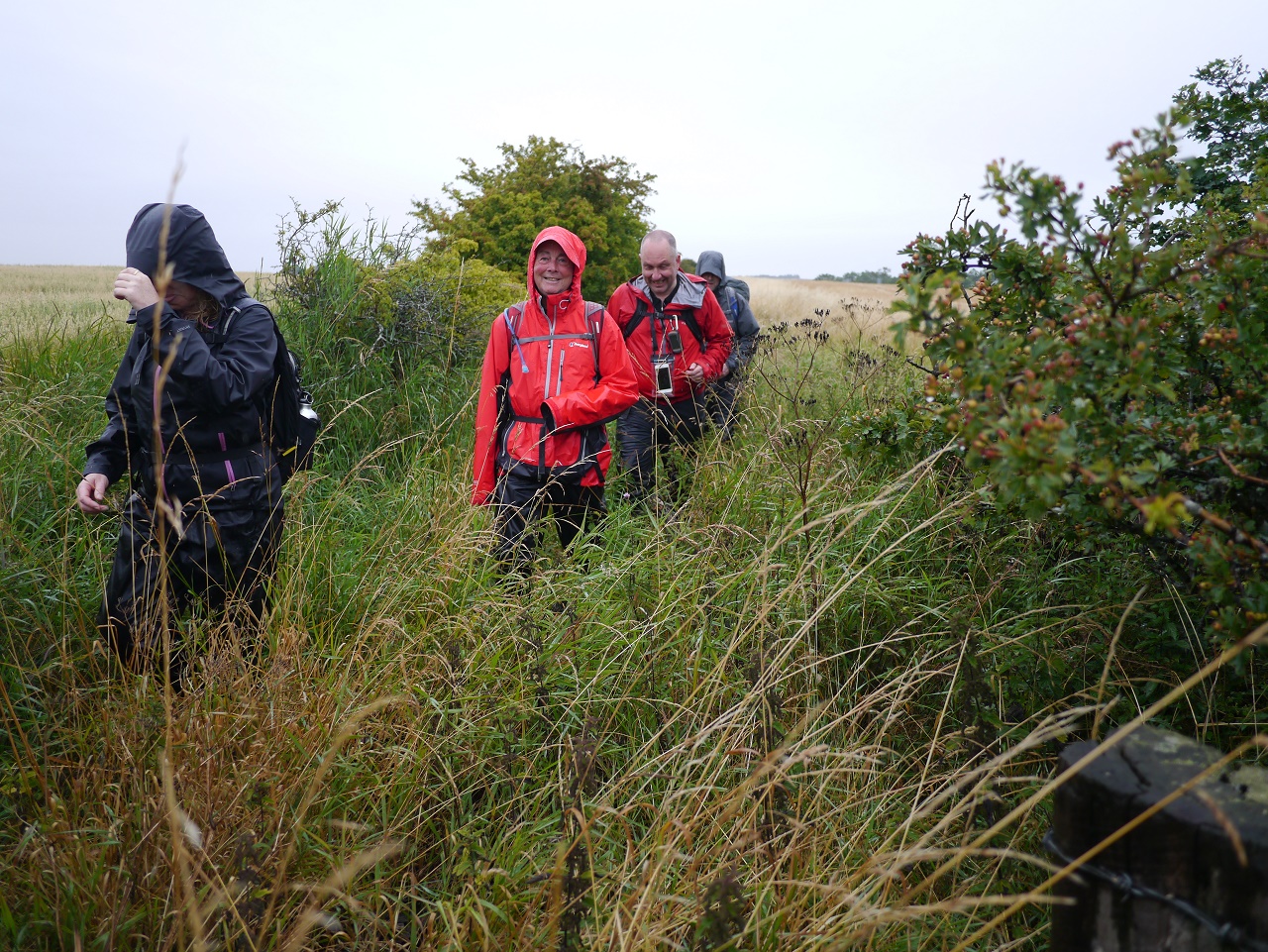
Over £4500's worth of waterproofs met outside of the Victoria Hotel. Let's
go!
The route leaves Bamburgh on the B1342 but soon forks off left to join St
Oswald's Way for a mile. It then leaves the Way and drops south towards
Bradford (not that Bradford) and then onto Lucker. Karen started the day off
in style by going A over T on a slippy wooden bridge. Karen and wet ground
aren't the best of friends so this could be a long bruising day for the
Queen of Slicks.
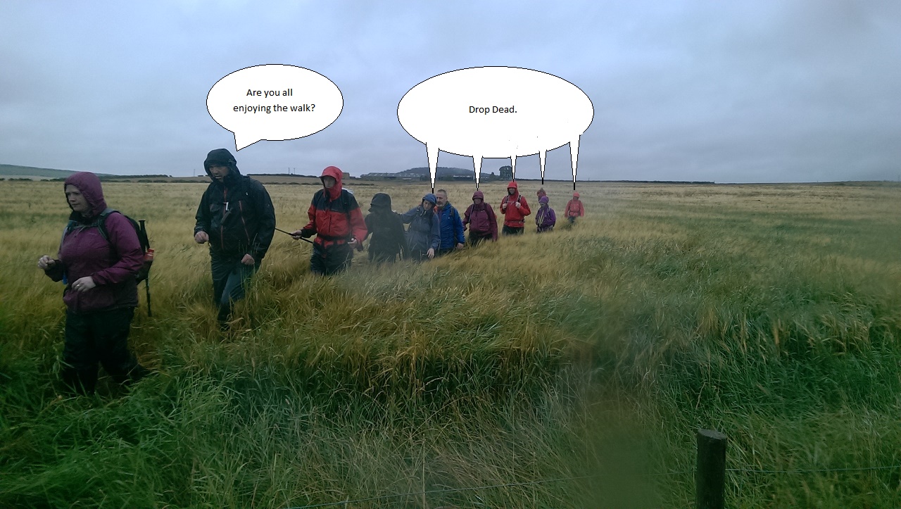
The stretch between
Bradford and Lucker, after passing through a shitty farm, saw us march at the side of fields full of waist high
wheat and barley which was particularly awful. Add onto this the ankle
twisting ground below the crops, persistent rain and the need to wear
waterproofs and all was not good.
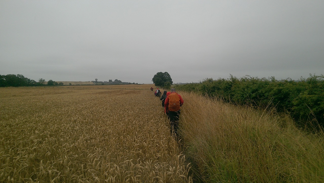
Rain and wheat = wet feet. Photo by James Eason Marine Photography.
On reaching Lucker a bloke approached us and asked to talk to the 'leader'
so I assumed the role of leader and asked what was up. Apparently, one of
our group had left a wicket open but this confused us as we'd seen many
gates on the way but no wickets. After a short explanation as to what a
wicket was (a gate) and a description of the incident (two walkers at the
back of the group, one wearing red) it became instantly obvious that Terry
had left a gate open. Terry explained that he remembered the gate in
question but couldn't actually shut the gate so left it open. This annoyed
the farmer, who must have been watching us from afar, so he asked us to shut all gates
for the rest of our journey.
So, shitty paths, rain, clothes full of cereal, nettles and miserable
farmers. Great!
Terry tries to enjoy the day. This was one of the easier sections.
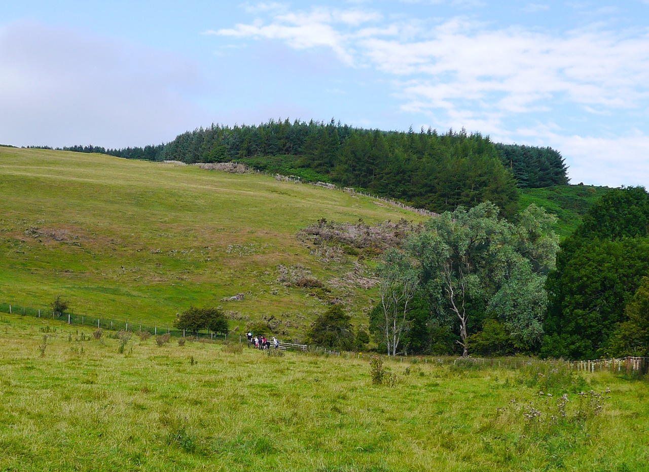
More fields saw us into Warenford where we would enter the unwelcoming world
of Twizell House but not before Ann took a tumble into the barley. She got
up having enjoyed two of her five a day.
Everything
at Twizell House, from the gates to the signs, gave the impression
that the owner doesn't want walkers anywhere near his land but, thanks to
numerous 'Private' signs and obvious post markers, ensured that no one would
stray off the path.
After passing a large farm we entered a coniferous plantation with hope that
the endless fields of crap were no more. It was now lunchtime - where could
we possibly eat in this rain?
As if by magic, just after leaving Cocklaw Dean, we came across an open shed
that provided respite from the rain and a chance to enjoy an upright lunch.
At last, something to rejoice about.
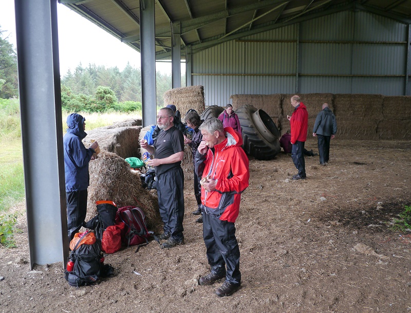
The highlight of the day - lunch in a shed.
Most of us donned an extra layer as the morning's rain was beginning to seep
through the waterproofs and the next section of the walk suggested open moorland and an
increased chance of wind.
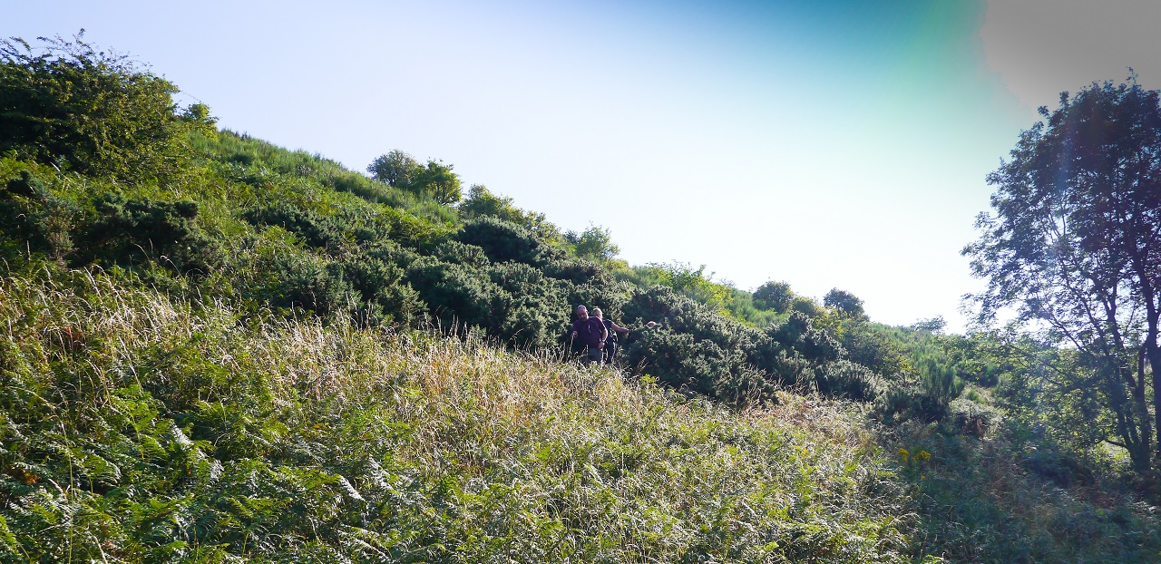
We left the shed and ventured onto the wilds of Chatton Moor and hopefully
clearer and improved paths. All was good for a while as we climbed towards
Brownridge but it all turned shitshaped on the descent to Shielhope.
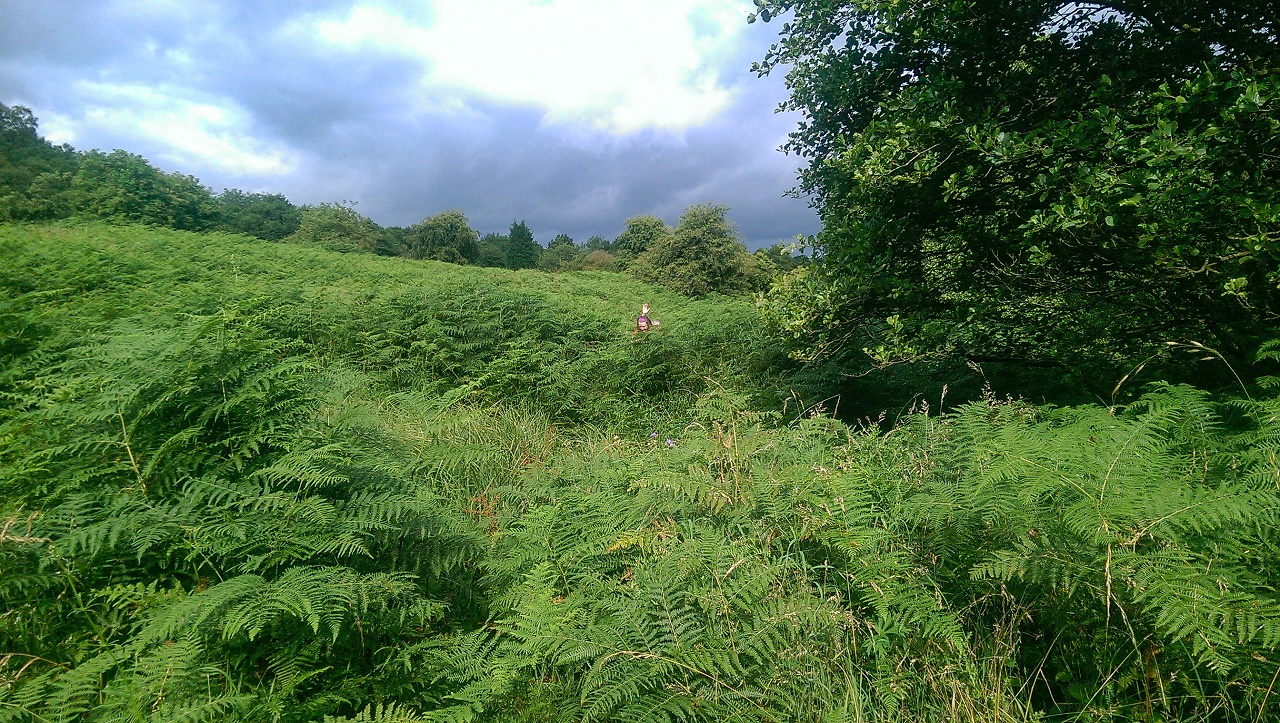
As we descended the path became rather indistinct and then rather missing in
deep bracken. Jim and I had checked the route using our GPSs as certain
sections after Brownridge hadn't been clear but we came across a wall of
bracken with the only obvious path heading in the wrong direction.
After confirming the correct direction I decided to march off into the land
of the bracken only to find myself on the ground with a thistle up my back.
WTF? As I stood up it became obvious that I'd tripped over a collapsed
barbed wire fence with the wire being only a few inches off the ground. It
was then pointed out to me that the wire had cut my waterproof trousers open
and that wearing my gaiters had saved me from a nasty shin gash. Great! -
there goes £130's worth of waterproof trousers. The previous pair suffered
from the same fate on the last day of the Cumbria Way so I was due a new
pair.
We all marched on the same line and then, a hundred yards later, reached a
point where the route changed direction - into even deeper and denser
bracken. As I was now beginning to suffer from severe bracken boredom and,
as I was covered in fourteen
packets of Kellog's Fruit and Fibre, decided that things couldn't get any
worse so battled through the bracken to confirm that there was in fact - a
path. The rest of the team followed me towards a small stream.
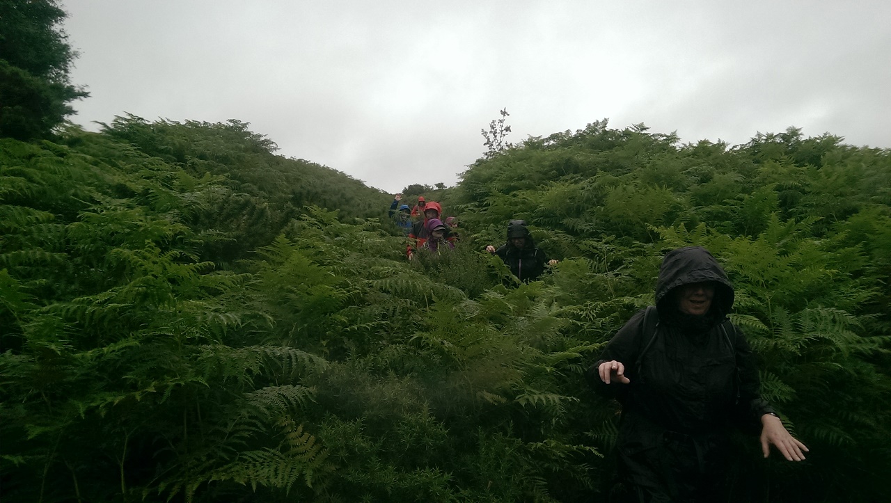
The hidden path to the stream. It's still raining and very wet. Photo by
James Eason Marine Photography.
Ann decided to carry on with the general tomfoolery by falling by the
stream, her second fall of the day, and Karen tried her best to repeat Ann's mistake by choosing the wettest
slipperest rocks to tread on but somehow, she managed to stay upright.
An obvious path led us to the farm at Shielhope where the farmer had decided
to add to the day's enjoyment by locking all of his gates and forcing us to
climb over them. This was the walk that just kept giving.
The road into Chatton was heavenly but fun was short lived as the bridleway out of Chatton was
yet again completely overgrown with nettles and all sorts of stinging crap.
The section to Fowberry Tower required the negotiation of more fields and no
visible path so we decided to march through whatever shit the farmer had
planted. Bollocks to him and his crops.
The only path here was the one we made. Photo by James Eason Marine
Photography.
A moment of respite near Fowberry Tower.
A steep little climb on the road saw us reach Weetwood Moor and hopefully a
clear and troublefree route into Wooler. The weather was still hopeless and
the visibility worsened as we headed over the moor which was a real shame as
for the first time in the day it looked like a good view would have been on
offer. Jim managed to arse up with his route finding but a short reversal
saw us descending off the moor towards Wooler but, yet again, much of the
downward route was through unmanaged wet bracken.
That was it - Wooler at last! It had been a pretty poor day on the walking
front with the overgrown paths, endless fields and poor underfoot conditions
making it far tougher than it should have been. This wasn't my sort of
walking by any stretch of the imagination.
Mark saved the day by booking a meal at the local Tapas restaurant and the
wine and ale created a better mood. The moorlands of the Cheviots and the
biggest day of the week was to be our next challenge. Fortunately, the forecast
was good and the paths couldn't be any worse. Or could they?
DAY 4 -
Wooler to Clennell Hall (22 miles)
The rain had gone and our clothes were nearly dry. Ken had
developed blisters and was suffering somewhat but after an application of
Jon's Gehwol and Compeed we were ready to hit the moors.
Mark had officially written the entire walk off and Terry had already written
this day off many months back. It was a no go for the Jones's. This was a
sad moment for Terry as he knew he'd ended his run of solid golds which
left Ken reigning supreme.
Waiting for Karen to get her sarnies in Wooler.
We headed off towards Wooler Common and, after reaching a small cottage,
realised that we had to turn left off the St Cuthberts Way. Unfortunately I
made the mistake of not checking for the Inn Way path over a stile and led
the team up a steep grassy hill which, once on the summit, required another
climb over barbed wire.
Once on the summit the views were excellent and, even though Jim and I
realised that we'd gone wrong, we could follow an access path to the road
where we'd rejoin the Inn Way. Unfortunately the access path ended next to a
field of cows so yet another traverse of waist deep bracken was required to
rejoin the route.
Shit! Here we go again but to be fair, this was my fault.
We were soon back on the correct path. The next minor challenge was that of
the choice of the two gates: the gate to the left was a large gate which led
into a no mans land of nettles, thistles and weeds. The smaller gate to the
right led into a field where a faint path led in the direction of the Inn
Way. We took the gate to the right.
After a hundred yards it became clear that we needed to venture left as the
GPSs showed that we were erring to the right. The path disappeared so we
tried to find an easy way of accessing the field to the left and eventually
the road. The only easy point just happened to be over a fence - which the
farmer had kindly finished off with a friendly topping of barbed wire. I,
being the tallest of the group, attempted to get over the fence without
puncturing my joeys but my inability to find a decent footing on the other
side of the fence resulted in numerous failures. Sue, who has no joeys,
managed to get over as did a few others. I eventually managed to solve this
little problem by standing on the fence and jumping.
Jane however wasn't so lucky as she cut the inside of her thigh on the
barbed wire and required urgent surgery to fix her gaping wound. I'd already
reached the road by this time and Jane's injury gave me a chance to assess
the path and where we'd gone wrong. A track over the fence suggested that
the gate to the left would have been the correct gate as this eventually led
to what must have been the road to the quarry but as the left gate led
into all sorts of shit we'd been forced to go slightly off route. Does
anyone walk the paths in Northumberland?
The team treat Jane's cut.
We were now on the road so no further navigational issues were expected.
A fair bit of road walking was in order but this helped get a few
more miles under our belt and acquire a quicker pace. The problems encountered
during the first mile had really slowed us down so we had to get a proper bimble
on.
The scenery was beginning to improve and it was all a far cry from the
miserableness of the previous day.
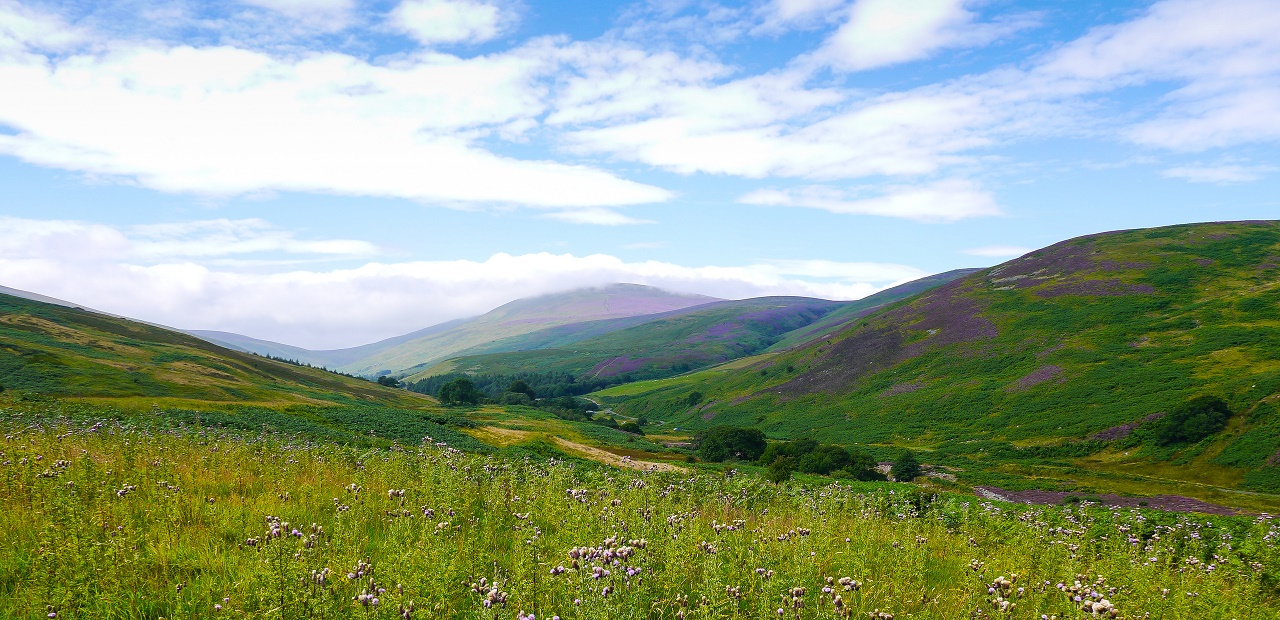
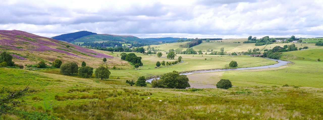
Looking down Harthope Burn towards the Cheviot (2673ft). This is better,
much better.
After a short walk next to Harthope Burn the route climbs south from
Langlee. This was a bit of a pull but as the views over to Langlee Crags and
Housey Crags opened up all seemed worth it.
The climb from Langlee.
Hedgehope Hill, Housey Crags and the Cheviot from the top of the moor.
We made it to the top of the moor in dribs and drabs and checked our
direction using the GPSs. The route headed in a south-easterly direction
into Threestoneburn Wood but after a while we began to head too far to the
east so rechecked the GPSs and corrected the error. This took us into knee
deep heather.
According to two GPSs we were bang on track but there was no track to
bang. A tiresome trudge through the heather in the search for a path proved
rather fruitless as we found numerous short traces of something like a path that looked
positive but instantly disappeared into a sea of heather. We were lucky that no
one turned an ankle during this stage of the walk.
We eventually reached a
hut near to the forest where a gate became visible. We spotted another walker
(yes that's right, another walker) who was heading in the same general direction
but then
suddenly disappeared so we assume his body will be found in the years to come.
Plodding through the heather.
Detailed post walk investigations using Google Earth suggest that the actual path
doesn't follow the route shown on the OS maps. The Google Earth images are
from 2007 so this may have changed.
The Google Earth image below shows our GPS route in blue, which matched the
marked paths on the OS map, and what appear to be paths. Either way, it was
another crappy path to add to the now lengthy list. A guess as to where we
ended up is shown in red.....
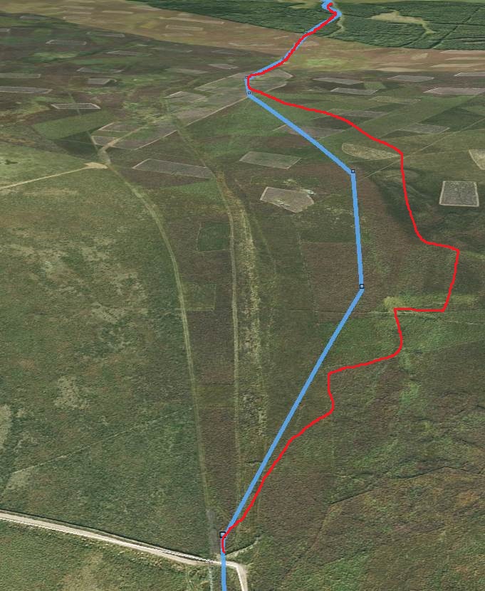 Follow the GPS? Follow the OS map or hire a helicopter?
The forest introduced a new horror - flies. They appeared to only like certain
people and I was one of them.....
 Me and my little friends. My favourite was Annabel (far right) because
she kept tickling my ear.
Me and my little friends. My favourite was Annabel (far right) because
she kept tickling my ear.
The pleasure of actually being on the correct route was dampened for a brief
period shortly before Threestoneburn House. A waymark post tempted us over a
small stream and as it seemed to be the only obvious route looked like the
only obvious route. The path then began to head in the wrong direction so
back over the stream we went and back into knee deep vegetation.
Once past Threestoneburn House we hit a track which allowed us to hit a
decent pace but the surrounding views of recently felled slopes couldn't be described
as scenic.
We took lunch at a point where the breeze removed the flies and considered
our options. The slow first hour plus the arsing about in the heather had
affected our usual Olympic pace levels and we were becoming increasingly
pissed off with the poor paths and constant need to check the direction of
the route. No one had brought the Inn Way Northumberland book with them and
we wondered if this may have been a mistake.
We had two options: 1) Continue on the official Inn Way and hope that the
remaining route was clear of the crap we'd endured over the last day and a
half or 2) head west towards Calder and use the cycle route. We opted for
option 2.
One of the downsides of option 2 was that it would add an extra mile or two
onto the walk but the thought of wading through various jungles made option
1
the clear and easy choice.
 Heading towards Calder. The official route headed over the hills to the
far left.
Heading towards Calder. The official route headed over the hills to the
far left.
A couple of observations shortly after making the decision to go off route
helped to confirm that we'd made the right choice. The first observation was
that the Inn Way route left the track near The Dod into a small forest but
the other side of the stile suggested that we'd need an army of Gurkhas to
help us through it. The second observation was that of a waymarker post
stuck in the middle of impenetrable nettles and a various assortment of leg
scratching vegetation. The waymarker post wasn't on the Inn Way but it was
another example of just how badly walked many of the paths are in this area.
It was a good long mile to Calder and we eventually reached the cycle route
where we headed south towards Clennell.
It was a sweaty couple of miles to Ingram but I'd previously suggested that
Ingram could be used as an opt out point for anyone that didn't fancy the
9.5 miles\1260 ft ascent between Ingram and Clennell. We'd already walked
thirteen
miles so Ken, still suffering from blisters, Jane (fatigued) and Sandra
(blisters) decided to call it a day and call a taxi. Alison's feet were
sore and her legs stiff but after a few stretches she was back on track and
dismissed any thoughts of packing in.
This was a big moment for Ken as he'd
never failed on one
of our long distance walks. Just what's going on? Is it the boots? Is he
losing his touch? Will he ever walk again?
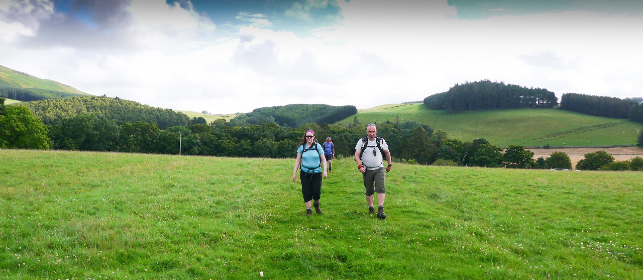
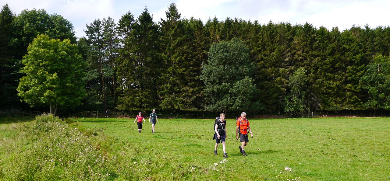
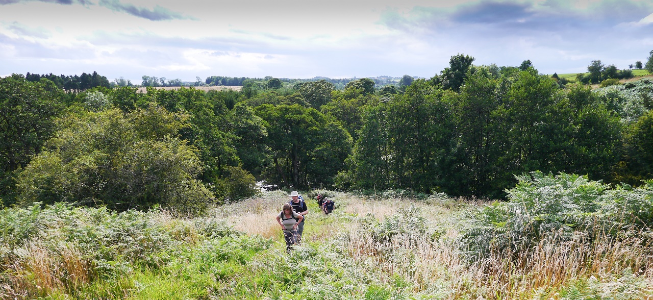
That was it. We were down to me, Alison, Jim, Sue, Karen, Mike, Gordon, Ann,
Jon and Sarah - just ten of us out of the fifteen that started the walk!
Immediately after leaving Ingram we left the cycle route and climbed a
bridle path that skirted the eastern slopes of Wether Hill. This was an
excellent three miles with good views and good underfoot condtions. The pace
was picking up and we knew what we had to do. We were now in SAS mode.
 On the ascent of Wether Hill. This is more like it!
We dropped into Prendwick and then marched through Alnham, Scrainwood,
Elilaw and Biddlestone. Clennell Hall was now only a couple of miles away.
 Alison performs one of her many feet and leg stretches on the long road
to Clennell.
Alison performs one of her many feet and leg stretches on the long road
to Clennell.
 Jimothy and Gordon lead the now strung out team towards Clennell.
A few spots of rain accompanied us into Clennell and we soon reached
Clennell Hall which would be our accommodation for the night. It had
been an annoying day. Would the tops have been OK or would we have wandered
around in ankle twisting heather looking for paths that didn't exist? We'll
never know.
A couple of
locals\visitors were playing guitar in the bar which made the place all
rather lively. Ken was tapping along to Buddy Holly but not too hard mind,
he had blisters.
The excellent juke box and friendly locals and owners made for an enjoyable
night which was very welcome after a long day's road walking. Sandra had
written herself off for the rest of the week so would be joining Mark in the cripplemobile. An easier day was on the cards for tomorrow.
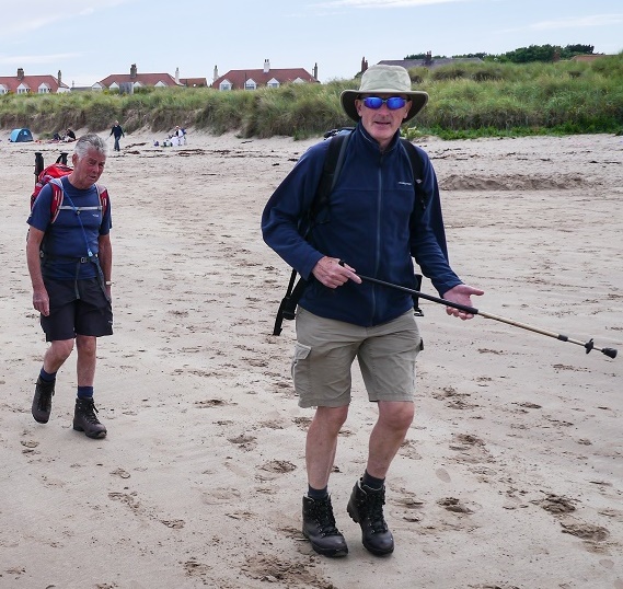
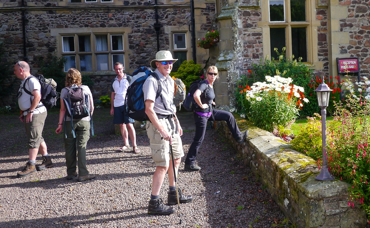
DAY 5 - Clennell Hall to Rothbury (15.5 miles)
It was a lovely warm morning. We gathered at the front of Clennell
Hall's main entrance and waited for the off but there was a
minor problem: Karen had blisters and wasn't too happy about it. Various
applications of various solutions were applied but a small practice walk
convinced her that today was not going to happen. There was another
passenger for the cripplemobile.
Mark was beginning to wonder if he'd have been better off hiring a minibus
for the week as Karen and himself were now permanent members of
the cripplemobile club. Fortunately the rest of us were OK, including Terry
who'd returned after his planned absence, so we all set off
towards Alwinton.
 Sue performs a few warm up exercises whilst Mark wonders how he'll fit
everyone into his car. Ken looks happy despite the blisters.
Sue performs a few warm up exercises whilst Mark wonders how he'll fit
everyone into his car. Ken looks happy despite the blisters.
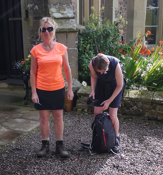 That's the end of the day for Karen. Is it the end of the week too?
The views and walking were fine until we hit Harbottle Wood. There was no
path in the forest and it didn't look like there'd ever been one so another
detour was to be taken by using the cycle track towards Holystone.
 Sarah and Mike on the path to Alwinton.
Shortly before reaching Holystone we turned sharp left and crossed a bridge
over the River Coquet to enter Britain's biggest field - a full mile of it!
Any rejoicing on leaving the field was shortlived as yet again we battled
through nettles and thistles. After surviving the nettles and thistles we
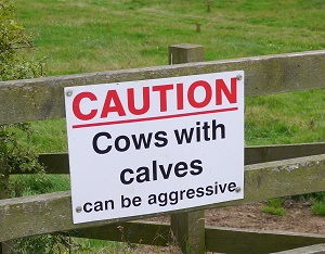
entered a field full of rather lively young cattle which, on first
impressions, didn't look good. Enter Jim the Cow Whisperer! He marched through
the swarming herd clapping his little heart out so we all followed hoping
that he wasn't sending them in our direction. We all got through safely
thanks to Jim.
 Sue and Ann in Britain's biggest field. Their faces don't really reflect
the excitement of the mile long trek.
Sue and Ann in Britain's biggest field. Their faces don't really reflect
the excitement of the mile long trek.
We then descended to Hepple where we hit the road and climbed slowly towards
Bickerton. Lunch was ate about half a mile outside Bickerton where we
enjoyed a scenic view over the Coquet and the surrounding hills......
 Today's lunchtime view.
 A romantic walk in the fields. This was taken shortly after they'd been
seen holding hands.
A romantic walk in the fields. This was taken shortly after they'd been
seen holding hands.
The lap suggested that the two and a half mile route between Bickerton and Thropton
would be quite scenic but apart from a glimpse of the lake\overflow the path
managed to remain behind a large grass bank before entering rather unscenic
fields. The one and only highlight was the sighting of a Kingfisher just before
entering Thropton.
 And when he was entered onto the path, his disciples followed him. And,
behold, there arose a great bed of nettles, insomuch that the legs were
covered with the scratches but he was asleep. And his disciples came to him,
and awoke him, saying, Lord, save us we perish. And he saith unto them, Why
are ye fearful, O ye of little faith Then he arose, and rebuked the nettles
and the thistles and there was a great calm. But the disciples marvelled,
saying, What manner of man is this, that even the nettles and the thistles
obey him.
And when he was entered onto the path, his disciples followed him. And,
behold, there arose a great bed of nettles, insomuch that the legs were
covered with the scratches but he was asleep. And his disciples came to him,
and awoke him, saying, Lord, save us we perish. And he saith unto them, Why
are ye fearful, O ye of little faith Then he arose, and rebuked the nettles
and the thistles and there was a great calm. But the disciples marvelled,
saying, What manner of man is this, that even the nettles and the thistles
obey him.
The most enjoyable part of the day's walk was now upon us. Praise the Lord!
Rothbury was only a couple of miles away by road but we had an additional
couple of miles over the moors. The steady climb from Thropton provided
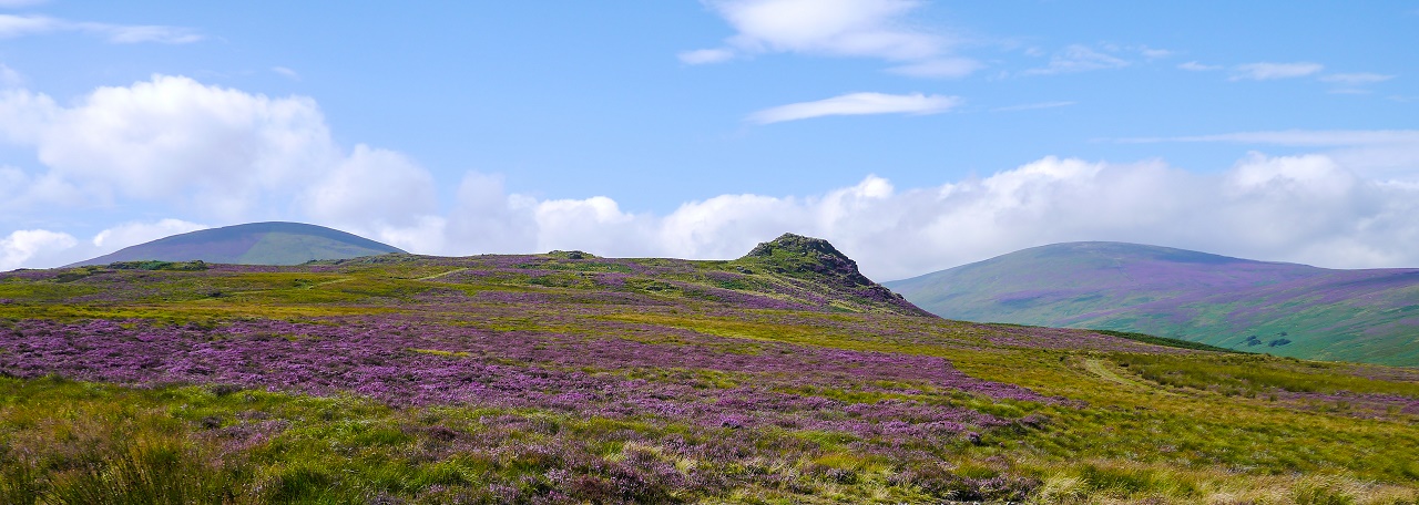
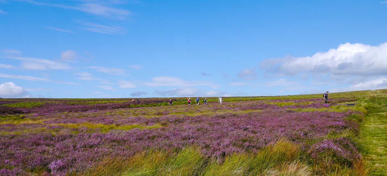
great views to the south and west and then suddenly, we hit a sea of bright
purple heather....
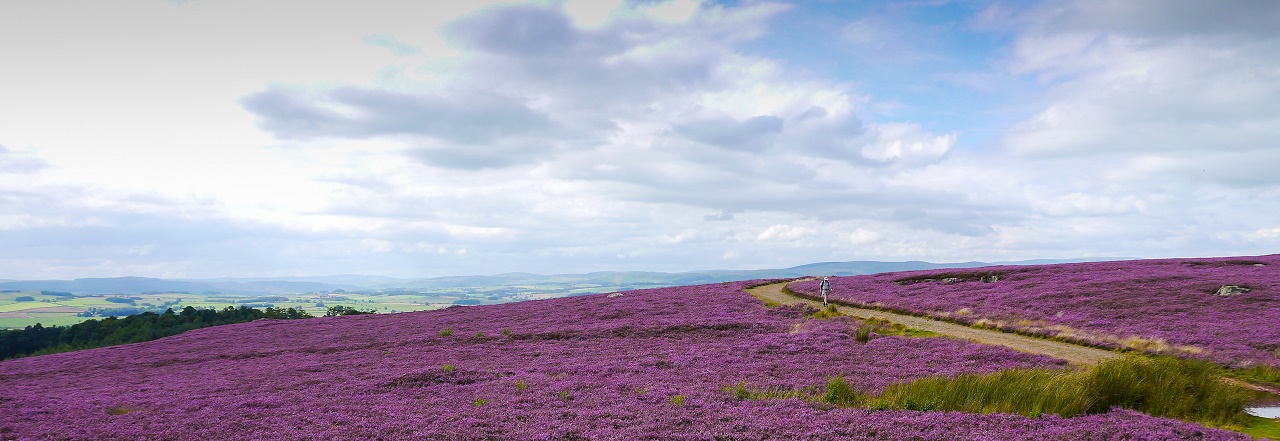
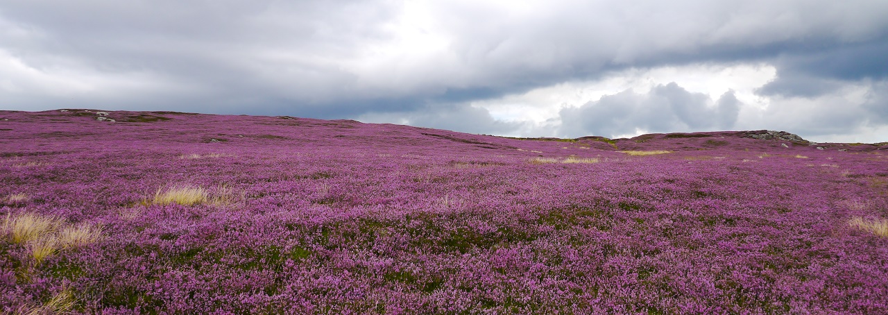 A blaze of heather on the way to Rothbury.
The hard paths weren't helping Ken's blisters so it was a slow plod down
into Rothbury which from above, looked more like a welsh mining town.
 'Ooh, ahh, ooh, ahhh, ooooooh, ahh, ahhhhh, ooooh'.
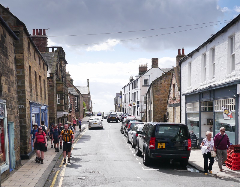
Rothbury turned out to be a pleasant looking town with fine old buildings
and a few decent looking pubs. Karen and Sue decided that there 'over the
corridor' bath wasn't their cup of tea so booked in elsewhere. Mark, during
his day off, had booked us into the Queens Hotel for food (we're thinking of
recruiting Mark as the official Pighole entertainment manager), so we all
enjoyed another nice meal along with a dollop of wine and beer which won't
come as any surprise for our friends and regular readers.
Sadly,
Ken announced that his week was over as the final few miles hadn't done his
blisters any favours. This, as had been the same
for Terry earlier in the week, meant that a proud record of pure golds had
come to an end.
 Alison and Terry waiting for a pint.
Day 5 was over. One more day to go: 17.5 miles back to Warkworth.
DAY 6 - Rothbury to Warkworth (17.5 miles)
It was a surprise to find out that Gordon had decided not to walk
so he joined Mark, Karen and Ken on the day's cripplemobile. Gordon
had been saying that one of his little toes was like 'mush' for a day or two
so it seems that it wasn't in a good enough state to take on the final day.
Sandra had also decided that her blisters wouldn't cope with another day so
her walk was over.
Today looked like being a pleasant walk by judging the map with easy walking
next to the River Coquet so, after a delayed start due to Jon and Sarah's
massive breakfast, we set off in slightly humid and overcast conditions to
head west to Warkworth.
We crossed the bridge and followed St Oswald's Way towards Wagtail Farm
where we caught a glimpse of Cragside in the forest to the north. It was all
pretty easy going until, after about a mile, we entered a wood where yet
another overgrown shitfest of a path greeted us with the additional problem
of the odd foot deep bog - great! This was slow going and we worked hard to
ensure that we followed the correct route. After finally leaving the wood we
hit the bracken which also proved to be pretty unenjoyable.
Walking on one of the better parts of the early route through the wood.
Out of the woods but into the bracken so we weren't out of the woods yet
- if you know what I mean. Sarah and Terry are in there somewhere.
I'd noticed that several tons of vegetation had filled both boots which gave
me the odd sharp poke around the ankles so I thought about stopping and
taking my boots. I didn't bother - sod it!
Once out of the bracken we entered sheep filled fields and began our journey
towards West Raw. This was a lot easier underfoot but we needed to get a
move on in order to make up for the late start and the forest of doom.
The farms and the fields kept coming with the route, on rare occasions,
giving a view over the Coquet.
Walking towards the river shortly after West Raw. What's Mike doing in
the distance?
The path heads to the left - over the barbed wire!
The parts of the walk that got close to the river were enjoyable but the
endless fields and average views made for a tedious morning. After finally
reaching the A697 we stopped on a patch of grass just before High Weldon and
sat down for lunch. As we were chomping away the owner appeared and told us
that we were sat on his front lawn and that it's not a National Park. What a
miserable bastard.
We packed our bags and walked a few hundred yards on where we eventually
found a patch of clear ground in a small coppice. Lunch was restarted with
the worringly close sound of gun shots ringing in our ears so we planned on
sending the expendable Terry off in front to check if the shots were coming
from the local leather faced madman. Fortunately, they weren't.
Fields continued to be the order of the day until a small steep climb at
Catheugh saw us enter a new exciting world of mud.
Mike arses about in the mud. Terry won't be long. Long on his feet that
is.
Jim and I marched off but were stopped in our tracks by shouts from behind.
Terry had fallen and cut his hand so had to be plastered up. This all wasted
valuable time and, in retrospect, we should have left him there as that's
what they would have done during the war. 'I'm sorry old chap, we need to get going. We
can't stop. I'm sure you understand - BANG!'.
The fields before Elyhaugh Farm threatened more fun....
OK - so thanks for the warning. Try providing a bit of advice.
 Always a favourite sign of mine. So, what are we supposed to do?
Despite the warnings we survived Elyhaugh.
On leaving Elyhaugh the route headed towards the river where at one point we
actually
reached the bank of the river. This came as a bit of a shock but provided
welcome respite from the fields. Well, that would have been the case if the
next few hundred yards hadn't have been over another overgrown mess of bracken and thistles.
 Wahay!
A pleasant mile of walking through a wood was enjoyed before reaching the
A1 road. Jim and I increased the pace at this point in an attempt to reach Felton
at a reasonable time but it wasn't making much of a difference so we slowed
down and waited for the others.
Felton was a critical point on the route. I'd been keeping tabs on the distance
walked and the time and planned that Felton would be the decision point as to
whether to continue or to abort.
On reaching Felton the time was 4pm and we had seven miles to go. Decision time
was here!
A vote system was implemented but this turned out to be as much use as the
Labour leader voting process. Terry was aware of the time, as was I, and
others, including me again, weren't exactly enamoured with the walk so far
and couldn't see anything on the map that promised better things. There was
also a forecast for rain.
There was a distinct possibility that parts of the remaining seven miles would
be overgrown and provide slow going so we estimated that we'd be looking at
landing in Warkworth at around 6:30pm - at least. Dinner had already been
booked for 7pm. The sad truth was that we were walking at too slower a pace
to reach Warkworth in time for dinner.
Alison and Sue wanted to continue and asked Jim if he'd carry on with them.
Jim said that he was OK with that if need be but I made an executive
decision and asked a local for directions to the nearest pub. The team were
told that anyone who'd walked all six days would still receive a gold.
 Sarah, Alison and Ann await a decision. Ann decided to don her favourite
Christmas tree walking hat.
Sarah, Alison and Ann await a decision. Ann decided to don her favourite
Christmas tree walking hat.
 Decision made - we're finishing at Felton. The end of walk photo was
taken seven miles from the end.
Decision made - we're finishing at Felton. The end of walk photo was
taken seven miles from the end.
We walked down the road to the rather posh Northumberland Arms and ordered
drinks. There was no mobile phone signal so the landlady kindly lent us her phone so we could ring for a minibus to take us
to Warkworth.
The walk was finished. An unusual collection of drop outs made it a rather
strange week but the lasting memories will be of the superb coastal walking
and, unfortunately, the shocking state of the paths on many of the inland
sections. It also has to be said that much of the inland route is generally
pretty average with the exception of the Wooler to Alwinton section which,
if the paths on the tops are in good condition, could be excellent.
Alison, Ann, Sue and Sarah completed with ease as did Jon, Mike, Jim and
myself. These people will receive a gold for their services to nettles and
bushes.
It's sad to see Ken and Terry lose their perfect gold record but they'd had
a good innings and, assuming that medical technology continues to progress
at its current rate, may once again achieve a gold. A special mention must
go out for Terry who walked impressively despite ongoing foot issues and
achieved far more than he expected. Mark was a surprise with an early finish
with what can only be gout so he needs to get that sorted as one silver
usually leads to another. Jane only missed half a day which was a shame as
she'd have easily completed the route but Gordon appears to be reaching the
Ken\Terry stage in life with an unforeseen and unexpected drop out. Sandra,
who I'd got down for a gold, fell foul of the dreaded blisters with Karen
too suffering the same fate. These people will receive a silver.
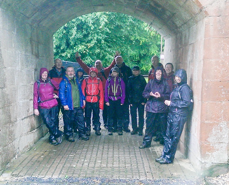
We met up with Rich, Netty and Dave who'd travelled up to see our triumphant
return to Warkworth which turned out to be a couple of minibus drop offs in
light rain. Hardly memorable.
The Friday and Saturday nights in Warkworth were enjoyed as was the trip to
Alnwick.
Now for next year - is it a 50th birthday Pennine Way attempt or stick to
our usual week long routine?
| Walker |
Blisters |
Barbed Wire Cut |
Drunken
Gout |
Nettle Sting |
Shoulder Ache |
Splinter |
Achy Feet |
Dizzyness |
Knackeredness |
Downstairs Distemper |
|
Sean |
|
|
|
X |
X |
|
|
|
|
X |
|
Alison |
|
|
|
X |
|
|
X |
X |
|
|
|
Ann |
|
|
|
X |
|
|
|
|
|
|
|
Mike |
|
|
|
X |
|
|
|
|
|
|
|
Sue |
|
|
|
X |
|
X |
|
|
|
|
|
Gordon |
X |
|
|
X |
|
|
|
|
|
|
|
Ken |
X |
|
|
X |
|
|
|
|
|
|
|
Karen |
X |
|
|
X |
|
|
|
|
|
|
|
Jane |
|
X |
|
X |
|
|
|
|
X |
|
|
Terry |
|
|
|
X |
|
|
|
|
|
|
|
Sandra |
X |
|
|
X |
|
|
|
|
|
|
|
Jim |
|
|
|
X |
|
|
|
|
|
X |
|
Mark |
|
|
X |
X |
|
|
|
|
|
|
|
Jon |
|
|
|
X |
|
|
|
|
|
|
|
Sarah |
|
|
|
X |
|
|
|
|
|
|
