Memories from the Scotland walking trip - 2010
This year's destination was to be Glencoe and the famous Clachaig Inn.
We'd managed to book the weekend before the beer festival which was expected
to cut down on the old drinkies but we all knew that it'd make no difference
whatsover.
The weather forecast was excellent so Jon picked both myself and the rat up
on the Friday - off we went!
There were no real plans on the walking front but Jon was keen on the Aonach
Eagach. I'd already done this on three occasions and the rat the once so
there wasn't the clamour to do it again. I'd done Bidean on two occasions
and the rat the once so again, we were looking for an alternative.
For many years I'd looked up at the two Munros that make up Beinn a'
Bheithir which is pleasantly situated on the junction of Loch Linnhe and
Loch Leven. The two separate Munros are Sgorr Dhearg (1024m) and Sgorr
Dhonuill (1001m). After a brief post-beer chat we decided that we'd drive a
few miles down to Ballachulish, park up, and all enjoy a new walk.
DAY 1 - SATURDAY
The weather on the Saturday was stunning. It was so nice I wondered whether
or not to venture out in shorts but the odd nippy breeze at sea level was
enough to persuade me to 'trouser-up'.
We set off up Gleann an Fhiodh and after a mile looked for the path that
climbed, rather steeply, up to Sgorr Bhan (947m). We walked past what looked
like a path but nothing was clear so the rat was sent on a mission to 'rat
out' the path whilst Jon and I took in the view. A quick look on the map,
which didn't show a path, confirmed that the rat had ventured too far so he
was whistled back so we could retrace our steps and venture up any route
that we knew took us onto the correct ridge.
A 'path' was found and we set off - upwards.
The summit of Sgorr Bhan could be seen directly in front of us - 2700ft in
front of us!
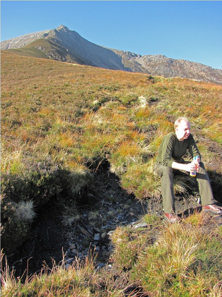 Time for a drink. The rocky ridge leading up to Sgorr Bhan awaits. The
rat can just be made out in the distance whereas Jon, wearing his
camouflage, can just be made out front right.
Time for a drink. The rocky ridge leading up to Sgorr Bhan awaits. The
rat can just be made out in the distance whereas Jon, wearing his
camouflage, can just be made out front right.
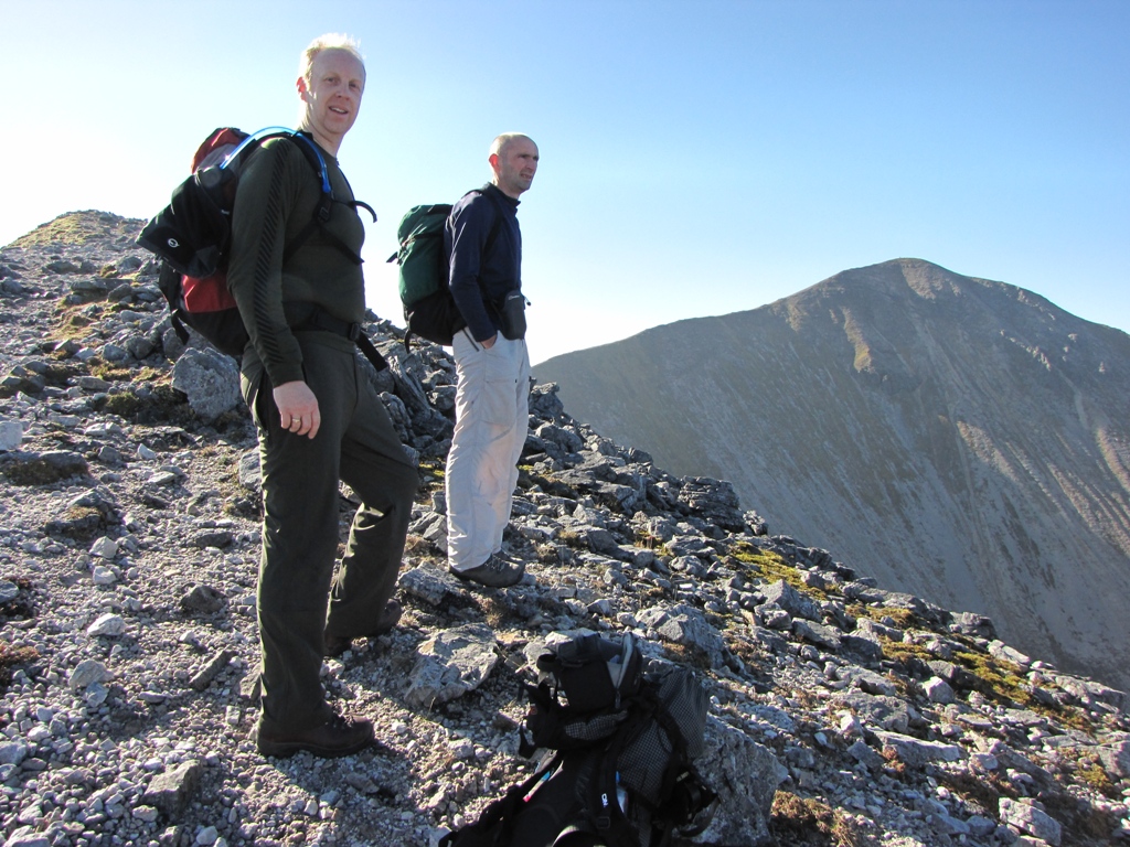
As expected the rat ratted up at rat pace. Jon took up the middle whilst I
enjoyed their sweat vapour at the rear (that's the rear in order and not
their rear although at times the latter may have been the case).
As we climbed the views over the Glencoe hills and Loch Leven opened up so a
number of
drink fucked
photo stops were enjoyed. We knew that the ridge was about to turn rocky so
we packed cameras away and hit the ridge.
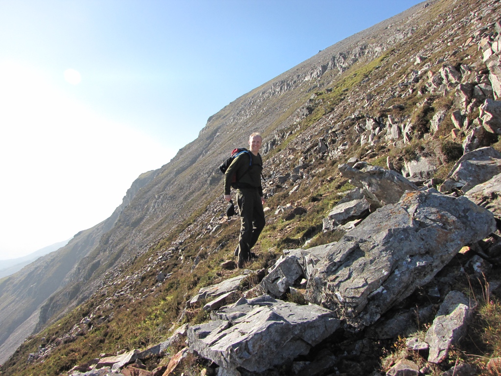 The slope steepened just before the rocky section. Jon had stopped
running so I could get this shot.
The slope steepened just before the rocky section. Jon had stopped
running so I could get this shot.
 Meanwhile, the ratster heads towards the rocks.
 Zoom on.....
On reaching the rocky section the rat disappeared over the first section. I
shouted to ask what it was like on the other side but for some reason his
Jodrellesque ears failed to pick up my wails.
For this reason Jon and I took a route to the left which averted the rocks
but resulted in us having to scramble up a shitty loose gully in order to
regain the main ridge. This is becoming a common occurrence now and I've
decided that from now on the direct route is usually always easier than the
alternative 'chicken' route.
 Looking over Loch Leven with Ben Nevis and the Mamores in the distance.
A quick drink stop was enjoyed on the top of the rocky ridge where short
climb separated us from the first peak, Sgorr Bhan (not a Munro due to its
close proximity to Sgorr Dhearg).
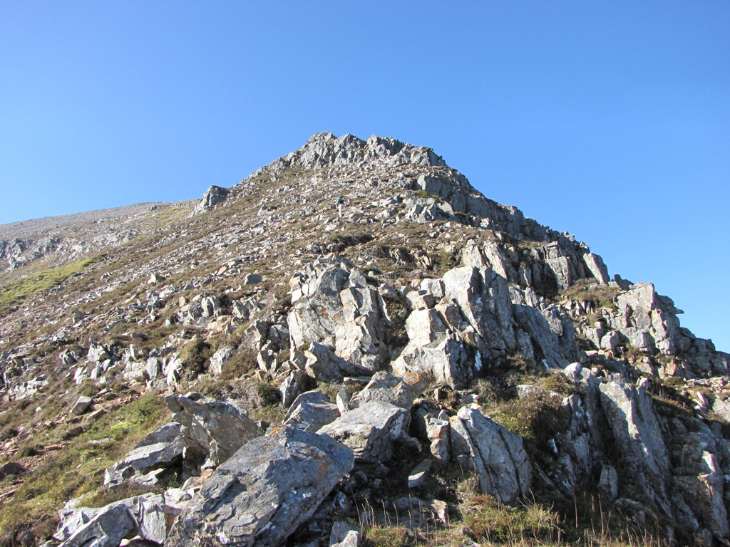
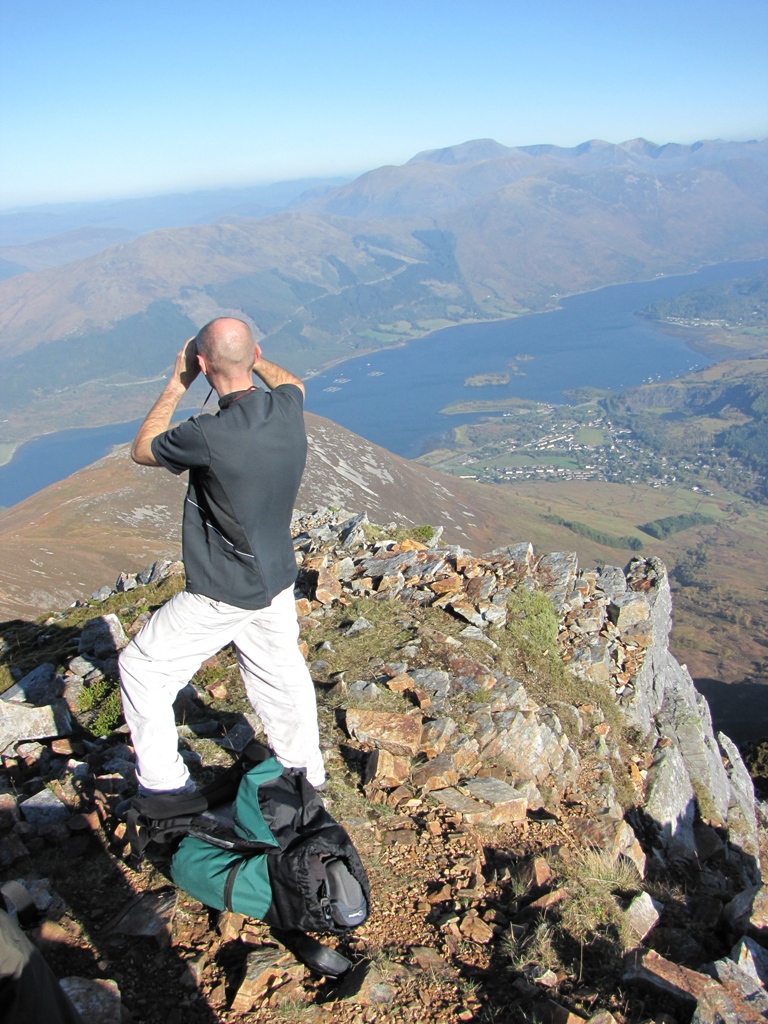
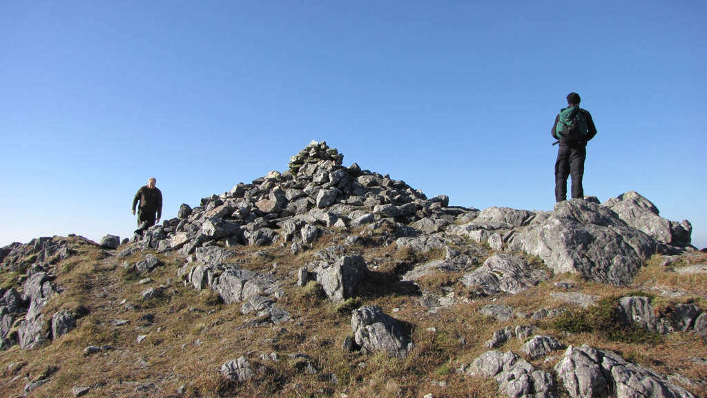
 Our heroes approaching the summit of Sgorr Bhan (it's not a fucking
Munro so stop going on about it) with Sgorr Dhearg (which is a Munro) in the
distance.
Our heroes approaching the summit of Sgorr Bhan (it's not a fucking
Munro so stop going on about it) with Sgorr Dhearg (which is a Munro) in the
distance.
The views from Sgorr Bhan were excellent so we couldn't wait to get to the
main summit of Sgorr Dhearg. The graceful ridge linking Bhan and Dhearg
provided excellent walking and before too long we reached the summit.
As expected, the views were stunning in all directions (except in the
direction of rat and Jon).
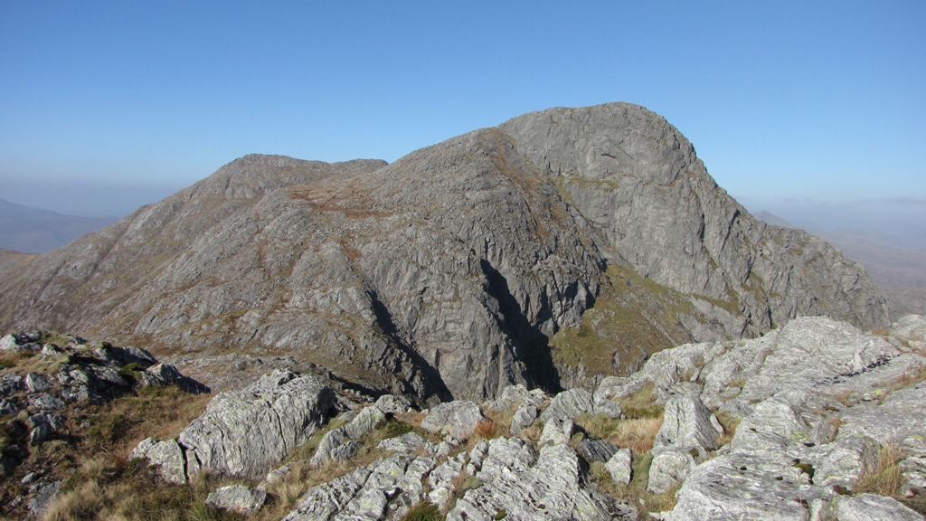
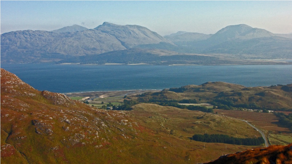
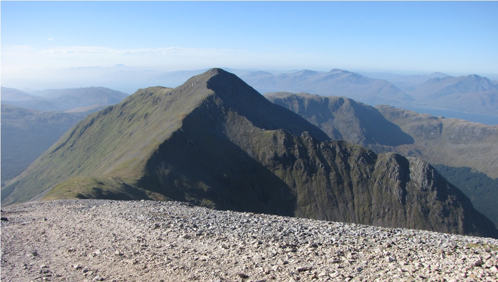 Looking over to our next summit, Sgorr Dhonuill, from the summit of
Sgorr Dhearg. The rocky peak of Garbh Bheinn can be seen centre far right.
That looks interesting!
Looking over to our next summit, Sgorr Dhonuill, from the summit of
Sgorr Dhearg. The rocky peak of Garbh Bheinn can be seen centre far right.
That looks interesting!
We ate our lunch halfway down the path to the col and measured up the 750ft+
climb up to the next summit. On reaching the col we had a clear view of our
route down through the forest of Gleann a Chaolais which would eventually
see us back to our starting point. Looks nice, but that's for later.
The initial climb up to Sgorr Dhonuill was a trudge but it soon turned rocky
and the last couple of hundred feet was over rock with the odd glance down
the steep cliffs to the north east. The summit was a delectable place with
great views over to Mull, Loch Linnhe and the peaks of Argdour. We walked a
couple of hundred yards to the west to take in the view and contemplated
descending into the forest further to the west but the lack of marked paths
and the fact that no route description mentioned this as a way down forced
us to retrace our steps back to the col.
 The view westwards from just below the summit of Sgorr Dhonuill. There's
Garbh Bheinn again - looks even better from here!
The view westwards from just below the summit of Sgorr Dhonuill. There's
Garbh Bheinn again - looks even better from here!
On reaching the col we descended, initially, over slightly boggy ground and
on a flakey but distinguishable path. What could possibly go wrong?
The path become less distinct as it headed towards the forest but a
convenient pair of large stones marked the route over the fence into the
forest. On we went. On descending into the forest however, the path
disappeared. A steep peaty 10-15ft drop into a tree covered stream was the
only route down. A lone boot mark appeared to suggest that others had taken
this route but a quick recce by the rat resulted in a 'no fucking way'
response. The main concern, due to the nastiness of the descent, was the
risk of not being able to climb back up if the invisible stream was too
dangerous to cross.
The rat decided to search westwards for other routes. Jon and I followed.
The forest became thicker and the ground more difficult. It was pretty damp
and steep in places and the only safe option was to grab hold of the fir
branches in order to obtain any chance of clambering up the steep grassy
gradients.
A long period of descent, re-ascent, contouring and touretting ensued. It
got to the point where we decided to use Jon's GPS and map to determine our
position so a decision could be made as to where to fuck about next. We were
officially going nowhere.
It took ten minutes to find Jon's map in his rucsac, five minutes to work
out that we were where we thought we were and a further ten minutes to fold
the fucking waterproof OS map back. I got fed up of this and decided to
leave Jon to it. The rat had ascended through the trees yet again so I went
to find him. That's when I came across the bear.....
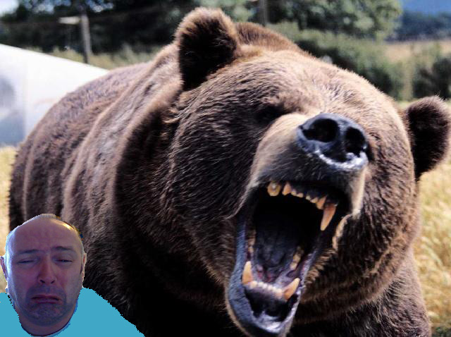
It was massive! It grabbed me by the arm and swung me around like a ragdoll
- there was no escape. I screamed that I knew Rupert and Barnaby and any
other bear I could name but to no avail. I had to do something soon or I was
a gonner.
Jon was still folding his map whilst the rat, whose rattishly light footwork
obviously failed to arouse the monster stood before me (plus the fact that
there's no meat on him), was now a couple of hundred of feet up the
hillside.
There was only one thing for it - shit myself in a 2009 Jonesque fashion.
This appeared to work as the bear staggered away in a confused state. I
scampered uphill and joined the rat. Jon appeared another ten minutes later
- he'd finally folded his map and put it back into his rucsac.
Neither rat or Jon refused to believe my bear tale so we agreed to forget
about it and concentrate on finding our way out of the forest.
We decided to ascend back up to the fence and contour further to the west to
find a gap in the forest. This was awful underfoot but we eventually found
the clearing and, a couple of hundred feet downhill, the forest road. The
descent was equally as bad underfoot - Tree stumps, branches, rocks, three
foot deep holes, moss - you name it. After an hour, yes that's right, an
hour - we reached the forest road and had a group hug. Tears were flowing -
we had survived.
We laughed and joked as we yomped the final three miles back to the car. We
all wanted a beer - badly. We enjoyed a few beers in the Clachaig where I
provided the ultimate proof of the bear attack...
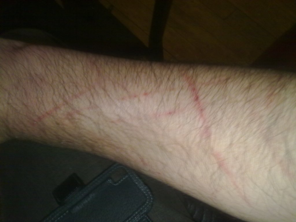 So what caused this then? Scotch mist?
So. a great day's walking had been enjoyed but with an unforeseen sting in
the tail. Where to tomorrow?
DAY 2 - SUNDAY
The weather was stunning again. We discussed the possibility of travelling
up the valley to the Kinghouse area but decided that a scenic drive around
Loch Linnhe and over the Corran ferry to Argdour was to be the order of the
day. Today's peak was the sub-Munro - Garbh Bheinn, a popular cliff-ridden
2903ft peak whose ascent is well documented and raved about in the books of
Walter Poucher.
We parked at sea level below the south-east ridge and found the small path
that led upwards towards the summit.
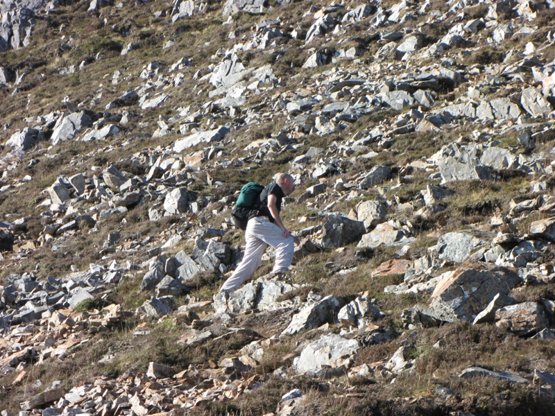
The first few hundred feet of the climb were quite enjoyable. The odd
scrambly section kept us on our toes and with the views opening up to the
north a good day was in prospect.
As we climbed higher though the path became less distinct and the walk
turned into a shitty clamber over tussocky ground. A path of sorts kept
appearing but this soon disappeared as we lurched from ridge to ridge.
Surely a well known peak like this had a path?
The route involved two peaks - the first at point 823m (the top of Sron a'
Gharbh Choire Bhig - which is Gaelic for 'Big Wank Pigshit Ridge') and then
a descent\ascent up to the main peak, Garbh Bheinn (885m). On at least two
occasions we thought we'd expended more than enough energy to reach point
823m but our hopes were dashed as more shitty uphill clambering revealed
itself. Jon then wailed like a banshee - he'd left his sarnie on his car
seat!
After consoling Jon we eventually reached point 823m and the view over to
Garbh Bheinn finally opened up in front of us.
 Thank god for that - Garbh Bheinn from point 823m. Just another few
hundred feet to go.
Thank god for that - Garbh Bheinn from point 823m. Just another few
hundred feet to go.
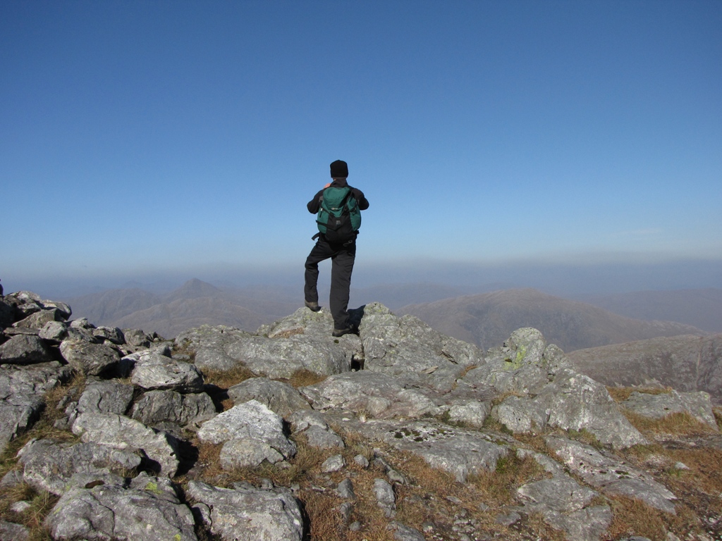
The summit of Garbh Bheinn was soon ours. We met a group of walkers on the
summit and took a few photos but it wasn't quite as clear as the previous
day so any shots were limited to close quarters.
The wind emanating from the gullies below the col prevented us from using
this as an alternative descent route so we decided to retrace our steps.
 Looking west from the summit.
 Jon looks for a suitable sheep dung sandwich alternative.
In retrospect the decision to retrace our steps on the descent was a
mistake. It was as shit as the ascent.
The saving grace was the view inland which was excellent but the need to
carefully place every step meant that the onus was on staying vertical and
not gazing longingly towards the array of peaks in the distance. At one
point we found the point at which we may have lost the path on the ascent -
it wasn't clear so there was no reason to blame ourselves. It's just a shit
route!
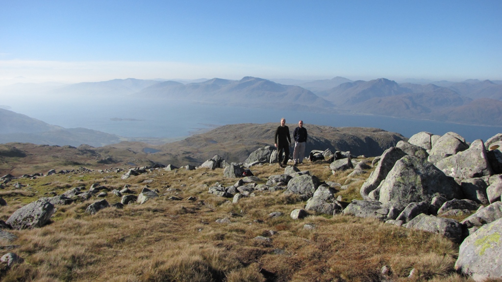
 The peaks of the previous day seen from the descent of Garbh Bheinn.
We eventually reached the car and Jon wolfed down his sarnie. A few photos
of a nearby stream were taken before heading off back to the Clachaig for
beers, shower, beers, wine and Guinness.
 Disgraceful!
Apart from the odd mishap it had been an excellent weekend. The Saturday
walk was a stunner whilst the Sunday was seen as a minor disappointment
considering the weather and the massive array of peaks that were within our
grasp. The route we'd taken up Garbh Bheinn wasn't the best and next time,
if there is one, we'll take the route up the glen and hit the summit from
the other side.
