The Rob Roy Way - August 21st-26th 2011
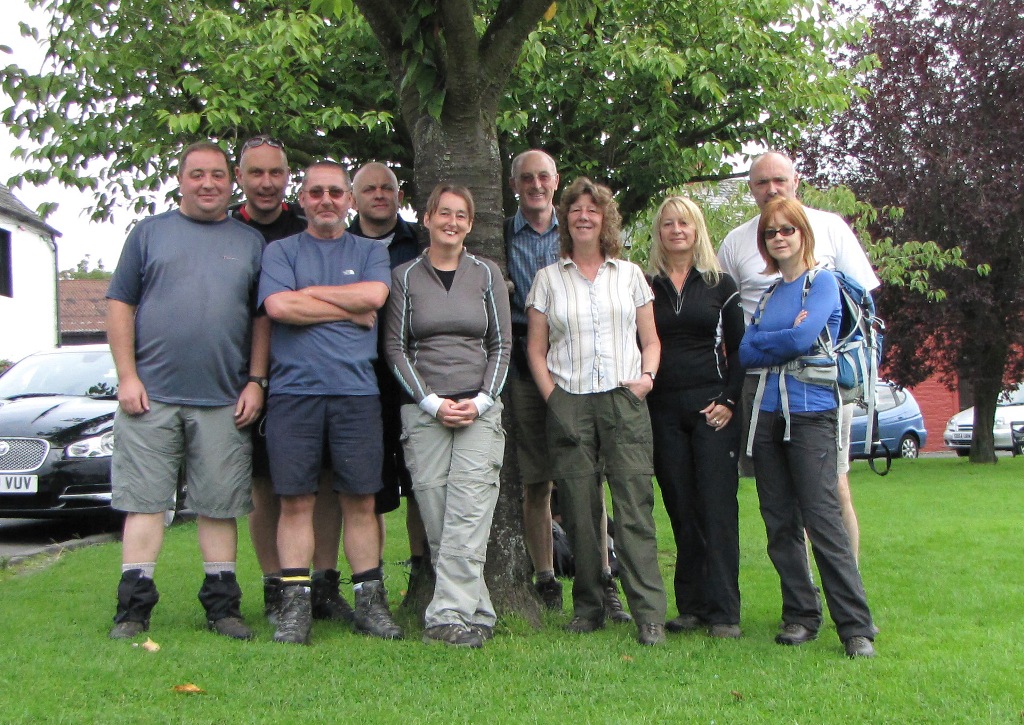
Dave Swarbrook, Mike Riley, Gordon Darlington, Jane Salt, Terry the Tree,
Ken Hodgkinson, Ann Baxter, Susan Lewis, Alison Bond, Sean Bond
DAY 1 - Drymen to Aberfoyle
After the foreign jaunt of the previous year it was decided that a UK long
distance route was the preferred option for 2011 so after much head
scratching and searching the team decided on the Rob Roy Way.
The 80 miles from Drymen to Pitlochry was deemed more than suitable for our
hardy heroes so ten of us gathered at Glasgow airport where we would leave
the cars and be 'minibussed' off to the Winnock Hotel in Drymen. The team
had a new long distance addition to the team as Susan Lewis had decided to
take on the challenge. Macca and Terry were nowhere to be seen but the
former decided that he'd be joining us in Pitlochry to hopefully celebrate a
100% completion.
Pighole now has a worldwide audience, with folk as far away as Australia and
New Zealand keeping an interest in our activities, so we were all keen to
complete the walk. Failing our faraway friends wasn't an option so would
this be the first 100% completion since the West Highland Way in 2004? Would
Dave maintain his 100% record in Scotland?
The forecast for the week was variable so we prepared for everything that
the elements could throw at us. I'd waterproofed our outers in readiness for
a week of rain and decided to bring leather boots for extra protection. The
weather in Drymen however was excellent so fingers were crossed in
anticipation that it'd stay for the week.
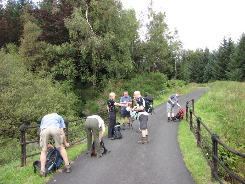
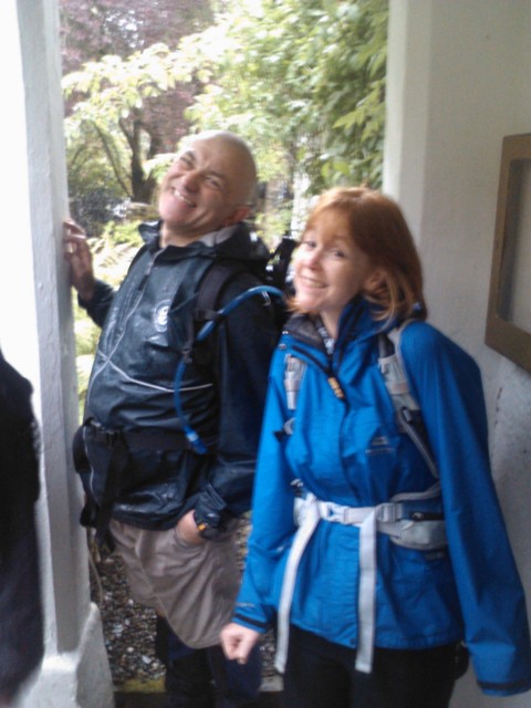
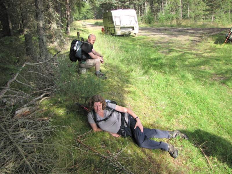
The Sunday arrived and, as is now customary, we huddled together for the
group shot. This, on the face of it, should have been a relatively trouble
free event but I accidentally bashed the top of my eye with my camera and a
small but annoying cut opened up - Great!
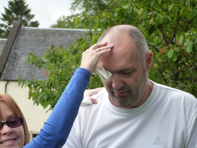 Alison uses her limited medical skills on my cut eye brow.
Some of the team decided to apply copious amounts of Smidge with a view to
getting midged to death at some point during the day but I decided to see
how it went as the combination of sweat and anti-midge cream wasn't an
attractive proposition especially now that I'd got a cut eye.
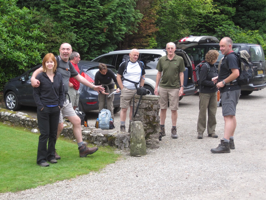
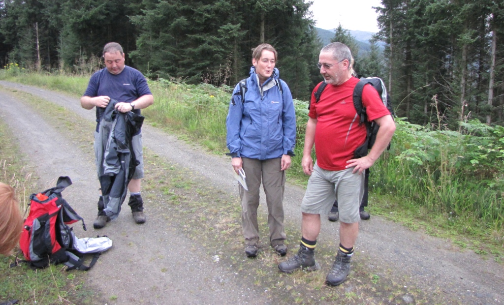
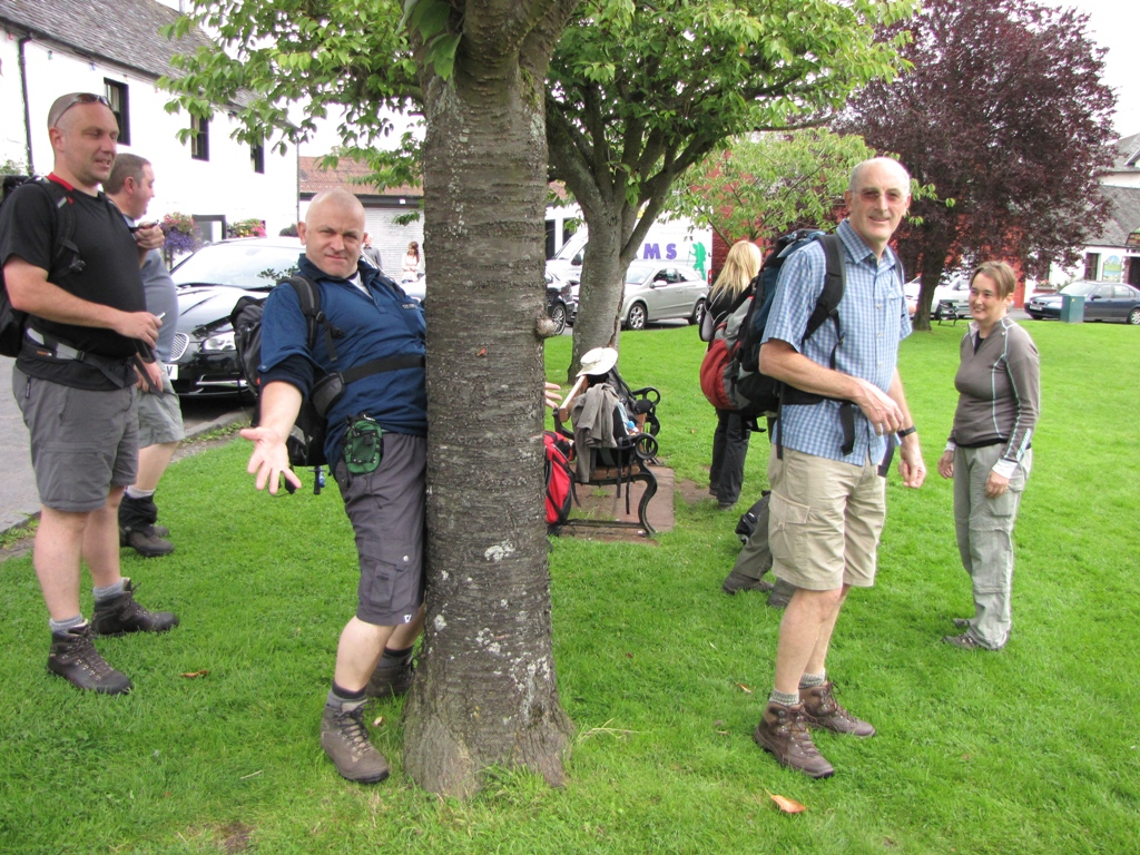 Preparing for the off on Drymen Sq. Nick finds a new friend whilst a
groggy looking Mike looks on.
Preparing for the off on Drymen Sq. Nick finds a new friend whilst a
groggy looking Mike looks on.
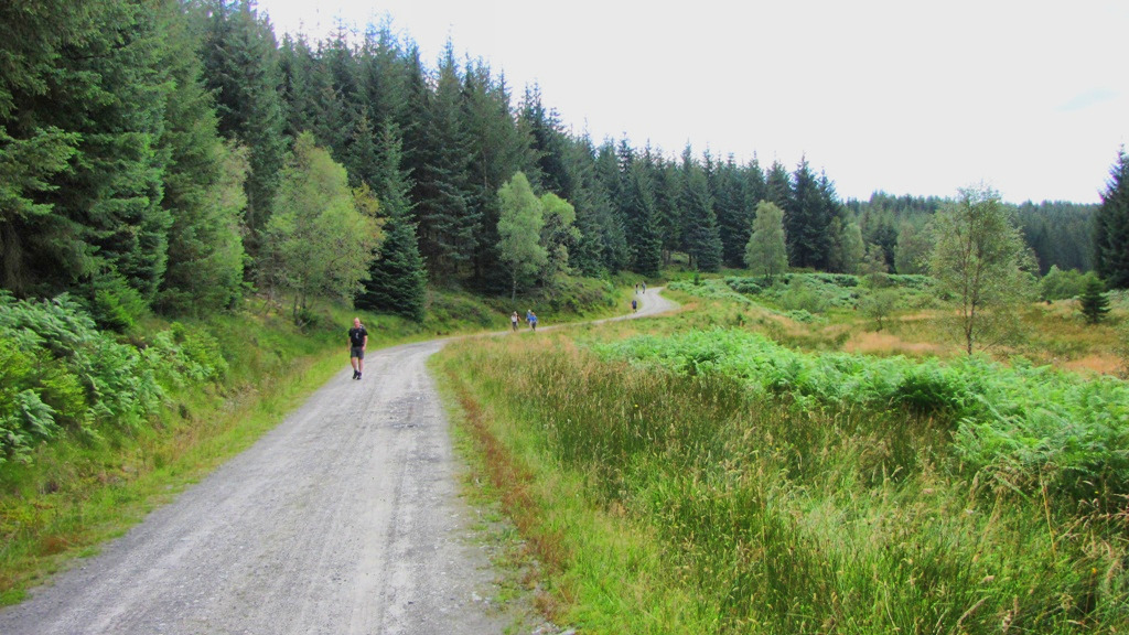
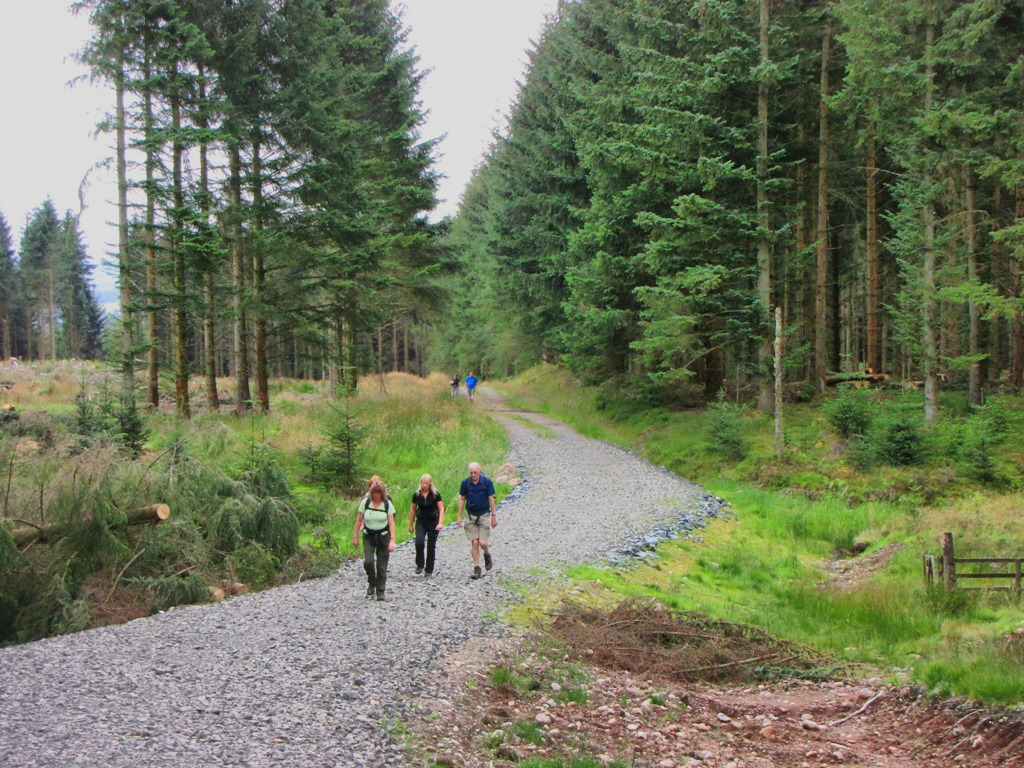
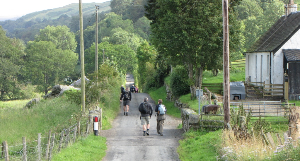
The route out of Drymen took the Gartmore road which after a couple of
miles crosses the West Highland Way. It was a pretty dour start scenically
with little of interest apart from a view over to Conic Hill. Ken and I
bored the other walkers with constant reminders of our famous ascent in 2004
(without oxygen) when completing the first day of the WHW.
A 'Passing' sign with a crossed out 'P' provided a minor moment of hilarity
but we were soon back to the dreariness of the road and surrounding forest.
After a mile the forest disappeared (hooray) but only because it'd all been
chopped down (booo)! This was no improvement on the previous scenery and,
coupled with the various telegraph poles, masts and other crap could only be
described as miserable. At least it wasn't raining.
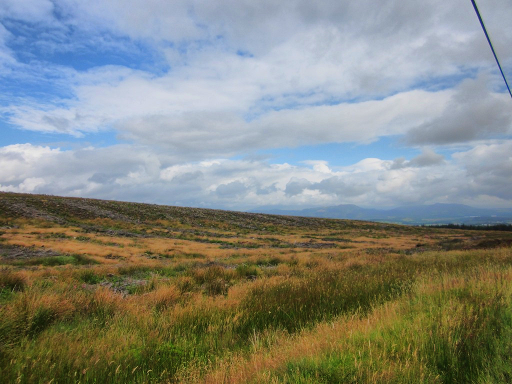 Looking south-east over the post-apocalyptic wastes off the Gartmore
Road. Urrghhh!
Looking south-east over the post-apocalyptic wastes off the Gartmore
Road. Urrghhh!
It had been noted that Mike was looking decidedly miserable. Mike's
initial reason was that Dave's horrendous snoring had resulted in very
little in the way of sleep so he hoped that he'd improve as the day
progressed. The scenery did little to help spur him on so we hoped for a
rapid improvement as we marched past Muir Park Reservoir and onto the first
navigational hotspot - Drymen Road Cottage car park.
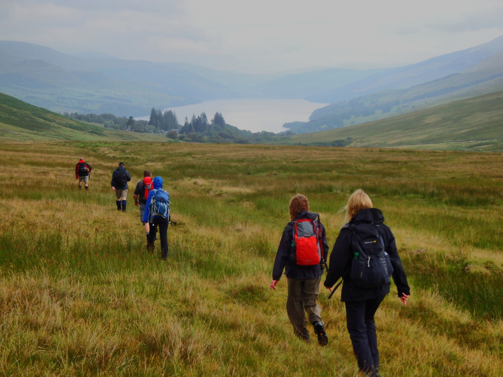
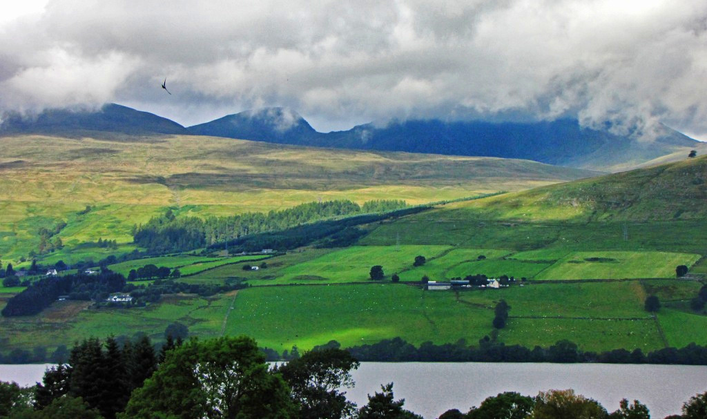
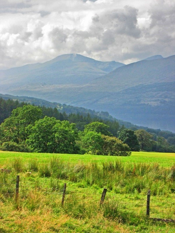
The descent to the car park provided a new vista to the north. This
included, rather annoyingly, a distance view of the day's destination -
Aberfoyle. Drymen to Aberfoyle is only 10 miles so we were in no rush to
finish the day off too early as some of us wouldn't be able to resist the
temptation of the pub and the general feeling was that a 2pm finish could
result in disaster.
Jane had decided to take on the role of chief navigator which gave the rest
of us ample time to concentrate on looking for wildlife. The official Rob
Roy Way guide detailed the numerous birds and animals that are seen on the
way so we prepared for a red squirrelfest.
Jane's navigation meant that we hit the correct path when turning north-west
off the road and into the forest. The scenery was beginning to improve as
was the weather. It was now warm and sunny and everyone, except Mike, had a
spring in their step.
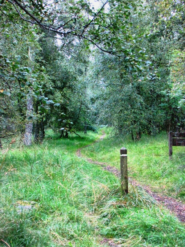
We came across the first of the domed shafts that would be a feature of the
walk and decided to have a short banana break.
 The team stop for a banana break on the outer edge of Loch Ard forest.
Ann has a go at attracting Ken using a tried and tested method.
The team stop for a banana break on the outer edge of Loch Ard forest.
Ann has a go at attracting Ken using a tried and tested method.
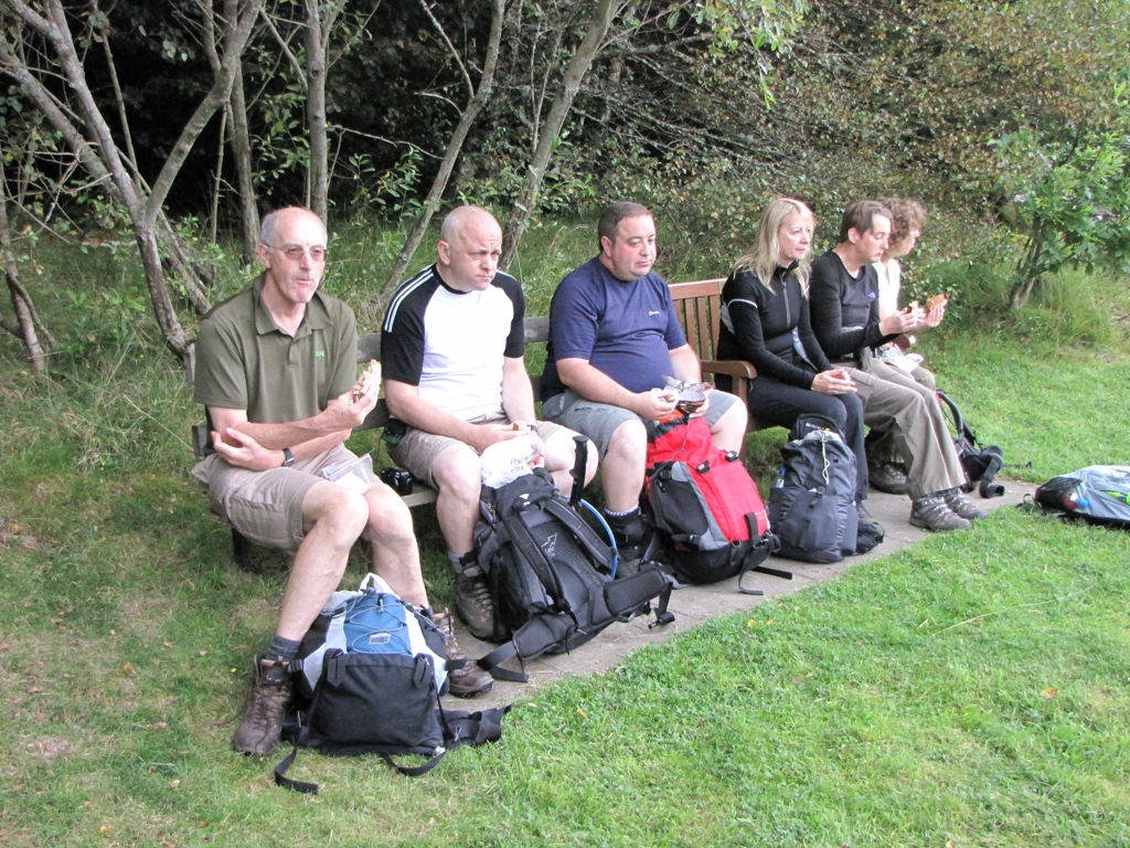
On we marched until we eventually came across the Corrie Aqueduct. The
cut grass looked rather tempting and as it was lunchtime we all decided
that this would be as good a place as any to take a bite.
 Time for a lunch stop next to the Corrie Aqueduct.
Mike had decided that there may be more to his glumness than snoringitus and
became concerned that he may be suffering from flu-like symptoms. His pace
had improved only marginally and he was rather quiet so the rest of us
wondered if we'd be better off leaving him alone in case he was harbouring
something nasty.
Lunch was over so on we went. Jane continued with the navigation and looked
forward to the next challenge which required her to navigate through a
number of domed shafts and locate the correct path that would lead us to
Aberfoyle.
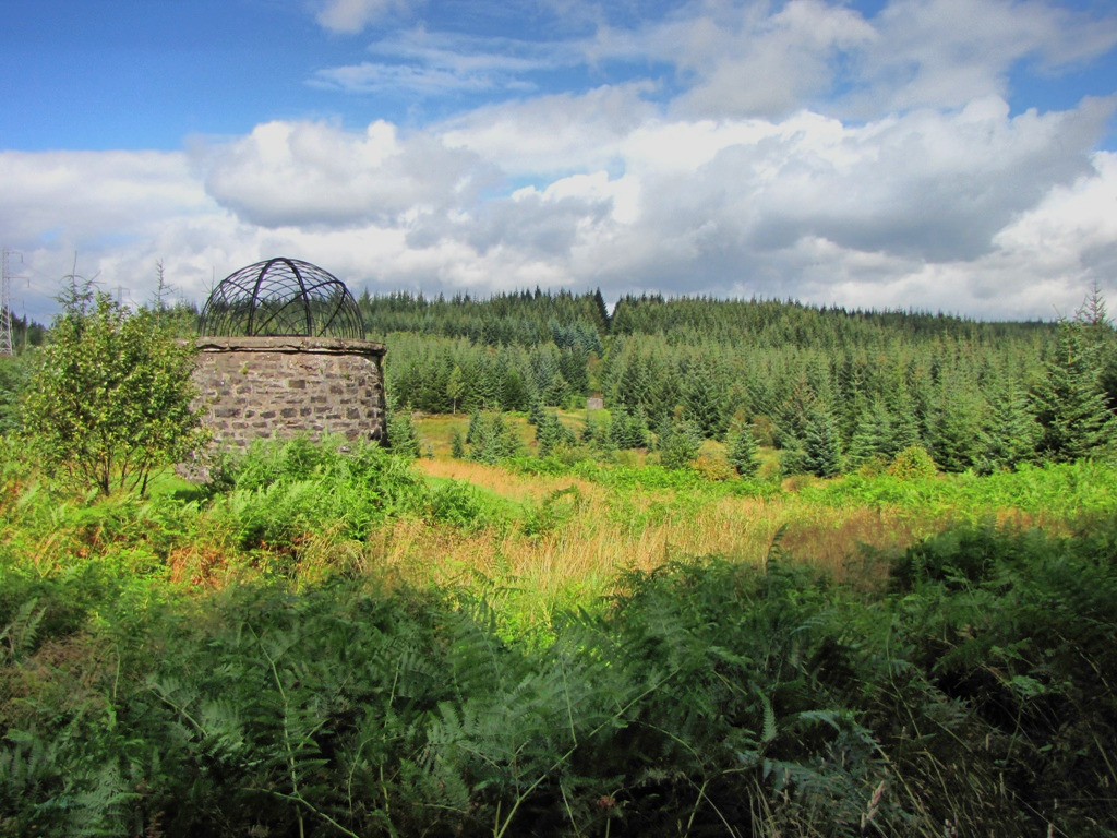 The *famous domed shafts of the Loch Ard forest. (* - they may not be
that famous)
The *famous domed shafts of the Loch Ard forest. (* - they may not be
that famous)
Rob Roy Way signs started to appear at various key points on the route
so this ensured we chose the correct option when coming across the numerous
forest roads. The signs also calmed certain unnamed members of the team who
had expressed concern that Jane was the day's navigator and that a night in
the forest wasn't something they were looking forward to.
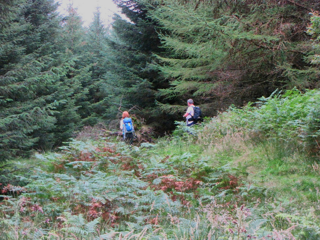
More forest followed until suddenly, Nick and I spotted a large bird of
prey flying over the trees in front of us. This was an exciting moment and
we hoped it would signal the beginning of a wildlifefest.
We
couldn't make out what it was but it was definitely bigger than the average
tit.
Waiting for the rest shortly before the descent into Aberfoyle.
A spot of sky watching ensued but there were no further sightings. The
route had now reached the Bofrishlie Burn and the forest scenery was
improving. We had also begun the descent to Aberfoyle.
 Powering on towards Abeyfoyle. Notice how we all kept a 50 yard
exclusion zone around Mike.
Powering on towards Abeyfoyle. Notice how we all kept a 50 yard
exclusion zone around Mike.
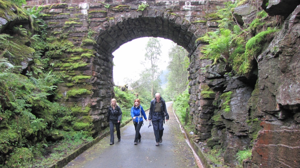
We eventually left the confines of the forest and hit the tiny hamlet of
Kirkton where, surprisingly, there's a Kirk.
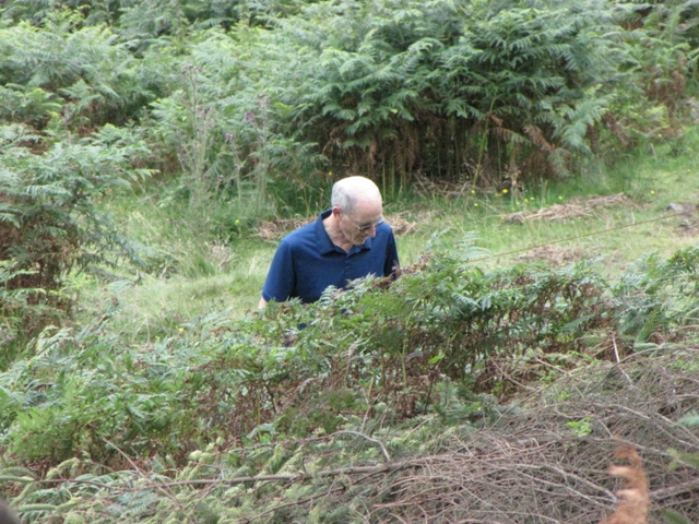
Alison, being a cheeky little chappie, decided to scale a wall and enter the
ruined church to have a nosey and take a few photos. The church is famous
for its cast-iron coffins or mort-safes that were made to deter body
snatchers.
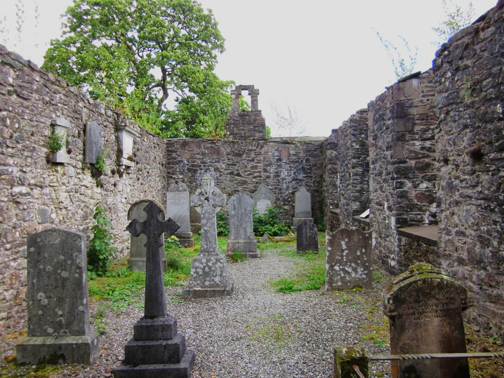 Inside the ruined Kirkton Church. Hang on, there's 10 graves there -
that's one each. Is someone trying to tell us something?
Inside the ruined Kirkton Church. Hang on, there's 10 graves there -
that's one each. Is someone trying to tell us something?
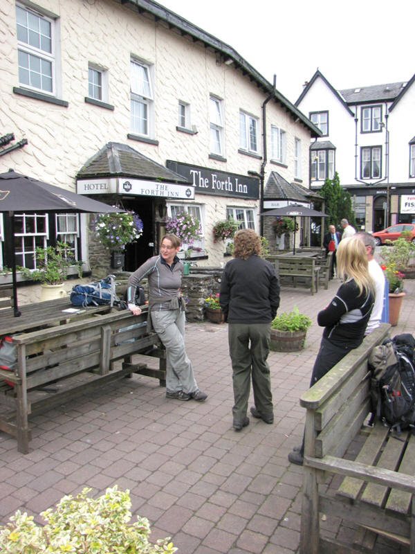
Aberfoyle was only a half mile distant and we were soon there. We had
achieved our aim of not reaching Aberfoyle at 2pm and getting plastered - it
was now 2:15pm.
Sadly, we did have a few pints before retiring to our rooms and preparing
for more beers and nosh. A quick scoot around the shops of Aberfoyle
provided the opportunity of purchasing new tweeds:
 It was a bit chilly around my trossachs so my hand helped to keep them
warm.
It was a bit chilly around my trossachs so my hand helped to keep them
warm.
The Forth Inn's food was enjoyed by all but Mike remained strangely
quiet and even resisted the chance of numerous beers.
Would he improve overnight? Would he be walking in the morning? Was our 100%
completion attempt already at an end? Would Mike kill Dave in the night in
order to stop the snoring? Would I give in to the temptation of the tweed?
Would Ann finally find a suitable pose to attract Ken?
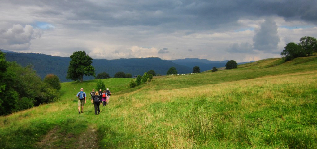
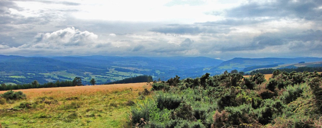
It had been an easy day with improving scenery but we all hoped that the
walk would improve over the coming days. We hadn't come across any other
walkers throughout the first 10 miles so could we be the only group on the
route?
Another easy 10 miler was the challenge for tomorrow with Callander being
the day's destination. What would the new day bring?
DAY 2 - Aberfoyle to Callander
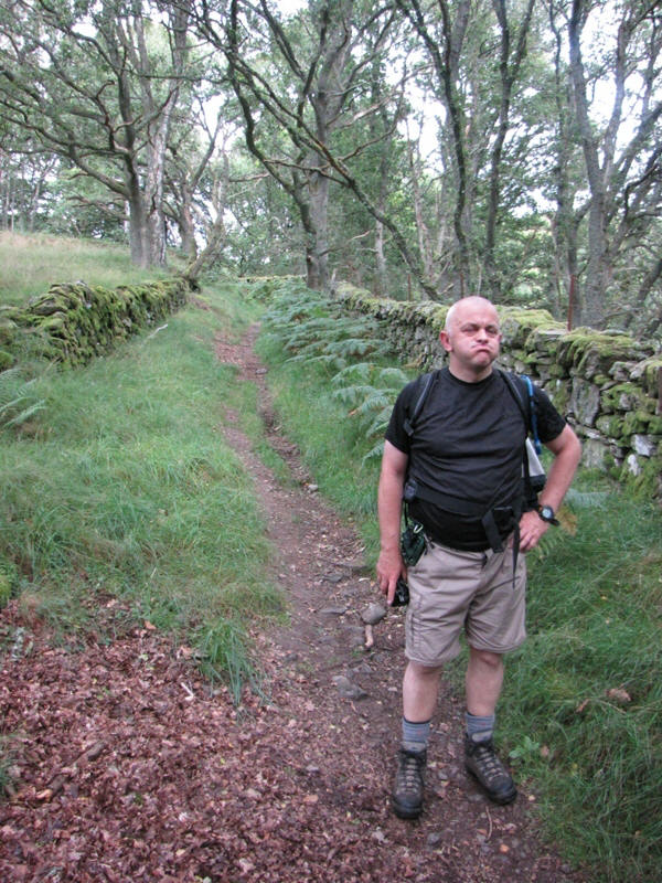
Mike appeared for breakfast but was still suffering from his lurgy. Everyone
else was fine so after gorging on our full English we all agreed on a 10am
start as another easy 10 miler was in store. Callander was the day's
objective with little in the way of ascent\descent so we marched out of
Aberfoyle in good spirits.
 Ready for the off outside the Forth Inn, Aberfoyle. The weather was
cloudy but quite muggy.
Ready for the off outside the Forth Inn, Aberfoyle. The weather was
cloudy but quite muggy.
A few of us had noticed, during the previous day, that the terrain to the
north of Aberfoyle was steep and rocky and as we were heading in that
direction to hit Callander wondered what the early stage of the walk would
bring.
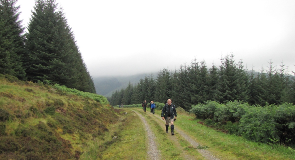
After walking past an outbound centre the track entered a forest and
provided decent views to the Campsie Fells to the south-east. A golf course
adjoined the path and the going was pretty easy with a more deciduous feel
to the plantations than the previous day's regimented firs. There were no
steep rocky climbs so nothing to get worried about.
It wasn't too long before the firs became the dominant species and with the
track now turning into what appeared to be a newly laid forest road the
scenery began to look pretty much like that of the day before - trees, trees
and more trees.
 Back in the trees and on a shitty gravelly track.
A better section followed where the track became narrow and wet and we were
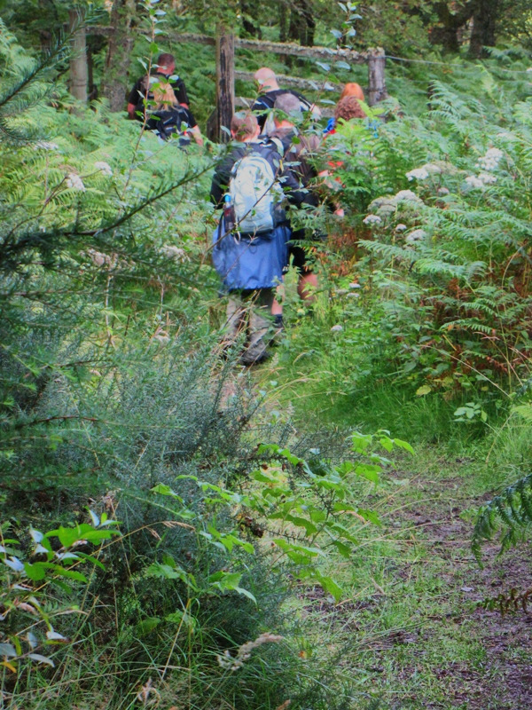
all glad to get off the forest road. The group had split up into the front
runners, middle section and slackers so for a short while we lost sight of
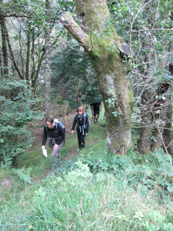
each other in the thick forest.
 Alison and Gordon bravely entering the depths of the forest.
Mike and Nick, the front runners, had stopped next to a stile that marked
the end of the thick forest and the start of open country. Crossing the
stile was a group of German scouts who had already walked the Rob Roy Way
and were now on the final stretch of the return hike. These were the first
Rob Roy Wayers we'd come across so hopefully we'd bump into many more and
share our experiences of trees, golden eagles, red squirrels, ospreys, stags
and leaping salmon.
I questioned them on the route, whether they'd had much rain and whether
they'd seen many midges. The latter query was answered when they all pointed
to their legs which were covered in what looked more like eagle bites than
midge bites. At this point a few of the team applied even more Smidge in the
expectation that they'd die from midgery sometime soon.
We bid our farewells to the scouts and commented on the flag that they'd
carried for the entire route. We wondered, if we were to do such a thing,
what our flag would consist of. This kept us occupied for a few minutes
until we then decided to take a banana stop.
 Vee have vays of making you itch.
Whilst enjoying our bananas, chocolate and jelly babies I detected the
presence of the first midges of the walk. Our 10 minute stop had given them
ample time to detect and attack so we quickly packed up and set off. To our
left were the small but rocky Menteith Hills and we wondered why the route
couldn't have taken the ridge which we assumed would have provided great
views over the surrounding countryside. Maybe the crossing of the strangely
named Bealach Cumhang could have been a sticky point?
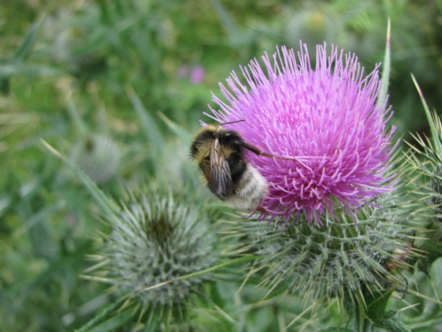 Aawww, a lovely wee bee on a wee Scottish thistle.
 Bugger, Ken's gone and wee'd all over it. Thanks to Ann for this photo.
Anyway, quickly on.
We soon came across the Allt a' Chip Dhuibh which looked like a loch to us
so we wondered why it was called the river of the black chip? This was quite
a scenic spot so we stopped for a minute and let a small group of Duke of
Edinburgh walkers past (along with their leader who seemed to be enjoying
watching the teenagers get lost).
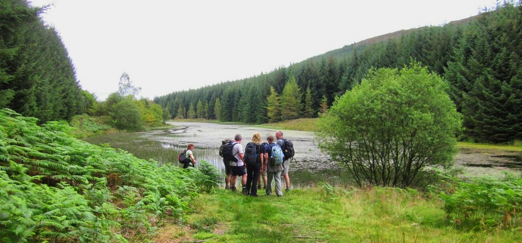 The team reach the black chip river.
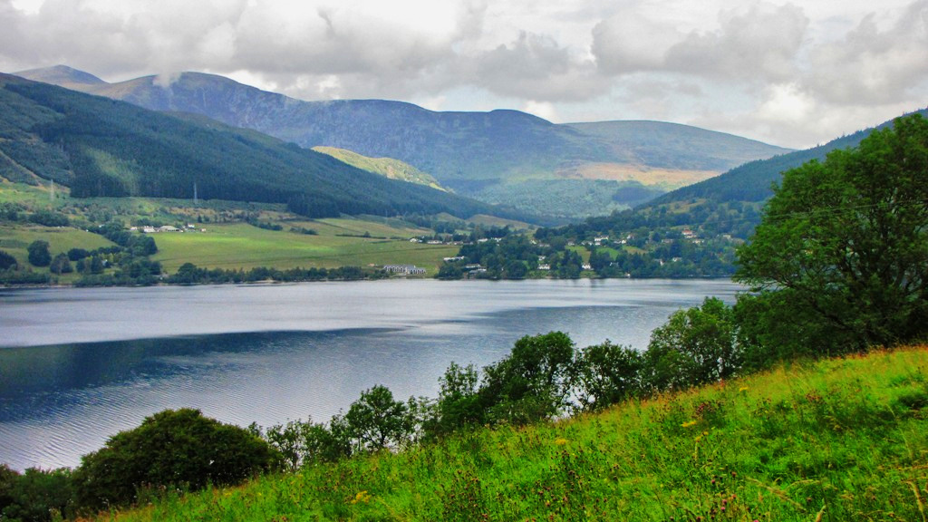
We'd covered pretty much half of the day's route and we about to see a
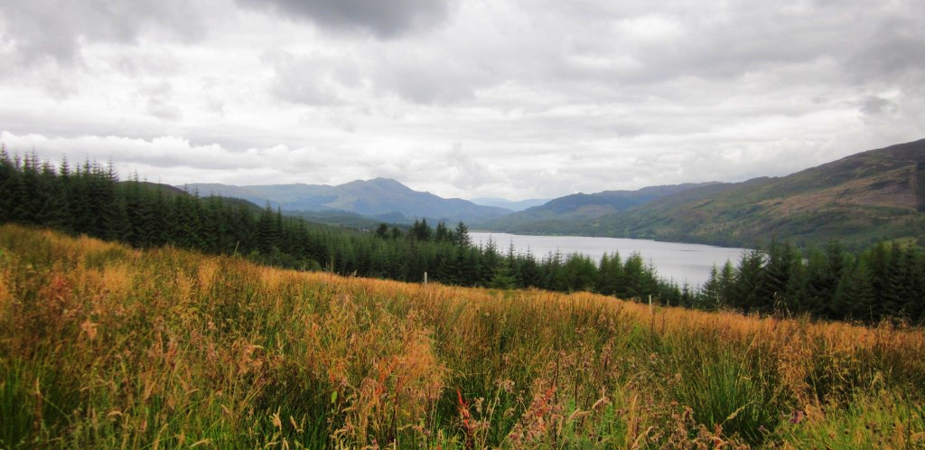
change of scenery. The views would now form to our left and we could now see
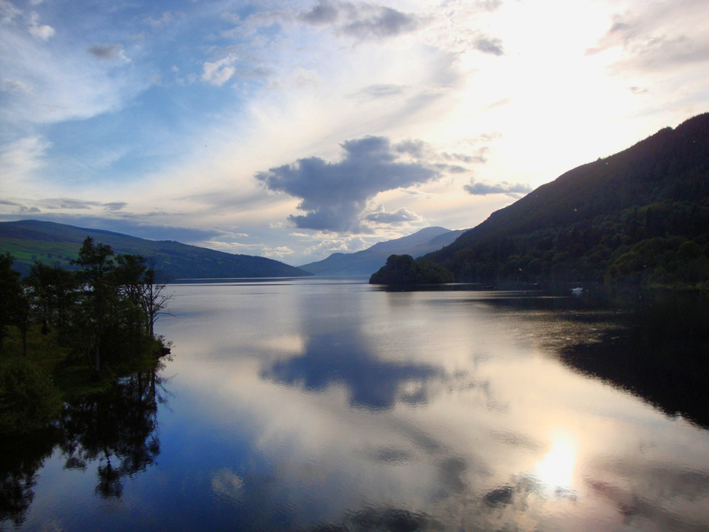
Loch Venachar with Ben Ledi rising behind. This seemed more like it and we
looked forward to better things ahead (apart from Mike who was still
suffering).
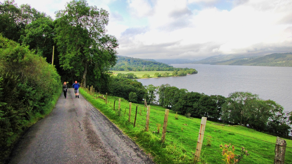
The route descended to the shores of Loch Venachar with the views in the
distance making up for the scruffy cleared forest directly ahead of us.
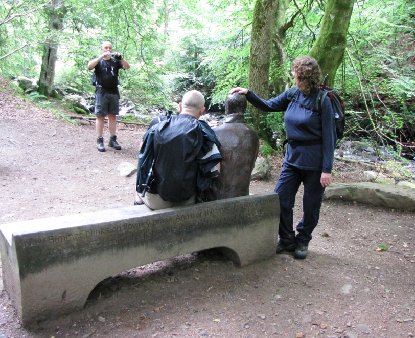
Lunch was enjoyed on a bench shortly before the loch so we were all prepared
for the final few miles into Callander.
 Looking towards Ben Venue over Loch Venachar.
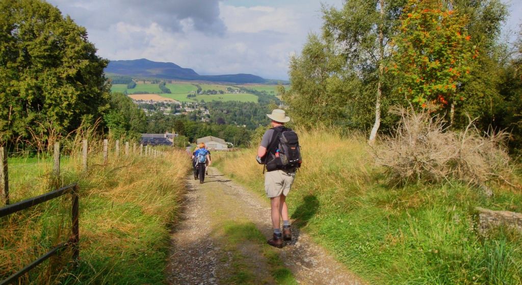
Once we'd left the shoreline behind the final couple of miles long the road
to Callander was a pretty dull affair and our hotel, the Roman Camp, was at
the far end of the town so we trudged up the main road and turned right into
the scenic grounds of the hotel.
I can safely say that the Roman Camp is the poshest place we'd ever stayed
at during one of our walks and it was a shame that this wasn't the end of a
gruelling 20 miler rather than an easy 10 miler. The rooms were lovely and
the hotel itself was rather grand.
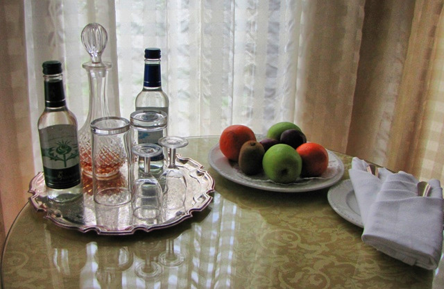 I could get used to this. Complimentary fresh fruit and sherry.
Another early finish so after a quick shower we scooted around the grounds
of the hotel and retired to one of the many lovely rooms for a good old
fashioned lager. The local Italian restaurant was the choice for the night
as the hotel restaurant was a little too pricey for our simple needs.
It was a Monday night and Sky were showing the Man Utd v Spurs game in a
local bar. Gordon disappeared from the restaurant before the others had
finished in order to watch the game in a local bar so after settling the
bill the lads decided to join him and catch the end of the first half. The
ladeez returned to the plushness of the Roman Camp whilst we entered the
Dalgair.
Gordon, in the meantime, had attracted one of the local women who only had
one thing on her mind - to ravish him!
The second half was an enjoyable affair as we swapped between watching the
football and Gordon's worsening plight. At times it was exceedingly funny
and at others rather worrying as she gyrated around our favourite grizzled
Lancastrian. He eventually managed to pull her off (after she'd tried to
pull him off) and we sprinted down the road to the safety of the Roman Camp.
We joined the girls and laughed whilst reliving Gordon's close escape.
 Gordon's bird - the one in the middle.
Two 10 milers had been completed but tomorrow would see a 17.5 miler to
Lochearnhead.
We all retired to our rooms and prepared for one of the longest walks of the
week.
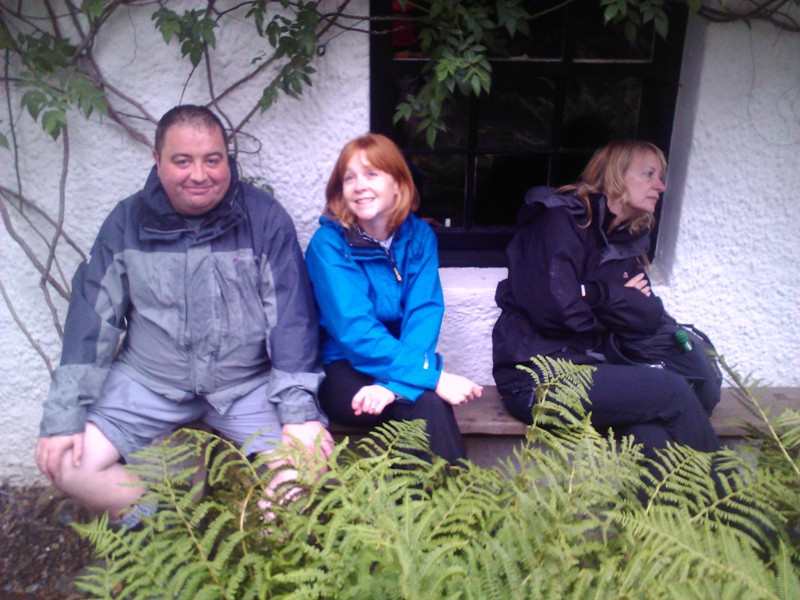
DAY 3 - Callander to Lochearnhead
Gordon and Jane were rather quiet at breakfast and so we can only guess that
words had been exchanged following the night's misdemeanours. Mike reported
that his condition was similar to that of the previous days and that Dave
had continued to snore like a hippo.
Lochearnhead was 17+ miles away so after a hearty breakfast and the threats
of midges and killer 'birch' flies from the hotel waitress we met on the
lawn and prepared for a tougher day. The weather was dry but overcast with
the forecast promising better weather for later but we'd wait and see.
 I try to lighten the mood as Gordon and Jane have a 'domestic'. 'I love
you Jane'. 'Just fuck off Gordon'.
I try to lighten the mood as Gordon and Jane have a 'domestic'. 'I love
you Jane'. 'Just fuck off Gordon'.
We marched back up the mile long main street of Callander and instantly
split up to buy drinks and sarnies. After what seemed like 3 hours Mike and
Nick, who'd originally entered the Co-op (the Co-op being a constant feature
of the walk so far) decided that it was shit and manned by imbeciles so
walked up the road to Greggs where normality was regained.
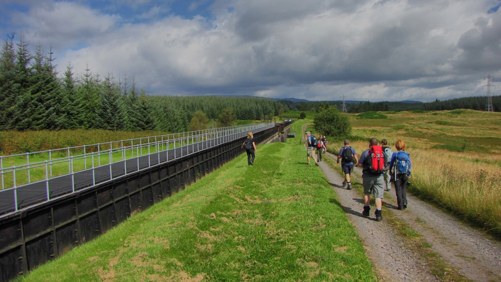
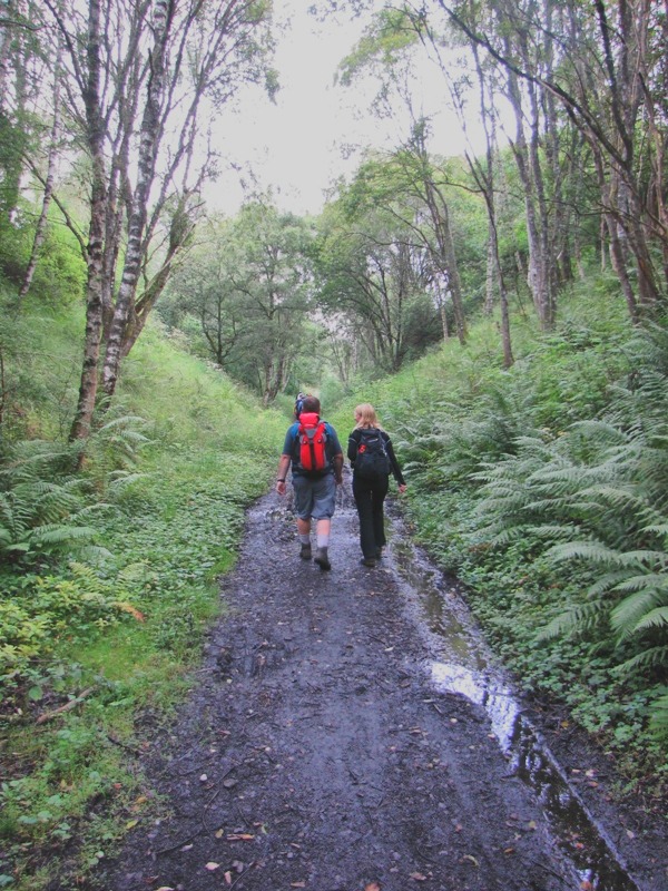
By the time we set off proper it was turned 10am so a reasonable pace was
set as we marched along the old railway track that led us through the Pass
of Leny and onto Loch Lubnaig.
The path was more suited to cycling than walking so we suffered numerous
interruptions as specially designed silent bikes attacked us from the rear.
There was a monotonous feel to the first 3-4 miles with little changing in
the way of scenery. The fast flowing Garbh Uisge provided the odd
interesting glimpse but the A84 traffic helped to quell any feelings of
remoteness.
 A bridge close to Kilmahog which is near to Stranglemapig.
A few folk commented on the never-ending hard tracks and that this was
making their feet rather weary. There hadn't been much in the way of
grass\soft tracks on the route so far and the map suggested that this wasn't
likely to change any time soon.
The path did improve for short period as it passed the Falls of Leny (I
don't think anyone really noticed these falls?) but after heading north to
the Loch the hard track was regained and it was business as usual.
We passed the ascent path for Ben Ledi which Jane tried to keep a secret
from me (in case I decided this was a potential detour) and then came across
the 5 mile long Loch Lubnaig.
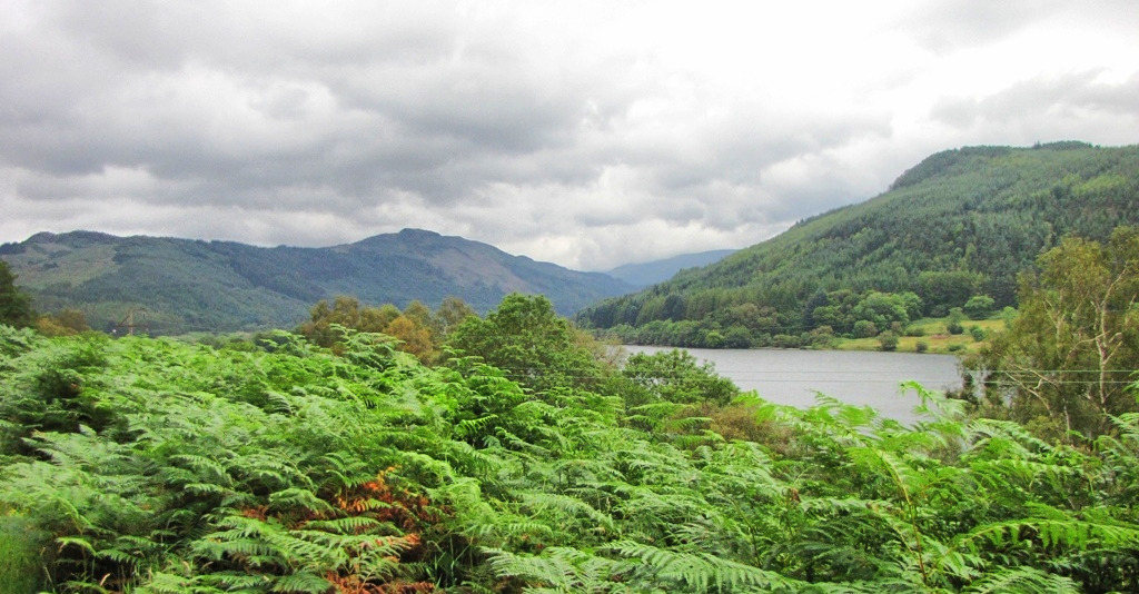 A view over Loch Lubnaig. There's another 5 miles of this!
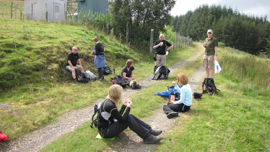
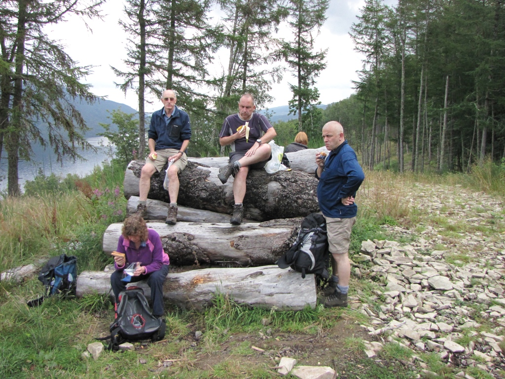
After breaking the back of the Loch we stopped for lunch at a place called
Kipp which was quite appropriate as the relatively dull morning's walk
resulted in most of use wanting a 'kip'.
We'd already walked 8.5 miles so were around the halfway point.
 The excitement of the morning's walk was etched in our faces.
Lunch was enjoyed by all and an easy half mile would see us reach Strathyre
and civilisation.
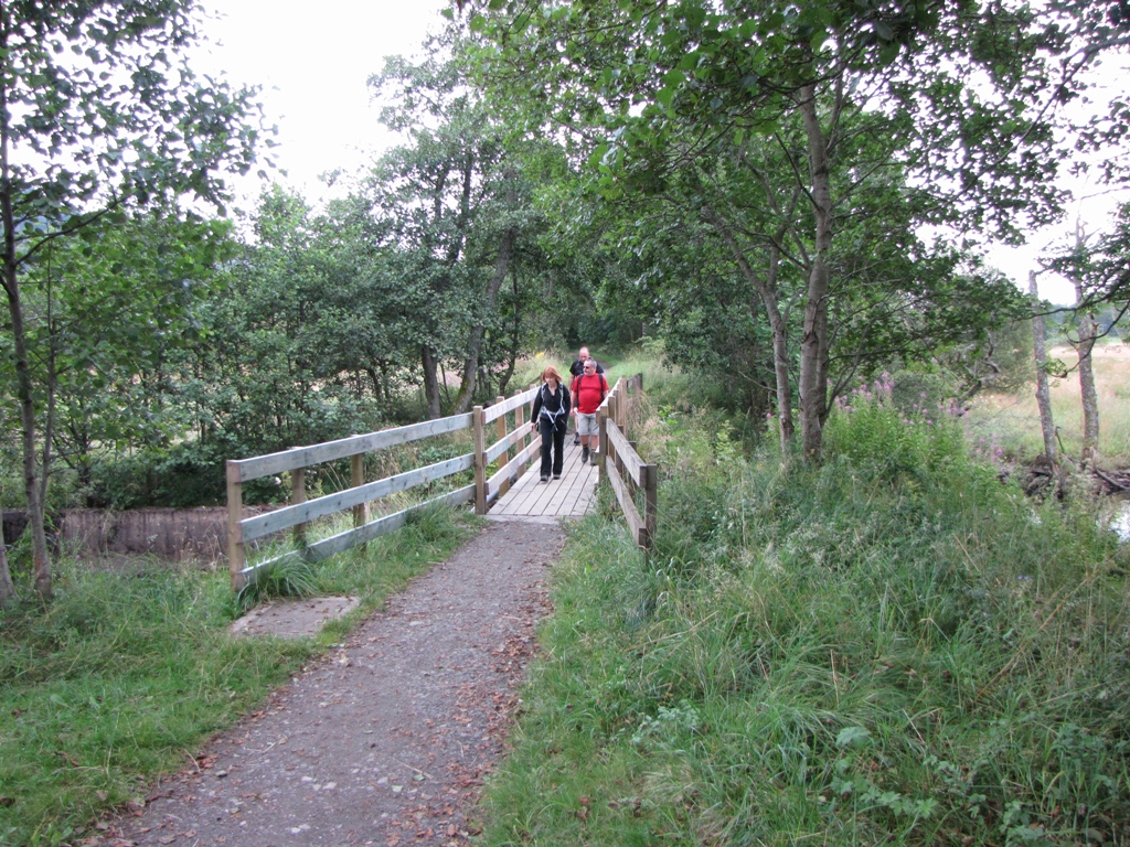
The midges and horror flies promised during breakfast failed to materialise
but a wobbly bridge did cause a few moments of panic as we failed to
readjust to the hard track.
 Notice that Jane is marching well ahead of Gordon.
The major portion of the team decided to use the well signposted public
toilets but had their hopes dashed by closure. I reminded them that we were
about to encounter many miles of forest and that there'd be ample
opportunity to take a sneaky behind any one of 4 million trees. For some
reason most weren't overly keen on the idea.
A steepish sweaty climb out of Strathyre followed and then, just as we
reached the main track, it started to rain.
 Clambering through the deciduous to reach the coniferous. Hhhmmm, rain
is in the air.
Clambering through the deciduous to reach the coniferous. Hhhmmm, rain
is in the air.
The rain was sufficiently wet to require waterproofs to be worn for the
first time on the route. A quick look at the map alerted me to the fact that
there was a gradual climb of 400ft directly ahead of us so this, coupled
with warm muggy conditions and rain, wouldn't make for the most comfortable
half hour walk.
Before we reached the ascent though, Jane, who had continued in her role of
chief navigator, decided to send us (uphill) in the wrong direction. The RRW
signs that had been placed at strategic points earlier in the route weren't
deemed to be of use in a large forest riddled with forest roads so we were
now depending on Jane to see us through the day.
I noticed the error which, if we'd have carried on and turned northwards to
head in the correct direction, would have seen us hit a dead end miles away
from anywhere and so we about turned and rejoined the official RRW.
 The correct route in green and Jane's route in red. The red circles mark
the points where we could have been found dead the following morning.
The correct route in green and Jane's route in red. The red circles mark
the points where we could have been found dead the following morning.
Gordon was itching to give Jane a bollocking but wasn't in a position to do
so thanks to the events of the previous evening.
We reached the start of the climb where I decided to test my newish
waterproof out by having a good march. By the time I reached the highest
point the rain stopped. Typical!
 A quick rest at the top of the climb. Jane reminding Gordon that he's in
no position to comment on her navigational skills.
A quick rest at the top of the climb. Jane reminding Gordon that he's in
no position to comment on her navigational skills.
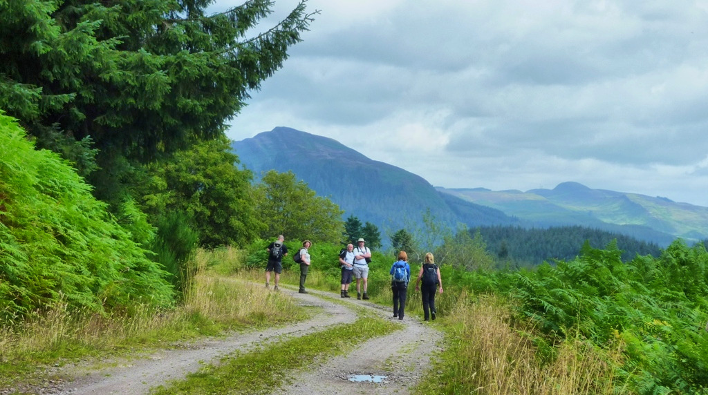
On the gradual descent through the forest we came across an excellent view
over to the Braes of Balquhidder and the settlement of Balquhidder which is
the burial place of Rob Roy himself. We'd decided that Rob Roy must have
hated any form of wildlife as the route appeared to have been carefully
designed to ensure that walkers or cyclists would see absolutely sod all in
the form of anything remotely interesting. Where were the squirrels, the
deer, eagles, crossbills - anything?
The descent included a sizeable dogleg (in the wrong direction again but
this wasn't Jane's fault) before heading north again towards the Kingshouse
Hotel (not that one, the other one).
We were around 5 miles away from Lochearnhead and all that separated us from
beer and food was more in the way of dismantled railway track walking. The
rain had stopped so with a bit of luck we'd hit the hotel in around and hour
and a half.
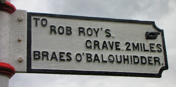 Two miles to the grave anyone? No? Thought not. I bet we'd have had to
fight our way through deer and squirrels to get there.
Two miles to the grave anyone? No? Thought not. I bet we'd have had to
fight our way through deer and squirrels to get there.
I think it's fair to say that the last few miles went on a bit. There was a
Tyndrumesque feel to the route as it snaked through trees and streams with
no real purpose other than to piss us off.
Nick and Mike were a good way ahead of the main group which had now
splintered. Jane and Gordon formed their own relationship bonding group
whilst the others mingled and chatted as the path continued in its own
annoying way.
As we reached Lochearnhead the reason for Nick's power push became clear. He
was desperate for a toilet and had decided to make a push (not that sort of
push) for the hotel or, even better, a public loo. Unfortunately the
Lochearnhead Hotel was half a mile out of the road going eastwards out of
the village but there, shining like a beacon, was a public loo. Mike stood
guard as Nick sprinted into the men's. All was now good in Nick's world.
A Ferrari, Aston Martin and a Lotus adorned the hotel car park. This pleased
Ann and Susan as they began to harbour thoughts of rich millionaires, fast
cars and yachts. Ann lost interest in Ken as his VW Golf was no match for
the hundreds of thousands of pounds worth of machinery on show in
Lochearnhead and, I assume for this reason, didn't bend down in a
provocative manner for the remainder of the night.
The water level of Loch Earn had risen noticeably in the short time it took
us to remove our boots and order the first pints. We assumed that this was a
sign that Nick had left the toilet and flushed the aftermath into the loch.
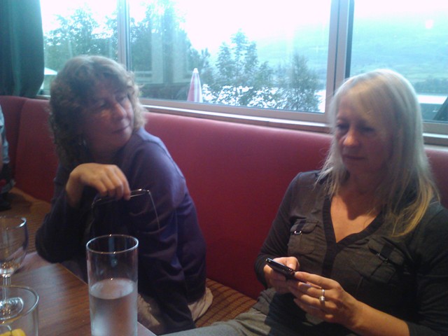 Ann and Susan discussing millionaire pulling tactics in the bar of the
Lochearnhead Hotel. Unfortunately the moneymen never turned up.
Ann and Susan discussing millionaire pulling tactics in the bar of the
Lochearnhead Hotel. Unfortunately the moneymen never turned up.
The rain became quite steady as we ate dinner and we wondered if the weather
would improve in time for our 15 miler to Ardeonaig the following day.
Everyone was still fighting fit. Mike's lurgy had subdued but Jane and
Gordon were suffering from rubs on their little toes. Ken had a stiff back,
as did I, but that was about it along with Nick now a full two stone
lighter. Al, Ann, Susan and Dave were complaint free so time for bed and to
prepare for Loch Tay!
DAY 4 - Lochearnhead to Killin
Day four was upon us along with the hope that the scenery would finally
improve as we headed towards the giant that is Loch Tay and the array of
munros that surround its northern shores.
Waterproofs were on from the off as light rain descended from grey skies and
there was a feeling that the day could be a wet one.
 Ken tells Susan that the best men don't have money whilst Dave, picking
his arse, instantly proves Ken wrong.
Ken tells Susan that the best men don't have money whilst Dave, picking
his arse, instantly proves Ken wrong.
We all bought lunch at the local shoppie before setting off northwards for a
couple of hundred yards where we would turn off for a 300ft climb to the
Glen Ogle cycle track. It had rained twice on the walk so far and both times
during the walk's biggest climbs.
Today would see us walking 15.5 miles but with 2600ft of ascent. We would
reach the walk's highest point and the most remote places.
Up until a few weeks before the walk the original plan was to descend from
the official route into Killin and then re-ascend the same route the
following morning. This however required a 5 mile return trip and 1300ft of
extra ascent - none of which was on the RRW so I arranged for us to continue
to a place called Ardeonaig on the sides of Loch Tay where we'd be picked up
by a minibus, taken to Killin and dropped off at the same point the
following morning. It felt like a good idea at the time and felt like an
even better idea when we set off.
The Glen Ogle cycle path was well tarmac'd and as expected, quite hard. The
scenery was more rugged as we followed the open glen for a good 4 miles.
 Susan, Al and Ken on the march along Glen Ogle.
We eventually came across a small loch (Lochan Lairig Cheile) and then,
excitingly, had to cross the road where we entered - a forest! A glance at
the map showed that this was quite a large forest and that we'd be in it for
a good 5-6 miles.
The rain had pretty much disappeared by the time we reached the memorial
remembering the victims of a Tornado bomber crash in 1994. Shortly after
passing the memorial Mike came across another walker who had set off from
Killin earlier that morning (only the second person we'd seen after the
German scouts on day 2) - the lack of walkers enroute had come as a bit of
surprise along with the lack of wildlife, soft paths and anything of
immediate interest.
A quick check of the map ensured we hit the correct forest track and we
entered the depths of what seems to be a huge unnamed forest.
 Trees, trees and more trees. Nick sports the long forgotten gaiters and
shorts look.
Trees, trees and more trees. Nick sports the long forgotten gaiters and
shorts look.
The highly anticipated views over Loch Tay to the Tarmachan ridge and the
mighty Ben Lawers failed to materialise thanks to miserable low grey cloud.
One thing that was apparent as we trudged eastwards through the trees was a
distance view of Killin which emphasised the size of the detour if the
minibus option hadn't have been taken - phew!
Midges were present in the forest so we tried to keep going and remove the
need for the unSmidged to Smidge and the Smidged to see if it actually
worked. Having our waterproofs on didn't help matters but hey, that's
Scotland!
We reached the Achmore Burn which would have been the point to descend to
Killin but, as the sun began to burn through the clouds, we turned south and
took on a wee 200ft climb.
All waterproofs were now off and a quick drinks break was taken at the top
of the climb. It was also a 'wait for Dave' moment who, after a few minutes,
arrived at the scene looking rather red and sweaty.
Lunch was to be taken by a mast a mile or so on so we veered back to the
east and finally left the confines of the forest.
 Lunch by the mast. Is there anything better than this?
The skies were slowly clearing and Loch Tay was now clearly in view as was
Killin. The munros still weren't visible but the weather was now sunny and
warm and the midges were only noticeable if we stopped for a few minutes.
Lunch eaten - off we went.
The next section of the walk, although on a sizeable forest road, felt very
remote. The forest remained to our left but to the right was rough open
hummocky moorland which gave the impression of a place where man has never
been and will probably never go.
In the far distance was another mast which marked the highest point of the
entire RRW (approx 1870ft). It looked some way off and with the skies in the
background looking rather dark we feared the worst as the route followed an
undulating road which eventually led to Lochan Breaclaich and its dam.
 The lonely road leading to the dam.
The dam was larger than expected, as was the Lochan itself, so we stopped
for a quick break and prepared for the 400ft climb to the mast.
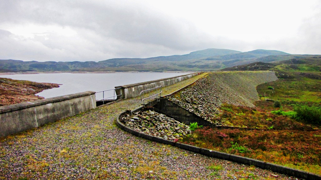 The dam and lochan.
The road was followed beyond the lochan and a gradual climb was enjoyed by
all, apart from Dave, who at times looked rather unhappy with the whole
thing so Jane and I took turns in coaxing him up the hill. I reminded him
that ale and nosh were waiting for us at the Killin Hotel whilst Jane
offered him £5000 for doing away with Gordon.
 Dave tells Jane that snooker balls in a sock is an effective method of
inflicting pain.....
Dave tells Jane that snooker balls in a sock is an effective method of
inflicting pain.....
....
which made Jane happy.
We finally reached the mast and took a banana break. Large flies started to
annoy us along with the odd midge so we rucsac'd up and set off for the 4
mile\1500ft descent to Ardeonaig and the shores of Loch Tay.
Something strange happened shortly after leaving the 'summit'. The
road\track disappeared and we were on what appeared to be A NORMAL WALKING
PATH -
Help ma' Boab!
It wasn't just the path that'd changed but the scenery too. We were
looking over the hills that border the remote upper reaches of Glen Lednock
and everything felt better. Loch Tay was visible in the distance and the
intrusion of human activity that had blighted too much of the walk on
previous days had gone - apart from the big bastard pipeline that suddenly
appeared in the immediate distance!
We followed the pipeline for a hundred yards and then turned a corner where
more pipeline disappeared into the distance. Us front runners continued
along the track that followed the pipeline until Jane, who was still
performing navigational duties, shouted us back and mentioned that the RRW
leaves the pipeline on an indistinct track and headed between two clumps of
trees.
I performed a quick check over a mound and, to my surprise, found out that
Jane was indeed correct as a faint track could be seen in the tussocky
grass. Good old Jane had made up for her cockup on the previous day!
The track was wet and soggy and at times could only be recognised by the
presence of trampled grass. It was at this point that we realised that the
RRW wasn't that well walked as the lack of a well worn path suggested a
distinct lack of footfall. We were unable to gauge the popularity of the
route on previous days as roads\railway lines gave no indication of wear and
tear. Another clue was that we'd only see two separate groups on the route
in nearly four days!
 At last a bit of wildlife - a dead sheep! Looks like rain in the
background.
At last a bit of wildlife - a dead sheep! Looks like rain in the
background.
The path was so poorly defined that at one point we hit a dead end. There
was no way through the locked barb wired fence so I negotiated a patch of
shitty shit for a couple of hundred yards and called the rest of the team
over to an open gate on the other side of the enclosure.
 The pathless trek to Ardeonaig and Loch Tay.
We were back on track. Not far now.
We eventually came across a farm and then the Outdoor Centre that signalled
that we were around a mile away from Ardeonaig. It then started to rain to
the extent that waterproofs were required just at the point that I tried to
contact the taxi company to check the ETA of our prearranged minibus. It was
also a call to remind them, in the unfortunate event that they'd forgotten
about us, that we were to be picked up and that an eight mile walk along
Loch Tay back to Killin would result in me being killed by the rest of the
team.
I spent around 20 minutes trying to get through to the taxi company thanks
to an engaged phone so was unable to confirm that all was OK.
The rain was now quite steady and we arrived at the disused Ardeonaig hotel
in dribs and drabs. It then began to piss it down.
We huddled under all available porches as the rain poured with a feeling of
good fortune as if we'd have been 15 minutes slower we would have got
absolutely soaked.
 Nick and Al enjoying the wait in the rain at the Ardeonaig Hotel.
 Ann arrives just in time - looking a million dollars.
 Dave celebrates the end of another day whilst Susan, deciding that her
hair should remain off-camera, tries to get out of the shot. Alison, as
ever, remains stupendously happy with everything.
Dave celebrates the end of another day whilst Susan, deciding that her
hair should remain off-camera, tries to get out of the shot. Alison, as
ever, remains stupendously happy with everything.
I eventually got in touch with the taxi company who told me that the minibus
was somewhere on the south shore road of Loch Tay and would be arriving in
approximately 15 minutes. It did arrive and we all climbed aboard for the
rainy ride to Killin.
It was still pissing it down on reaching the Killin Hotel where we changed
the pickup time for the following morning from 9am to 10am which allowed for
more beers, a lie in, time to get food or whatever. We then either checked
in or hit the bar. I decided to have a quick shower and then hit the bar
which had been admirably manned by Captains Swarbrook and Riley.
Multiple pints were enjoyed along with a rather large meal in the impressive
restaurant room. Dave and I then decided to have a crack at the various
whiskies on offer (there were quite a few) before retiring to our rooms.
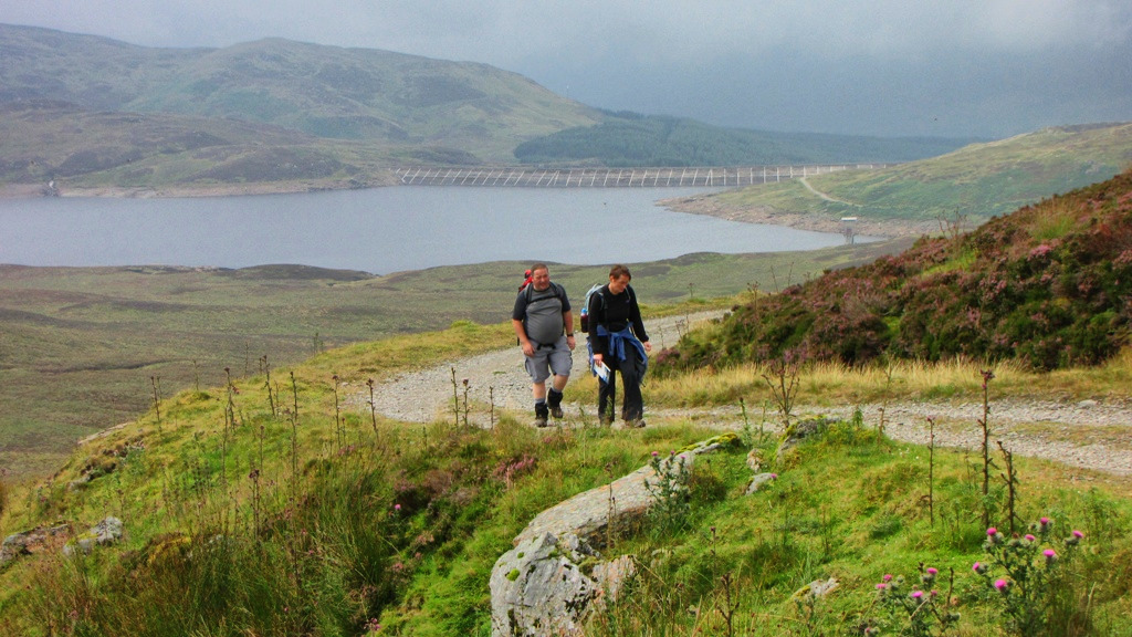
The following day was an easy 11.5 miler from Ardeonaig to Kenmore. The
forecast was good so an enjoyable day was on the cards.
DAY 5 - Killin to Kenmore
Breakfast done, lunch bought and new lining socks for Al so all we had to do
was wait for the minibus which arrived as planned at 10am.
It was an overcast morning but it looked like things would improve as the
day progressed. After the 8 mile trip along the south shore of Loch Tay we
were back at the disused hotel at Ardenaig and ready for our 11.5 miler to
Kenmore.
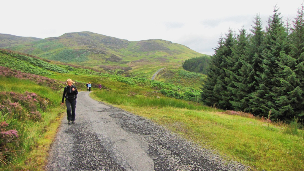
Our route would continue along the south Loch Tay road before climbing up to
see the falls of Acharn and then dropping down to our hotel in Kenmore.
A quickish first mile was met with the addition of a fleece for most of us
as the breeze was quite cool - Don't want to get a chill do we. The sun
however was making more of an appearance so it was only a matter of time
before we reverted to short sleeves.
 Any they're off. The road to Kenmore!
Thanks to the improving weather and the grandeur of Loch Tay and its
surrounding peaks the route along the road was quite an enjoyable affair.
The odd car led to numerous shouts of 'car' bellowing between frontrunners
and backmarkers but we were eating up the miles in grand fashion.
 Al and Dave enjoying the views over Loch Tay.
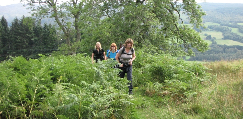
A couple of small features of interest were seen along the way which brought
an added mirth factor.
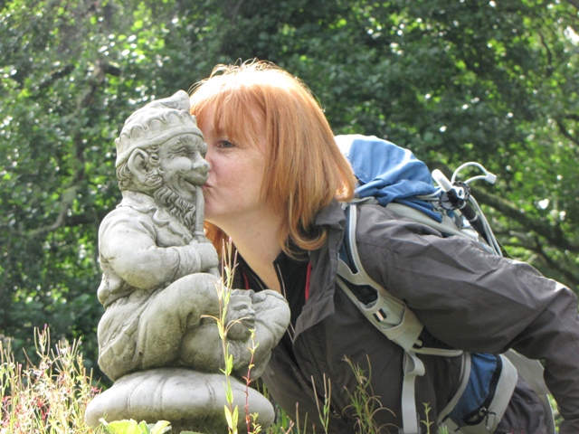 The lucky imp, seen kissing a stone elf.
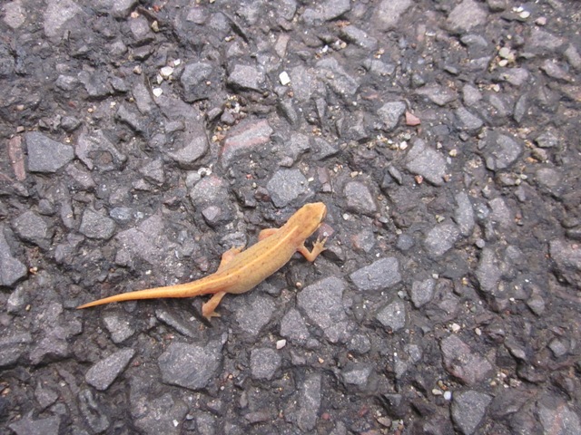 A lizard. This is about as good as the wildlife got on the whole walk.
Whilst passing through the hamlet of Ardtalnaig Jane bumped into an old man
who commented on how fit she was. Gordon was absolutely incensed by this but
he was in no state to intervene after the tomfoolery of Callander.
 A view across Loch Tay to the munro An Stuc (1118m). Meall Garbh is the
peak in cloud to its right.
A view across Loch Tay to the munro An Stuc (1118m). Meall Garbh is the
peak in cloud to its right.
Kenmore was in view for most of route until we reached a gap in the forest
near to Ardradnaig where we realised we hadn't been looking at Kenmore at
all but a place called Fearnan. We then noticed that Loch Tay bent to the
east and that Kenmore was a good 5 miles distant - bollocks!
 Fearnan seen over the loch which from a distance we thought was Kenmore.
The highest hill in the background is Meall na Aighean, another munro, at
981m (at least we think it was - we obviously hadn't a clue where we were).
Fearnan seen over the loch which from a distance we thought was Kenmore.
The highest hill in the background is Meall na Aighean, another munro, at
981m (at least we think it was - we obviously hadn't a clue where we were).
We found a cleared area of forest which had a great vantage point over the
loch and decided that this was a good place for lunch.
 Lunch on the logs. Nick decided to take lunch standing up as he'd
already sat on a few massive logs at Lochearnhead. The memories came
flooding back. Hang on, is that a red squirrel in the background? No, it's
Al.
Lunch on the logs. Nick decided to take lunch standing up as he'd
already sat on a few massive logs at Lochearnhead. The memories came
flooding back. Hang on, is that a red squirrel in the background? No, it's
Al.
 A lovely moment with Callander no longer in their thoughts. He wasn't
getting any crisps though.
A lovely moment with Callander no longer in their thoughts. He wasn't
getting any crisps though.
The midges had detected our presence and were gathering so it was time to
get going again. It was only a couple of miles to the falls of Acharn where
we'd hopefully see a distinct change of scenery.
It was on this stretch that we came across more wildlife. This wildlife was
a rabbit that, rather than run off, remained still in the road as we walked
by. For some reason it looked rather disturbing and as its eyes were a deep
red colour we assumed that it'd been injured by a passing car. This was to
be named the Wed Eyed Wabbit of the Wob Woy Way.
We'd had enough of Loch Tay by the time we reached Acharn and we were now
greeted by a 520ft climb. Dave had been looking forward to this part of the
walk since the start
so shot off ahead of the rest.
On and up and on it went until we came across the Hermit's cave. Ooooh! I
crept inside the low dark cavern until, suddenly.....
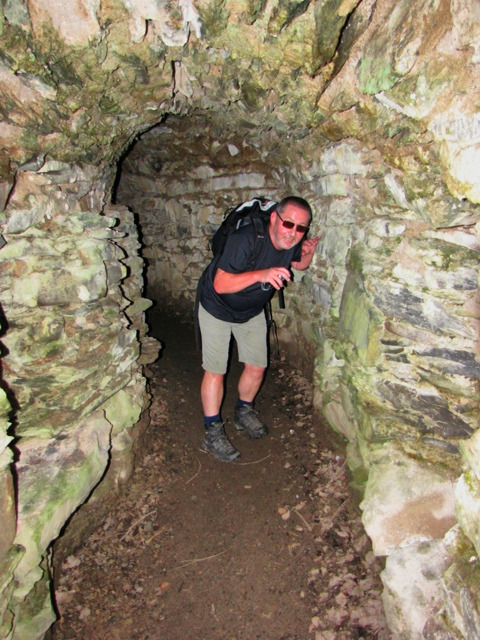 A deformed twisted little creature inhabited the cave.
I'd decided to tackle the 500ft+ climb in a single stretch but the fooling
about in the cave and the growing clamminess resulted in the sweat of the
week. The falls were still a few yards uphill and by the time I reached them
I was dripping like a
parental advisory explicit
content.
The Falls of Acharn were impressive and the excellent viewing platform gave
a bird's eye view of the tumbling cascade. Nick was in camera heaven as he
suddenly had low light, a striking scene and the steam of my sweat to
contend with when creating his shot.
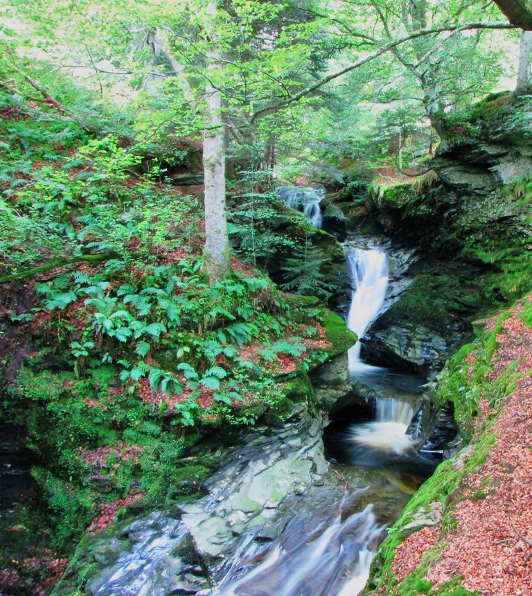 I plumped for 1 second exposure, no flash and a steady hand to get the
above shot.
I plumped for 1 second exposure, no flash and a steady hand to get the
above shot.
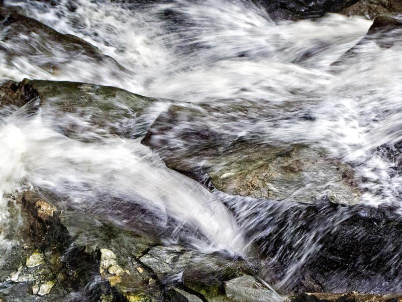 Nick captured this little beauty....
Whereas from the famous 'Lens of Dave'.....
 Dave's shot of the cataract is only viewable by people with cataracts.
Anyway, quickly on.
At one point Jane and Dave appeared to not want to bother with the falls but
were persuaded, after we'd explained that no more uphill was involved, to go
and give them a viewing.
A quick banana stop was enjoyed at the top of hill but yet again the midges
had detected out presence as had been the case earlier. Another small uphill
section was demolished before the route contoured across the hillside and
Kenmore (the real Kenmore) finally came into view.
The sun was now happy and out and Kenmore looked rather lovely from our
hillside eyrie.
This final section of the walk was probably the best of the route so far as
the sun burnt away the clouds and revealed excellent views in every
direction. We were also walking on a path with no tarmac to be seen -
Hooray!
 The huge bulk of Ben Lawers (1214m) rising above Loch Tay.
Our route would see us walking along the side of the hill until we reached
the road between Kenmore and Amulree. Once at the road we would go off-route
and descend into Kenmore where beers would be ordered in huge quantities.
 The excellent walking on the sides of Kenmore Hill.
We all grouped together and began the descent to Kenmore.
It was now pretty warm and this made the long steep descent a bit of a
corker (600ft+). I was sensing the same levels of end-of-walk fatigue in the
group as those seen on the ascent to the White Lion at Cray on the Dales
Way.
I decided to kick in and get to the hotel first. There were two reasons for
this:
1) To see if the receptionist could arrange for us to be taken back up the
600ft climb by minibus the following morning.
2) To order beer.
The following, final, day was the longest and toughest of the day and, as we
were still running at 100% completion, I didn't want anyone to chicken out
thanks to a first mile which included 600ft of climbing. The receptionist
informed me that she'd try her best so it was time to complete task number
2.
As the remainder of the team entered the hotel pretty much all of them
commented on 'that bastard descent' and that it would be waiting for us the
following morning. I shared my plan and would update them as any news of a
possible booking reached my room.
After a few beers and a shower the hotel phone rang. The receptionist
informed me that a local taxi company would take us up the hill (1
mile\600ft) for £50 (a fiver each). I told them OK but then quickly texted
the rest of the team to check that they were OK with the cost.
It soon became obvious that the steep hill was more of a worry than the
steep price as almost everyone replied in seconds with a big fat 'YES!'. Job
done, minibus booked - time for a walk around Kenmore.
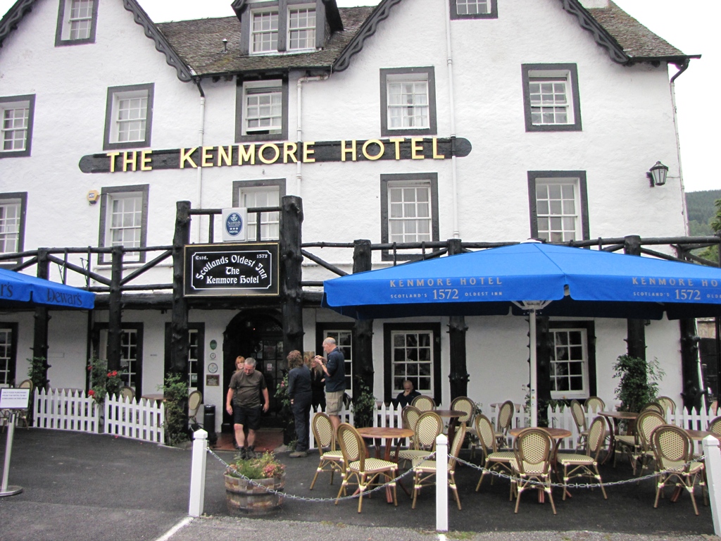
Kenmore itself is a very pretty place to look at but the views from the town
down the length of Loch Tay are even better.
 Looking down Loch Tay to Ben Lawers (photo courtesy of the Mike Riley
Photography Studio).
Looking down Loch Tay to Ben Lawers (photo courtesy of the Mike Riley
Photography Studio).
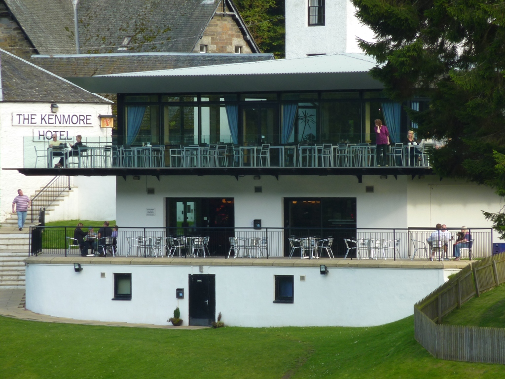
The Kenmore Hotel, our lodgings for the night, has a large balcony which
overlooks the River Tay. It's a rather grand place to sit and have a beer
(and was mercifully midge-free) or in Sue's case - a coffee.
 The start of the River Tay as seen from the Kenmore Hotel. Twas rather
nice.
The start of the River Tay as seen from the Kenmore Hotel. Twas rather
nice.
We ate in the hotel restaurant which went well until Al began to complain of
stomach pains. Ann plied her with various pills from her mobile hospital kit
so Al decided to have an early night and prepare for the following day.
 Ann and Susan taking in the view from the Kenmore hotel.
A group of us hit the downstairs bar where we drank beer and played pool
whilst watching Rangers get knocked out of the Europa league. This helped
cheer the locals up no end.
Only one day's walking remained but it was a 17.5 miler with 2600ft of
ascent (the major portion of which was at the end of the walk). Could we
achieve the first 100% completion since the West Highland Way in 2004? Would
the minibus turn up to take us back up the hill? Would Al's tum be OK?
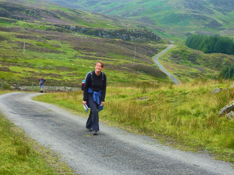
DAY 6 - Kenmore to Pitlochry
The final day was upon us. 17.5 miles to Pitlochry.
The minibus, which was to take us the one mile back to the official RRW
route (along with 600+ ft of ascent), arrived as expected so this was a good
start.
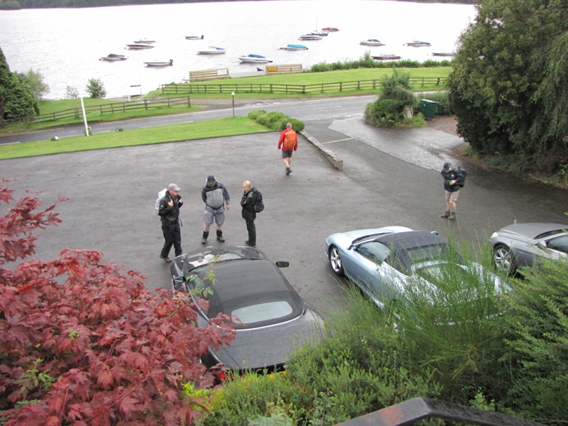
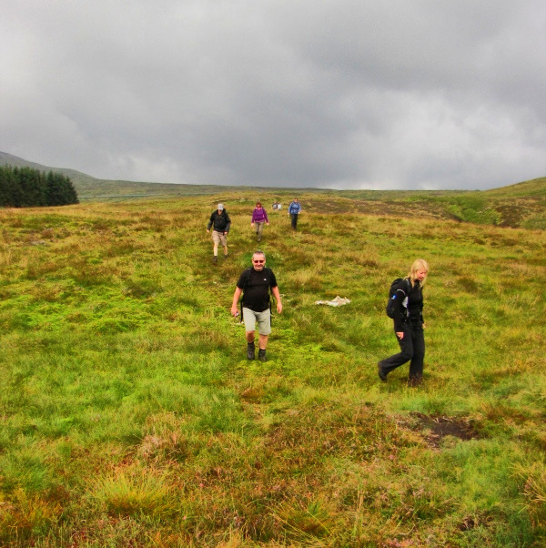
 The world famous Pighole team get ready for the final walk of the week.
The drive back up the hill confirmed that it would have been a bit of a
slog. The minibus climbed the narrow road and negotiated numerous bends
whilst we all looked out for the exact spot where we hit the road on the
previous day. This moment was greeted with a few shouts of 'here' and so the
bus stopped and we all jumped off.
A quick climb to Tombuie Cottage saw us turn off the road and onto the the
track that would lead us in a north easterly direction towards the town of
Aberfeldy. The weather was overcast and the general feeling was that rain
was on its way.
The height gained by the initial climb was soon lost as we descended into a
forest. We hadn't walked through a forest for nearly 36 hours now so this
was a welcome change to the non-forest monotony of the previous day.
A brief moment of muddiness forced some of the team to don their gaiters but
we soon hit dryer ground (about 10 yards later) and found ourselves on a
pleasant grassy track.
 Ken the unstoppable near Druim an Tuir.
As we walked across the hillside we looked down on the infant River Tay and
the Appin of Dull whose name described the conditions to perfection.
The route continued alongside Bolfracks Hill and bobbed in and out of
forestry before descending slightly below a set of powerlines.
A ladder-like stile ensured we all had a chance to stretch our hamstrings
and this seemed a good moment to get the camera in position in readiness for
a fall...
 She'll never get over that at her age.
Everyone of our heroes negotiated the stile with ease. Even Dave failed to
break sweat.
On reaching a place marked on the map as Dunskiag the route decided to
recover the lost height and climb 300ft+ to the Falls of Moness. The Falls
of Acharn were marked on the map in bold and surrounded by etching unlike
the Falls of Moness which were simply marked in blue. This, I assumed, was
due to the Falls of Acharn being far more impressive than the Falls of
Moness but this wasn't the case.
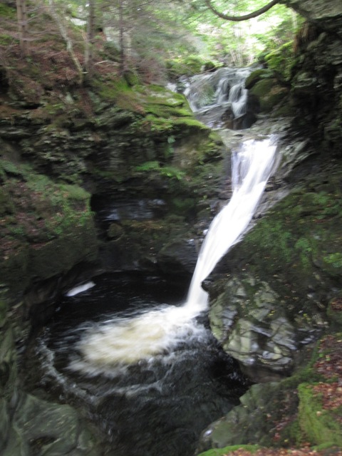
We headed towards the falls on a small woodland path and suddenly came
across the most impressive waterfall I've ever seen in the UK. It was a
fantastic sight.
 Where's this innocuous looking path heading for?
A wooden viewing platform, similar to that seen at the Falls of Acharn,
allowed a bird's eye view of the waterfall which plunged into a rocky abyss.
This was a real spectacle but the photos don't give the reader an idea as to
how impressive it all was.
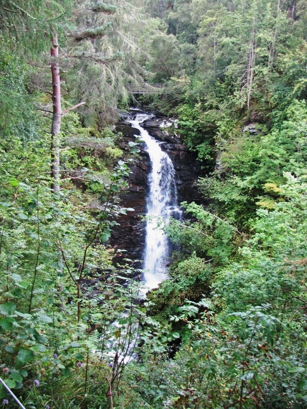 Crikey! The viewing platform can be seen above the falls.
Click
here for a short video that gives a better impression of
the falls.
After viewing the falls from all angles we started our descent through the
Birks of Aberfeldy. The steep ground could only be negotiated by use of
various wooden walkways which provided fantastic views into the gorge below.
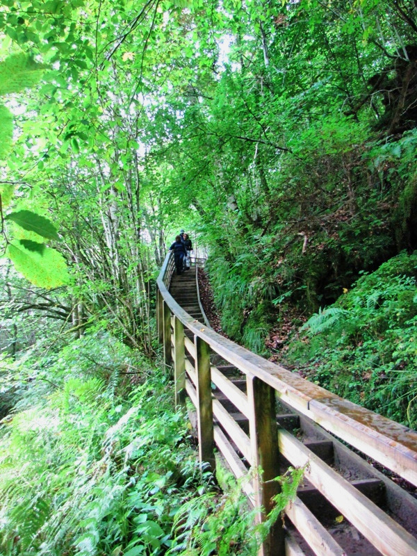 Ann. Jane and Ken descending one of the many wooden walkways.
The descent passed numerous cascades that anywhere else would be a major
tourist attraction. Many of them crashed either directly below or to the
side of the walkway which made you wonder what could be around the next
turn.
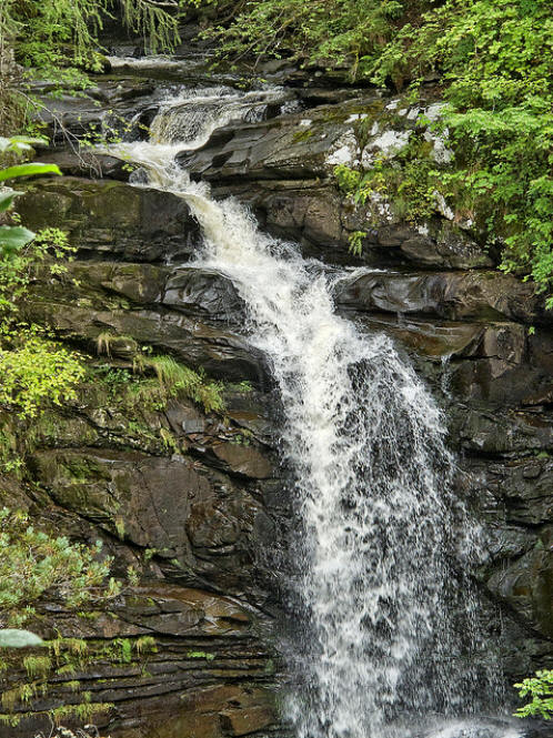 Nick captured this shot of one of the 'minor' falls.
On and on it went. The Urlar Burn was impressive enough in itself with its
moss covered craggy edges providing numerous points of interest. As the
gorge widened we came across a statue of Robbie Burns who had written the
'famous' song - The Birks of Aberfeldy. Nick didn't want to miss the
opportunity of having his photo taken alongside a hero of British literature
so Mike did the honours....
 Mike captures a moment Nick thought he never see - a threesome with him,
Ann and Robbie Burns.
Mike captures a moment Nick thought he never see - a threesome with him,
Ann and Robbie Burns.
After leaving the Birks of Aberfeldy we came across the town of Aberfeldy
itself. The town looked quite pleasant as we entered and the centre wasn't
too bad but there was an air of desperation as we entered the 'east side' en
route for the banks of the River Tay.
A good portion of the team decided that it was time for a toilet break so
Nick, Mike and I waited for a good ten minutes as the rest took turns in
using the 'Bog of Aberfeldy', another well known song by Burns:
Bony lassie, will ye go,
Will ye go, will ye go;
Bony lassie, will ye go
To the bog of Aberfeldy.
Let bladders release their yellowy haze,
And o'er the porcelain streamlets plays;
Come let us spend a penny todays
In the bog of Aberfeldy.
The little ladies blythely sing
While the queue outside does panic bring,
Just hurry on and do your thing,
In the bog of Aberfeldy.
On seat descends the fatty ar's,
Then foamy stream deep-roaring fa's,
O'erhung wi' pungent spreading drawers,
The bog of Aberfeldy.
The air no longer is crownd'd wi' flowers,
While o'er the seat the burnie powers,
And rising, weets wi' misty showers
The bog of Aberfeldy.
Let nature's gifts at random flee,
They shall draw a wish frae me;
That none will land upon my knee,
In the bog of Aberfeldy.
Bony lassie, will ye go,
Will ye go, will ye go;
Bony lassie, will ye go
To the bog of Aberfeldy.
After much arsing about we finally regrouped and set off along the A827
where we would shortly turn off for a path that followed the river bank.
Jane's guide described crossing the river but this appeared to be following
the cycle track route (of which we'd had more than enough of over the last
few days). The 1:50000 OS map had the route marked on the south of the river
so this was the option we took.
The skies were now pretty dark and Al's phone beeped. It was Macca, who was
now in Pitlochry, informing us that it was 'pissing it down' in Pitlochry
and that things were looking pretty grim. Great!
The odd rumble of thunder suggested that Macca's weather wasn't far off and
so after passing Dewar's distillery we left the road and hit the river.
Waterproofs had been the order of the day for most of us since the Aberfeldy
toilet stop but I'd resisted the call as I thought the weather would change
and as it was the last day I wouldn't mind getting wet. The trees which
covered the river bank were providing added protection so on we went.
A call was made to the front runners to stop at a suitable lunch spot.
Unfortunately the path had the river on one side and either fields or a
hedgerow on the other so no suitable sitting area could be found. As the
weather appeared to be worsening we decided to have a 'stand up' lunch under
a tree covered patch of river bank. I decided it was now time for the
waterproof.
The grassy river bank path now moved onto a disused railway track where we
would stay for another 2.5 miles.
 Dave and Sue, on the railway track, heading for Grandtully.
The torrential rain never arrived and before long the waterproofs were off.
We'd managed the near 5 miles between Aberfeldy and Grandtully in decent
time and all was looking good. The sun was now bursting through the cloud
and there was a noticeable increase in temperature which could only mean one
thing - a climb!
Grandtully was a busy place. The campsite was packed and the river was
packed with canoeists. We'd forgotten that this was the Friday which
signalled that start of the last bank holiday of the year.
Shortly after crossing the bridge over to Strathtay something magical
happened - we saw a red squirrel! There wasn't much to see as it crossed the
road and disappeared into the trees in seconds but it did count as an
official RRW wildlife sighting. Hooray!
Pitlochry was now only 4.5 miles away but a 1000ft climb awaited.
Strathtay was left behind and the climbing began.
 Nick decided that it was time to practice for next year's Egremont Crab
Fair.
Nick decided that it was time to practice for next year's Egremont Crab
Fair.
We all knew that once we'd broken the back of the climb that the RRW was
ours for the taking. It was getting rather warm now so a couple of 'sweat'
breaks were enjoyed on the way up. The views over Strath Tay opened us as we
left the trees and all was going well. This was as good a walk as we'd had
all week thanks to the scenery and it being excellent underfoot.
We came across a couple who had just started the RRW from Pitlochry but had
no real plans as to where they were heading to that night. It looked like
they were camping judging by the size of the packs.
 All smiles on the sweaty climb out of Strathtay.
The climbing began to relent as we headed towards the top of the hill and
the forest that would lead down to Pitlochry. This gave the lead group time
to take a break and in Ann's case, time to try a few pulling moves.
 After failing to attract Ken, Ann tries a new pose in order to arouse
Nick. To be fair, Nick does look like he's interested.
After failing to attract Ken, Ann tries a new pose in order to arouse
Nick. To be fair, Nick does look like he's interested.
We all reached the summit, took a break and checked out a large mushroom.
 A final look back to the valley of the Tay before the descent to
Pitlochry.
A final look back to the valley of the Tay before the descent to
Pitlochry.
The descent through the forest was an enjoyable affair. The walking was good
with the odd boggy patch keeping us on our toes. Gordon just missed out on a
visit to the undergrowth as he slipped on a peaty slope but we all managed
to survive.
 We're in there somewhere..
Pitlochry appeared in the distance but after the infamous Inverness moment
on the GGW we knew that objects in the distance are much further away than
they appear.
 Nearly there. The descent to Pitlochry.
Susan planned to stop walking at the 80 mile point as this was the distance
we'd promised. On finding that the 80 mile point was on a track outside a
disused cattle shed she decided that continuing would be a good idea.
All that could stop us now was the A9 but being of a certain age our Tufty
Club training saw us all safely over the road.
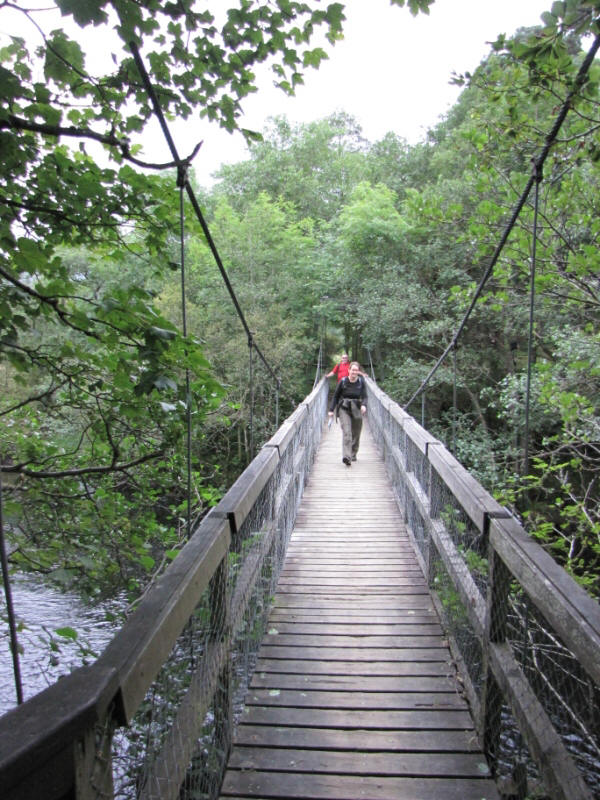
On entering the outskirts of the town we bumped into Macca who escorted us
into the centre of town via a wobbly bridge - always one of Jane's
favourites.
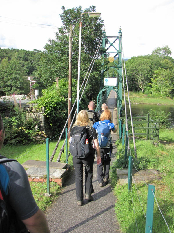 Get ready to wobble!
We'd made it - the centre of Pitlochry, but where would we take the
customary end of walk photo?
Macca pointed out a war memorial which seemed as good a place as any. I
later learnt that the official end of the RRW is at a B&B somewhere in town
but I find this a rather strange place to end a long distance route.
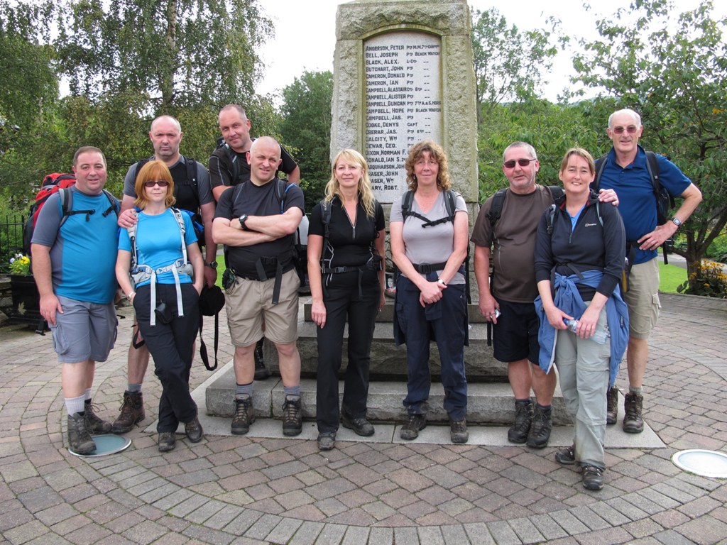 Done it! 100% completion and hardly an injury to speak of.
The Rob Roy Way isn't one of the better known long distance routes but
there's still a great sense of achievement at the end. Much of the walking
is on hard surfaces and for the most part, especially during the first three
days, much of the interest is concentrated on distance views rather than
anything in close proximity.
We were lucky that the weather had been so kind as this is a walk that is
best appreciated in good weather - not for the terrain you walk on but to
make the most of the distant vistas.
This would be a great walk to undertake on a cold clear week in winter.
There are very few boggy sections and there's little chance of going astray.
The highest point on the route is just over 1800ft and the villages and
towns we stayed in all host hotels and B&Bs that offer good value for money
and plenty of food.
As for the team, well, what can I say?
Dave achieved his aim of maintaining his 100% record for Scottish LDPs with
ease. Susan, a LDP first timer, made easy work of it all (but will she join
us again?) and 100% Ken just keeps on going. Nick, who usually suffers on
hard terrain managed to banish his foot demons and powered his way through
(for some reason he was even quicker after Lochearnhead). Mike, despite
sleeping the same room as a warthog and contracting a strange flu-like
virus, battled on and Gordon and Jane, despite Gordon's offshore drilling
escapade, managed to keep it together. Ann, now in her early 60s, seems to
get quicker by the year and Al breezed through the walk without a murmur. I
was eager to find out if my Cotswold Way back injury would reappear but
apart from the odd twinge all was fine.
Now for the bad news. Alison has made repeated comments about this being her
last LDP. This cannot be allowed to happen and hopefully, after reading the
fun packed memoirs of this walk, she'll change her mind and return to being
a key member of the world's most famous walking group. Al and Neil promised
to burn their walking boots after the WHW and look what's happened since -
six more LDPs and six lots of treasured memories.
Back to the walk - two nights were enjoyed in Pitlochry. Thanks to Macca, a
curry house was the destination for the Friday night and the Fern Cottage
restaurant the place for food on the Saturday night.
We returned to Staffordshire on the Sunday thanks to a minibus return to
Glasgow airport and the welcome relief of our car seats.
Where to next year?
And, finally, here's the now famous injury list:
| Walker |
Blister |
Toe injury |
Achy back |
Lurgy |
Midge
bites |
Achy feet |
Sleep deprivation |
Camera Eye |
| Sean |
|
|
X |
|
X |
|
|
X |
| Alison |
|
|
|
|
X |
|
|
|
| Ken |
|
X |
|
|
|
|
|
|
| Mike |
|
|
|
X |
|
|
X |
|
| Nick |
|
|
|
|
X |
|
|
|
| Ann |
|
|
|
|
X |
|
|
|
| Gordon |
X |
|
|
|
|
|
|
|
| Dave |
|
|
|
|
|
X |
|
|
| Jane |
X |
|
|
|
|
|
|
|
| Susan |
|
X |
|
|
|
|
|
|
